Surveying with a Drone - Step 2
"A Step-by-step process"
Surveying with a Drone (a.k.a. UAV, UAS, sUAS). These acronyms have specific technical meanings however in the context of this article they are synonymous to the commonly used name of Drone.
To survey with a Drone several things need to be in place as follows:
- FAA Part 107 Remote Pilot License (Step 1)
- A fixed or rotary wing Drone (Step 2)
- Photography and Ground control (Step 3)
- Desktop or online mapping software (Step 4)
Step 2
Step 2 will cover the different type of drones.
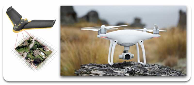
There are two basic types of drones, Fixed Wing and Rotary Wing.
Which type is the best for your project will depend on several factors. The size (how many acres), the Ground Sample Distance (GSD which equates to image resolution) and budget (how much do you have to spend).
For large sites, using a aerial photographic company will be the best economical option but may not always be the fastest due to scheduling and processing.
For sites that fall within the range for utilizing a drone, a Fixed Wing or Rotary Wing will be the next best option.
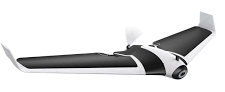
Fixed Wing
There are a multitude of fixed wing manufacturers. You are going to have to do your homework to determine which one will be right for you. The cost for a fixed wing vary from a thousand dollars to many thousands of dollars.
Pros: A fixed wing has a long flight time, up to several hours for some models. They fly faster and can cover a lot of ground. In some ways they are very similar to manned aircraft used for aerial photogrammetry.
Cons: A fixed wing cannot hover or capture videos around a Point of Interest. The landings are painful to watch especially if you spent thousands of dollars and it does a controlled crash landing on a hard surface. It usually takes two people for flight operations.
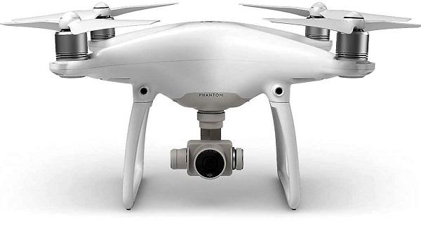
Rotary Wing
There are a multitude of fixed wing manufacturers. You are going to have to do your homework to determine which one will be right of you. The cost for a rotary wing will vary from a few hundred dollars to a few thousand dollars.
Pros: A rotary wing can do more than a fixed wing such as hover and take videos around a Point of Interest. They can be used for building and tower inspection. One person can handle most flight operations.
Cons: The flight time is usually limited to less than 30 minutes. Several batteries will be needed for large sites.
______________________
Without a FAA waiver, line of sight must be maintained for all drones, fixed and rotary wing. Mission planning to keep the drone within line of sight by the Pilot in Command and/or a visual observer is required.
A waiver is also needed to fly over non-participates for any flight operation such as mapping a parking lot or site where there are people and moving vehicles.
The drone will need to be able to fly autonomously so that flight patterns and image overlaps meet the required ground sample distance for the project when processed.
You need the option to take over the flight manually for emergencies and to avoid other aircraft.
______________________
I am still new at surveying with a drone. I am sharing my experience to help other newbies get a jump start on the process.
I started with a DJI Phantom 4 which has all of the features that I currently need for my flight operations. I like the option of using third party apps such as DroneDeploy with the DJI drones. I will get more into the mapping software in Step 4 of this series. The Phantom 4 is very reliable and the manufacturer DJI has been around for quite some time.
When you buy a drone, you want to get one from a reliable manufacturer. Do your research. There are plenty of Youtube videos on the top drone models.
Practice - Practice - Practice
To really get good at flying and mapping with a drone you will need lots of practice.
Don't forget to log your time for your drone and your pilot hours for documentation for insurance or other requirements. This may be critical should you ever have to defend yourself against a claim.