Surveying with a Drone - Step 1
"A Step-by-step process"
Surveying with a Drone (a.k.a. UAV, UAS, sUAS). These acronyms have specific technical meanings however in the context of this article they are synonymous to the commonly used name of Drone.
To survey with a Drone several things need to be in place as follows:
- FAA Part 107 Remote Pilot License (Step 1)
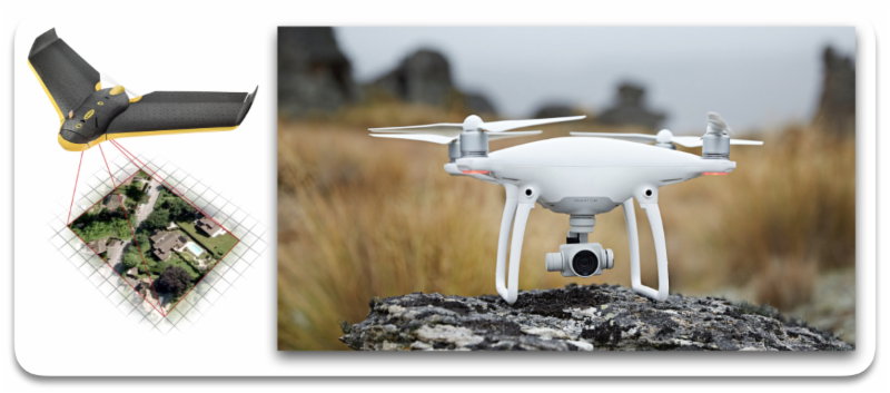
- A fixed or rotary wing Drone (Step 2)
- Photography and Ground control (Step 3)
- Desktop or online mapping software (Step 4)
Step 1
Step 1 will cover the FAA Part 107 Remote Pilot License process.
First you will need to get your hands on some study material in regards to Part 107.
Start by looking at the FAA website for Unmanned Aircraft Systems (UAS).
There are plenty of online resources for learning the required information in preparation for the exam. It can be a daunting task to sort through all that is available.
I personally had great success with Remote Pilot 101.
The instructor did an excellent job in covering the items needed to pass the FAA exam such as:
- Rules and Regulations
- Airspace
- UAS Weather
- UAS Loading and Performance
- Crew Resource Management
- NOTAMS & TFR's
- Radio Communication
- Emergency Procedures
- Preflight and Maintenance
I also used an app that contained the study questions and sample test that I took several times to reach the comfort level to take the exam.
Once you are ready to take the exam you will need to schedule the test through CATS.
From here you will pick the testing location and time that is closest to your location.
You can not take your phone, watch or other items with you during the test. The testing facility will provide you with everything you will need.
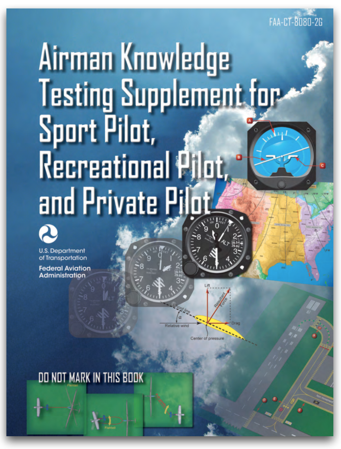
They will provide you the following book.
Get familiar with this book so that you can quickly find what you are needing during the test.
There are 63 questions on the test but only 60 count towards the grading. You will need 70% to pass the exam.
After you pass the test you will need to create an account on
Integrated Airman Certification and Rating Application (IACRA) system.
It may take up to 10 days for your test score to show up on the IACRA system.
You will need to create an application for a Remote Pilot to assign your test score to. Once in the system, the FAA has up to 90 days to process your application. You will receive a temporary pilot certificate until your official one is mailed to you.
______________________
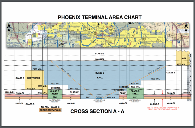
The U.S. National Airspace questions that are the ones being missed the most on the exam. A thorough understanding of Aeronautical Sectional Charts is a must.
The "Drone Operations" page has many useful links and information in regards to Sectional and Terminal Area Charts.
Steps 2 through 4 will be presented over the next few issues of Closing Corners.