|
Greetings!
I hope this note finds you all safe from the impacts of Hurricane Beryl, the second named storm of the Atlantic hurricane season and the first named storm to enter the Gulf this year. Beryl broke numerous meteorological records for June and July, including for its intensity and longevity. The storm, which made U.S. landfall near Matagorda, Texas, left a wake of devastation and power outages and is believed to have caused more than 30 deaths in the U.S. and across the Caribbean and Mexico.
Beryl was surprising in how quickly it intensified, first to a category 4 storm and then again overnight to a category 5 storm in the Caribbean Sea.
Operators of gliders and other autonomous vehicles working together to plan hurricane-related missions were prepared, and at least three vehicles — including two from TAMU-GERG — were in the path of the storm and able to collect and report important data on ocean temperatures and salinity as the storm moved through the region. In the storm’s aftermath, forecasters and modelers are using the data collected to see how accurate our models were and to help refine future storm prediction efforts.
In other news:
- Thanks to the efforts of the IOOS Association and other supporters of the nation’s ocean observing system, the House has included full funding — $56 million — for regional associations like GCOOS in the FY2025 budget. We hope the Senate follows suit!
- This month, we welcomed Jerad King as our new GIS Developer. His focus will be on our biodiversity efforts and maintaining and developing GCOOS GIS-based applications and projects.
- We’re also now accepting applications for a new position: Associate Director of Operations. This new role will help to support day-to-operations at GCOOS and allow us to develop an even more robust observing system in the Gulf. Applications will remain open at least through Aug. 2. Please share the job announcement below with colleagues!
Until next month!
| |
GCOOS Seeks Associate Director of Operations | |
|
GCOOS is accepting applications for a new position: Associate Director of Operations. This highly motivated and experienced associate director will contribute to the management of the Gulf of Mexico’s ocean observing system and support GCOOS grants, projects, staff, and strategic priorities. This is an ideal role for someone with interest in managing ocean observing system programs and projects. The associate director's efforts will be integral to ocean industries, research and education benefiting society and the environment.
| |
|
Please join us in welcoming Jerad King, GCOOS GIS Developer! Jerad will support our biodiversity work through the CETACEAN and sea turtle atlas projects, as well as the maintenance and development of new and existing GCOOS GIS-based applications and projects.
Jerad graduated from Texas A&M University with a master’s degree in Geography with research focused on novel methods of GNSS and remote sensing. Working with the Cyber Infrastructure and Spatial Decision Intelligence research group, he participated in multiple projects including the development of ESRI StoryMaps for AP curriculum. In graduate school, King focused on honing skills related to the development of GIS software to enhance the ability of researchers to study the environment, including wildfires.
| |
Congratulations to GCOOS Howard Scholarship recipient and Outreach and Education Council (OEC) member Matthew Barrs (pictured third from left below) who completed his first year of undergraduate study in mechanical engineering at the University of Central Florida. In keeping with his interest in uncrewed systems, he took advantage of many opportunities offered as a member of UCF’s Marine Environmental Robotics Club. The club, a student organization that specializes in applying robotics for marine use and raising awareness about aquatic issues, provided him the chance to assist fellow OEC member Dr. Tina Miller Way during the Marine Advanced Technology Education (MATE) ROV regional competition held in April at the Dauphin Island Sea Lab in Alabama, participate in the 2024 MATE competition held in May in Tennessee and travel to Wisconsin for the Innovative Additive Manufacturing 3D Challenge where his team won third place for their 3D printed drone. As a recent addition to the Underwater Glider User Group (UG2), a community-based coalition aimed at bolstering scientific collaboration, information and resource-sharing for gliders, Matt is eager to learn more about opportunities related to uncrewed systems. |  | |
Webinar: Ecosystem Services and the Blue Economy | |
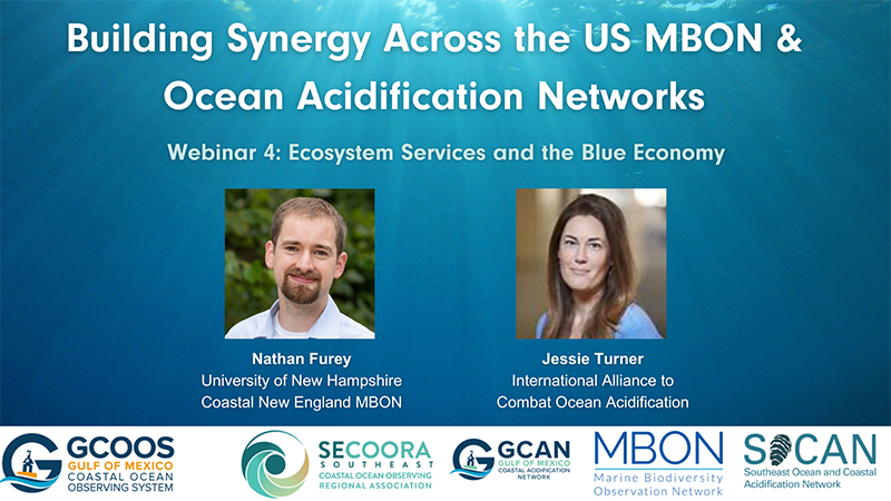 | |
The next webinar in the joint GCOOS and SECOORA Spring Series is focused on Ecosystem Services and the Blue Economy is scheduled for noon to 1 p.m. ET Thursday, July 25. GCOOS and SECOORA have teamed up for this series designed to establish collaborative opportunities among the U.S. Marine Biodiversity Observation Network (MBON), the Gulf of Mexico Coastal Acidification Network (GCAN) and the Southeast Ocean and Coastal Acidification Network (SOCAN) to build synergy across these networks to advance science in support of resource management and the Blue Economy.
- When: Noon to 1 p.m. ET Thursday, July 25
- Click to register now
July Speakers:
- MBON: Dr. Nathan Furey, Lead Investigator of the Coastal New England Marine Biodiversity Observation Network and Assistant Professor at the University of New Hampshire, will focus on current tools for measuring marine biodiversity, particularly those of priority for the Marine Biodiversity Observation Network. He will discuss potential linkages between marine biodiversity and various ecological functions and ecosystem services.
- OA: Jessie Turner, International Alliance to Combat Ocean Acidification, will focus on how communication, education and collaboration drives OA policy at a national and international level, and how OA policy shapes the path for research that directly or indirectly looks at impacts on biodiversity.
| |
Hurricane Training for Florida Communities | 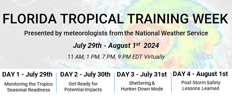 | |
National Weather Service meteorologists in Florida are teaming up in advance of peak hurricane season to review recommended tropical readiness, preparedness, response and recovery. Their goal is to teach residents about tropical weather forecast products and how to properly interpret them. The webinars are free and open to anyone. (Note: though the webinars are targeted to Florida residents, most of the information shared will be applicable for anyone in a hurricane zone.)
The meteorologists are offering four days of webinars covering everything from monitoring and seasonal readiness to post-storm safety lessons. There will be four sessions daily for each webinar, so register for times that are most convenient.
- Day 1, July 29: “Monitoring the Tropics & Seasonal Readiness.” Webinar times: 11 a.m., 1 p.m., 7 p.m., 9 p.m. ET. Day 1 registration.
- Day 2, July 30: “Get Ready for Potential Impacts” Webinar times: 11 a.m., 1 p.m., 7 p.m., 9 p.m. ET. Day 2 registration
- Day 3, July 31. “Sheltering & Hunker Down Mode.” Webinar times: 11 a.m., 1 p.m., 7 p.m., 9 p.m. ET. Day 3 registration.
- Day 4, Aug. 1: “Post-Storm Safety & Lessons Learned.” Webinar times: 11 a.m., 1 p.m., 7 p.m., 9 p.m. ET. Day 4 registration.
| |
Webinar Recording: “Hurricanes, NWS and GCOOS” | |
In June, GCOOS and the National Weather Service (NWS) joined forces to talk about the 2024 hurricane season outlook and preparedness measures, as well as changes to “the cone” and how data gained by gliders and shared via GCOOS helps to improve hurricane activity forecasts. The webinar also covered GANDALF, the GCOOS glider piloting dashboard.
Webinar speakers:
- Brian LaMarre, NWS NOAA Gulf regional team lead and the meteorologist-in-charge of the NWS office for the Tampa Bay Area/Ruskin, Florida.
- Bob Currier, Research Specialist in the Department of Oceanography, Texas A&M University and Product Developer and Co-Data Manager at GCOOS.
- Didn’t have the chance to attend? Watch now
| |
|
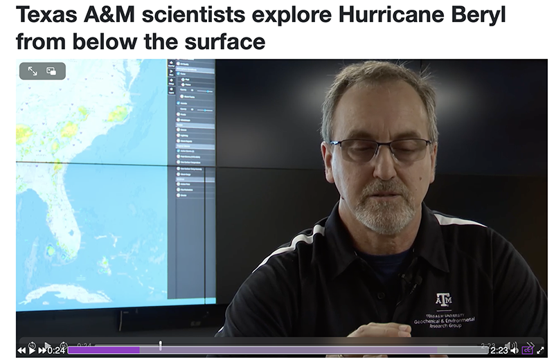
In June, Hurricane Beryl became the earliest Atlantic hurricane on record to achieve Category 4 status; a day later, when it further intensified, it became the earliest Category 5 on record. Texas’s KBTX News3 featured Texas A&M’s Geochemical and Environmental Research Group’s (TAMU-GERG) glider deployment during Hurricane Beryl in a recent newscast. Dr. Steve DiMarco had the opportunity to share information about how gliders support storm prediction and tracking.
| |
Galveston Bay Pollution Settlement | |
|
A federal court in Texas has approved a $6.6 million settlement for damages caused by the Intercontinental Terminals Company, LLC (ITC) to Galveston Bay following a 2019 storage tank fire that led to the release of petrochemicals and other hazardous substances into area waterways including Tucker Bayou, Buffalo Bayou, San Jacinto River, Houston Ship Channel, Carpenters Bayou, Old River, Santa Anna Bayou and other surrounding water bodies.
Trustees for the settlement include the United States Department of the Interior, through the United States Fish and Wildlife Service, NOAA, jointly with the State of Texas, appearing through the Office of the Texas Attorney General, on behalf of the Texas Commission on Environmental Quality, the Texas Parks and Wildlife Department and Texas General Land Office.
The ITC Trustee Council will begin working to identify restoration projects that will improve habitat and recreational use of the injured natural resources in Galveston Bay. The proposed projects will be included in a Restoration Plan where the public will have an opportunity to provide input.
| |
|
Healthy Ecosystems & Living Resources
| |
Time-Release Treatment for HABs? | |
|
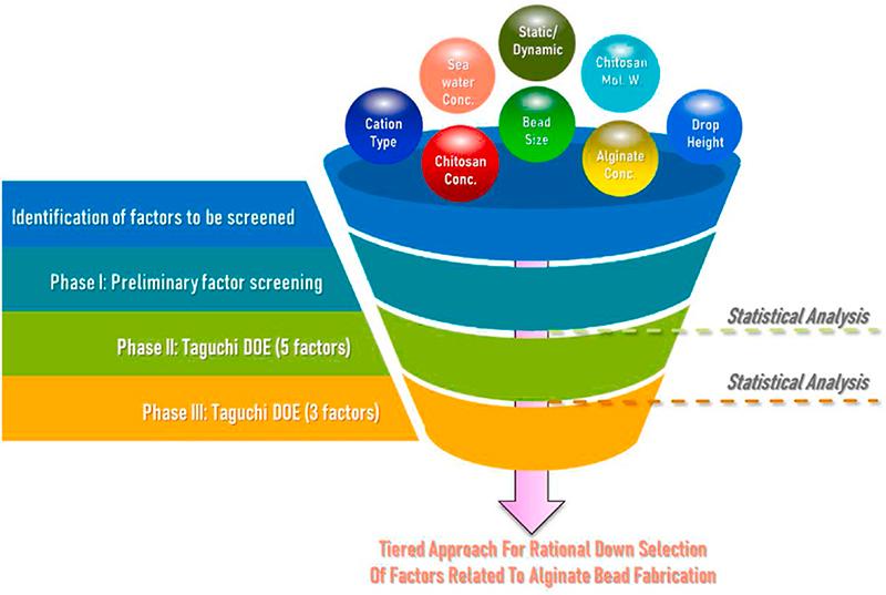
Researchers at the National Centers for Coastal Ocean Science (NCCOS) and their partners are exploring a new method to deliver controlled-release treatments for managing harmful algal blooms (HABs). Controlled-release technologies would allow for a product to be delivered at a predictable and consistent rate to achieve an optimal dosage or application rate over time. While controlled-release technologies are commonly used for pharmaceuticals, applying this technique for environmental purposes is relatively new.
The study “Development of alginate beads for precise environmental release applications: A design of experiment based approach and analysis,” in the Journal of Environmental Management indicated that a combination of both large and small beads may be the most successful strategy to maximize effectiveness in controlling HABs in marine waters in the future.
| |
Mark Your Calendar: Virtual Panel on the U.S. Biodiversity Strategy | |
|
Lead authors of the U.S. National Ocean Biodiversity Strategy released in June by the White House Office of Science and Technology Policy will come together in a virtual panel in August to discuss the essential ingredients and on-the-ground partnerships needed to effectively implement the Strategy on behalf of communities.
Lead authors of the Strategy and the Lenfest-supported project, “Marine Biodiversity Dialogues,” will bring together knowledge holders from three regions – the Chesapeake Bay, Gulf of Mexico and Puget Sound for the discussion.
- When: 1 p.m. ET Thursday, Aug. 7
- Click to register now
The panel will be introduced by Dr. Emmett Duffy, Smithsonian Institution, and Gabrielle Canonico, U.S. IOOS/MBON, and moderated by Kelsi Furman, Smithsonian Institution.
Panelists include: Tiara Thomas, Accokeek Foundation/Piscataway Conoy Tribe, Maryland Commission on Indian Affairs; Philip Plack, Annapolis Oyster Company, Maryland; Richard Rutland, Cold Blooded Fishing, Alabama; Scott Banon, Alabama Marine Resources Division; and Jodie Toft, Puget Sound Restoration Fund, Washington State.
| |
New Stamp: Protect Sea Turtles | |
|
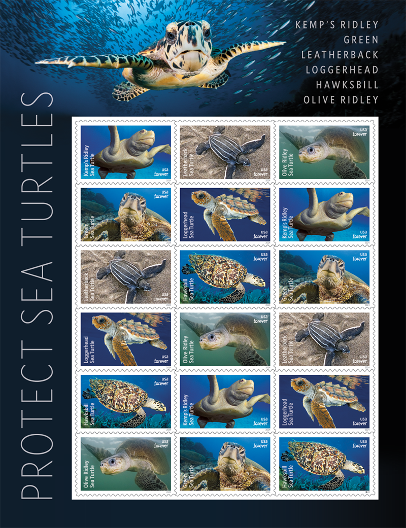
The U.S. Postal Service has issued a new “Protect Sea Turtles” stamp series. First issued on June 11 in Corpus Christi, the stamps feature six species of endangered sea turtle endemic to the U.S. and highlight the need to continue to conserve and protect these ancient reptiles — one of the oldest species on Earth.
The stamps showcase a gray-green Kemp’s ridley (Doug Perrine, photographer); a black and white leatherback (Rowan Byrne, photographer); an olive ridley (Solvin Zankl, photographer); a green sea turtle (David B. Fleetham, photographer); a mottled orange-brown loggerhead (James D. Watt, photographer); and a brownish-yellow hawksbill (Claudio Contreras, photographer).
| |
Latest NHABON Webinar Recording | |
|
Did you miss the National Harmful Algal Bloom Observing Network’s (NHABON) June webinar? You can watch “Synergies in HAB Observations Across UN Ocean Decade Programmes” by clicking below to watch on the IOOS Association’s YouTube channel.
- And don’t forget to mark your calendar for their next webinar: "The Role of Satellite Observations in NHABON and Exciting advances in Space-Based HAB detection."
- When: 3-4 p.m. ET Wednesday, Sept. 18
| |
Understanding the Implications of Louisiana’s Flash Drought of 2023 | |
|
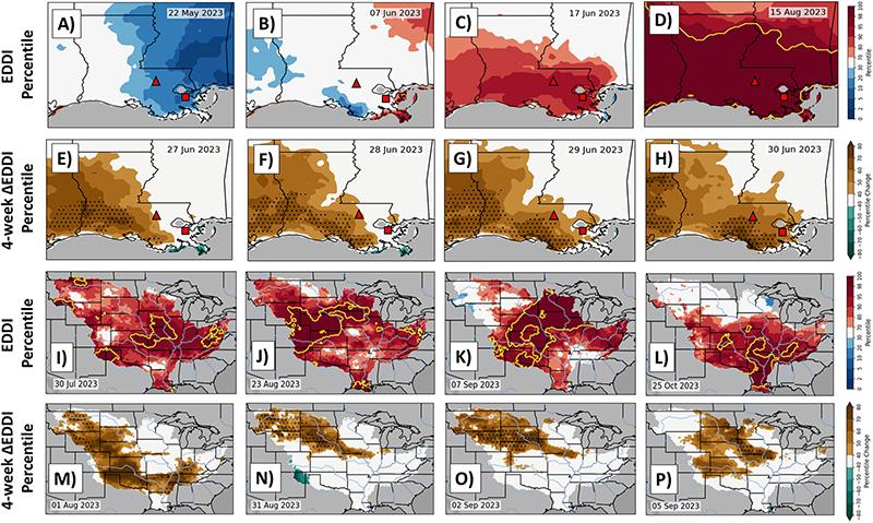
What happens when river communities face unprecedented drought and saltwater intrusion? A new paper by Louisiana State University (LSU) faculty members Dr. Paul Miller and Matt Hiatt, examines Louisiana’s 2023 water crisis when a historic drought caused up to $290 million in agricultural losses and record-low Mississippi River water levels led to saltwater intrusion that threatened New Orleans water supply.
The paper shows how the “flash drought” in Louisiana can serve as “a motivation for understanding the full gamut of coupled terrestrial-marine drought dynamics and the enormous economic and environmental problems that can arise.”
| |
|
(a–d) Evaporative Demand Drought Index (EDDI) percentile with the 98th percentile contoured in gold and (e–h) 4-week EDDI percentile change over Louisiana. The locations of Baton Rouge (triangle) and the Belle Chasse river gage (square) are denoted in red, and cells that satisfied the flash drought criteria during the 4 weeks ending on the date shown are stippled. (i–p) Same as (a–h) but for the entire Mississippi River basin. Warm (cool) hues indicate dry (wet) anomalies.
— From “Hydrometeorological Drivers of the 2023 Louisiana Water Crisis” in Geophysical Research Letters.
| |
|
The study was funded by NOAA's National Integrated Drought Information System (NIDIS), the National Science Foundation and the U.S. Geological Survey.
| |
Coastal Resilience Adaptation Conference — Virtual | |
|
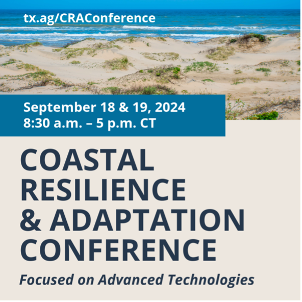
Resilience of the Texas coast is important not only for the immediate residents, but also to support the natural ecosystems and economic stability of this state and nation. Texas Sea Grant and partners — including GCOOS — are coordinating a virtual two-day Coastal Resilience and Adaptation Conference to provide information and resources to coastal communities.
The conference is focused toward decision makers, elected officials, city and county staff, natural resource managers, academics and the private sector and will feature the latest technological advances for coastal resilience and adaptation.
Conference sessions will explore technological applications in four thematic tracks:
- Coastal Energy Transition
- Marine Debris
- Nature-Based Solutions
- Early Hazard Warning Systems
| |
New Deep-Sea ROV in the Gulf | |
|
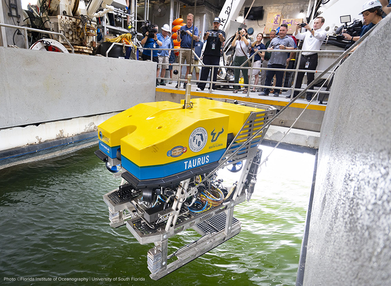
Researchers studying the deep sea have access to a powerful new tool with the acquisition of a sophisticated, remotely operated vehicle (ROV) by the University of South Florida and Florida Institute of Oceanography (FIO).
Nicknamed “Taurus,” the ROV can reach depths of up to 2.5 miles, allowing for exploration of some of the most remote areas of the ocean and the potential discovery of new species. The vehicle can also capture and livestream 4k imagery, expanding educational opportunities and appreciation for the underwater environment.
USF, the host institution of FIO, is the only university in the continental United States to own an ROV with such advanced capabilities. The ROV’s first scientific mission is expected to take place later this month when it will be used by FIO’s Peerside program in studies focused on deep-water shark and coral research.
| |
New GOES Satellite Now in Orbit | |
|
The newest in the Geostationary Operational Environmental Satellites (GOES) — GOES-U — was launched in June as part of the NOAA-NASA collaboration that provides continuous imagery and data on atmospheric conditions and solar activity (space weather). NASA builds and launches the GOES and NOAA operates them.
On July 7, GOES-U executed its final engine burn, placing the satellite in geostationary orbit 22,236 miles above Earth. Upon reaching this milestone, GOES-U was renamed GOES-19. (GOES satellites are designated with a letter prior to launch and a number once they achieve geostationary orbit.)
- Click below to watch as GOES-U separates from the SpaceX Falcon Heavy rocket
| |
|
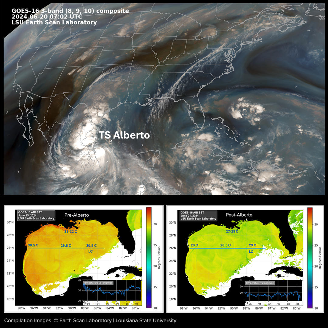
Louisiana State University’s (LSU) Earth Scan Laboratory (ESL)
Happy Anniversary ESL!
| |
|
Congratulations to GCOOS Board Member Dr. Nan Walker and the team at LSU’s ESL for celebrating their 36th anniversary on June 28! ESL operations started by using a tracking antenna mounted on the roof of an LSU building to capture imagery from a NOAA polar-orbiting satellite. Since then, the ESL has expanded its real-time image processing operation, employing a dedicated team of staff and many students over the years to provide near real-time ocean and atmosphere satellite images for many applications in emergency response, education and research.
That’s more than three-and-a-half decades of continuous operation to provide near real-time ocean and atmospheric satellite images, such as the one pictured here that depicts sea surface temperature on June 28. “What’s interesting about this image is that it reveals how very quickly maximum temperatures in the range of 31-32 degrees C (88-90 degrees F) rebounded along the Louisiana and Texas coasts after Tropical Storm Alberto had lowered them 1-4 degrees C the previous week,” said Walker, who has been ESL Director since 2003. ESL images like this are composites created from more than 100 individual images taken by the GOES-16 satellite.
|  | |
|
University of Alabama Cooperative Institute for Research to Operations in Hydrology (CIROH)
CIROH Science Meeting
| |
Preregistration is now open for the 2024 CIROH Science Meeting scheduled for Oct. 14-17 in Tuscaloosa, Alabama. The meeting agenda includes:
- Keynote presentations from CIROH and NOAA leaders, federal partners and practitioners; Presentations for ongoing projects in poster and podium format;
- Working group meetings and roundtable discussions on emerging opportunities for CIROH;
- A chance to interact with CIROH, NOAA and USGS;
- Brainstorming sessions to inform CIROH strategic initiatives and
- Networking and Community Building activities
| |
|
Gulf Research Program (GRP)
GRP Launches Gulf Futures Challenge
| |
 | |
The GRP has launched the $50 million Gulf Futures Challenge to fund bold solutions that apply translate, or communicate science, engineering, and medical knowledge to address critical challenges in the U.S. Gulf Coast Region. The Challenge aims to leverage the talent and knowledge of the Gulf by supporting ideas and solutions from those who understand the region best.
The Challenge seeks innovative solutions at the intersection of: the Future of the Energy Transition, the Future of Environmental Change along the Coast, and the Future of Healthy and Resilient Communities.
Nonprofits, local, state, and tribal governments, and academic institutions are eligible to participate as lead organizations, with partnerships and collaborations encouraged. Lead organizations must be based within Alabama, Florida, Louisiana, Mississippi or Texas, and proposed projects should occur within 100 miles of the U.S. Gulf coastline.
- Deadline: Organizations must register to apply before 5 p.m. ET Aug. 20
-
Registration
- More
| |
Networking and Mentorship Program | |
|
Expressions of interest are now under review for the Peerside Program, a program of the Florida Institute of Oceanography (FIO) focused on career networking and mentorship in ocean STEAM (science, technology, engineering, arts and math) for current community college, undergraduate, and graduate students, recent graduates and early career professionals.
The Peerside program aims to broaden access and ongoing involvement with the ocean through an innovative program that increases and sustains social, educational, technical and professional support. Peerside cohort members become part of a network that participates in year-round career development, including one week aboard the R/V Western Flyer, a mission-dedicated vessel to support student learning and growth. Participants also learn remote science during a one-week expedition, building their skills to be part of the New Blue Economy.
Peerside’s goals are to:
- Transform the social and technical processes by which people access the ocean and participate in ocean research and the New Blue Economy;
- Increase ocean STEAM participation by people across broad backgrounds and experiences;
- Build a cooperative support network to promote a sense of belonging within the ocean STEAM enterprise.
- Learn more
| |
|
-
Texas A&M University; Department of Oceanography - Associate Director of the Gulf of Mexico Coastal Ocean Observing System
-
National Science Foundation - Program Director
-
Hello.gov - Sr. Cloud and Data Engineer
-
National Academies of Science, Engineering and Medicine; Gulf Research Program - Executive Director
-
National Academies of Science, Engineering and Medicine; Gulf Research Program - Program Officer - Environmental Protection and Stewardship Board
- Mote Marine Laboratory
- Aquarium Biologist III – Mammals and Reptiles
- Postdoctoral Researcher in Marine Sediment Sciences
- Harmful Algal Bloom/Seagrass Techician
- Building Operations Lead
- Aquarium Biologist
- Staff Biologist – Photogrammetry
- Philanthropy Officer
- Manager Development Operations
Postdoctoral Positions:
-
National Oceanographic and Atmospheric Administration: National Centers for Coastal Ocean Sciences, NRC Research Programs
-
Monterey Bay Aquarium Research Institute: Postdoctoral Fellowship
-
National Research Council: Research Associateship Programs Postdoctoral and Senior Research Awards
-
Mississippi State University: Postdoctoral Associate
Fellowships:
- Susan L. Williams National Coral Reef Management Fellowship
-
National Oceanographic and Atmospheric Administration - Coastal Management Fellowship
-
National Academies of Science, Engineering and Mathematics: Early Career Fellowships
-
Department of Defense: Visualization of Coastal Data, Coastal Vulnerability Assessment Fellow
| |
|
- National Oceanic and Atmospheric Administration; Office of Response and Restoration - Abandoned and Derelict Vessel Removal Grant Program
- National Oceanic and Atmospheric Administration - Long Term Trends in the Gulf of Mexico Ecosystem
- The National Academies of Sciences, Engineering, and Medicine – Early Career Research Fellowship
- Gulf of Mexico Alliance
| |
1-2: Marine Technology Society, Tech Surge 2024, Baltimore, Maryland | |
GCOOS is the Gulf of Mexico regional component of the U.S. Integrated Ocean Observing System (IOOS) and the only certified system dedicated solely to the Gulf of Mexico. Our mission is to provide on-demand information about the Gulf’s coastal and open ocean waters that is accurate, reliable and benefits people, ecosystems and the economy. | |
Dr. Jorge Brenner, Executive Director • Dr. Barbara Kirkpatrick, Senior Advisor • Dr. Uchenna Nwankwo, Oceanographer • Dr. Chris Simoniello, Outreach & Education Manager • Felimon Gayanilo, Systems Architect, Co-Data Manager • Bob Currier, Product Developer, Co-Data Manager • Tuomo Saari, Scientific Computing Specialist • Jennifer Vreeland-Dawson, Program Coordinator • Megan Howson, Marine Mammal Biologist and Data Scientist • Grant Craig, Project Manager and HABscope Volunteer Coordinator • Nadine Slimak, Public Relations & Content Marketing, Vetted Communications, LLC • Laura Caldwell, Program Assistant | |
In Memoriam: Matt Howard, 1952-2018
| | | | |