Winter 2023-24 Newsletter | | |
Dear Florida Climate Center Friends, | |
We'd like to present you with the Winter 2023-2024 edition of our quarterly newsletter. In this newsletter, you'll find our most recent monthly climate summaries for the past 3 months, a review of our winter weather, the latest El Niño status, the spring outlook, and what may be in store for the hurricane season. You will also find an update on recent events and activities we've been engaged in. If you have any questions, please send us an e-mail at climate@coaps.fsu.edu.
Thanks,
The Staff of the Florida Climate Center
| |
|
Monthly Climate Summaries for Florida | |
The Florida Climate Center's December, January, and February Climate Summaries for Florida are available, as well as previous monthly summaries. These summaries provide an analysis of temperature and precipitation patterns across the state, along with data on hazardous weather, drought, and daily records tied or broken each month.
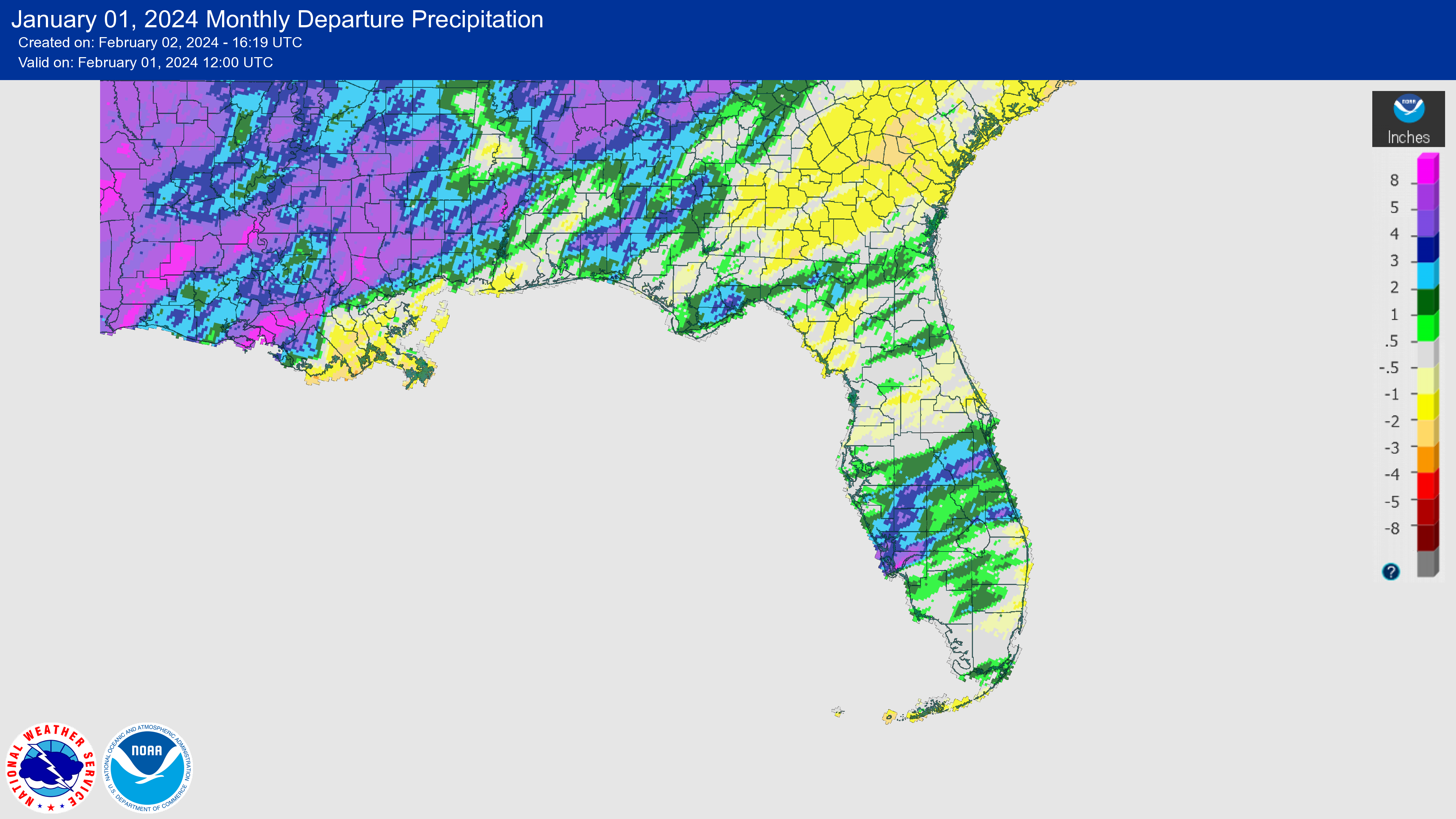
Monthly average temperatures in December were variable but were generally near normal with some areas above normal. The monthly departures from normal in December ranged from -1.0 ̊F in Key West to +2.2 ̊F in Gainesville. No monthly temperature records were set during the month.
Average temperatures in January were near normal for the month across the state. The monthly mean temperature departures from normal ranged from -1.9 ̊F in Pensacola to +2.2 ̊F in Miami. A hard freeze affected the state mid-month, with minimum temperatures dipping to below freezing for three consecutive nights in North Florida and the Panhandle. Above normal temperatures had returned by month's end.
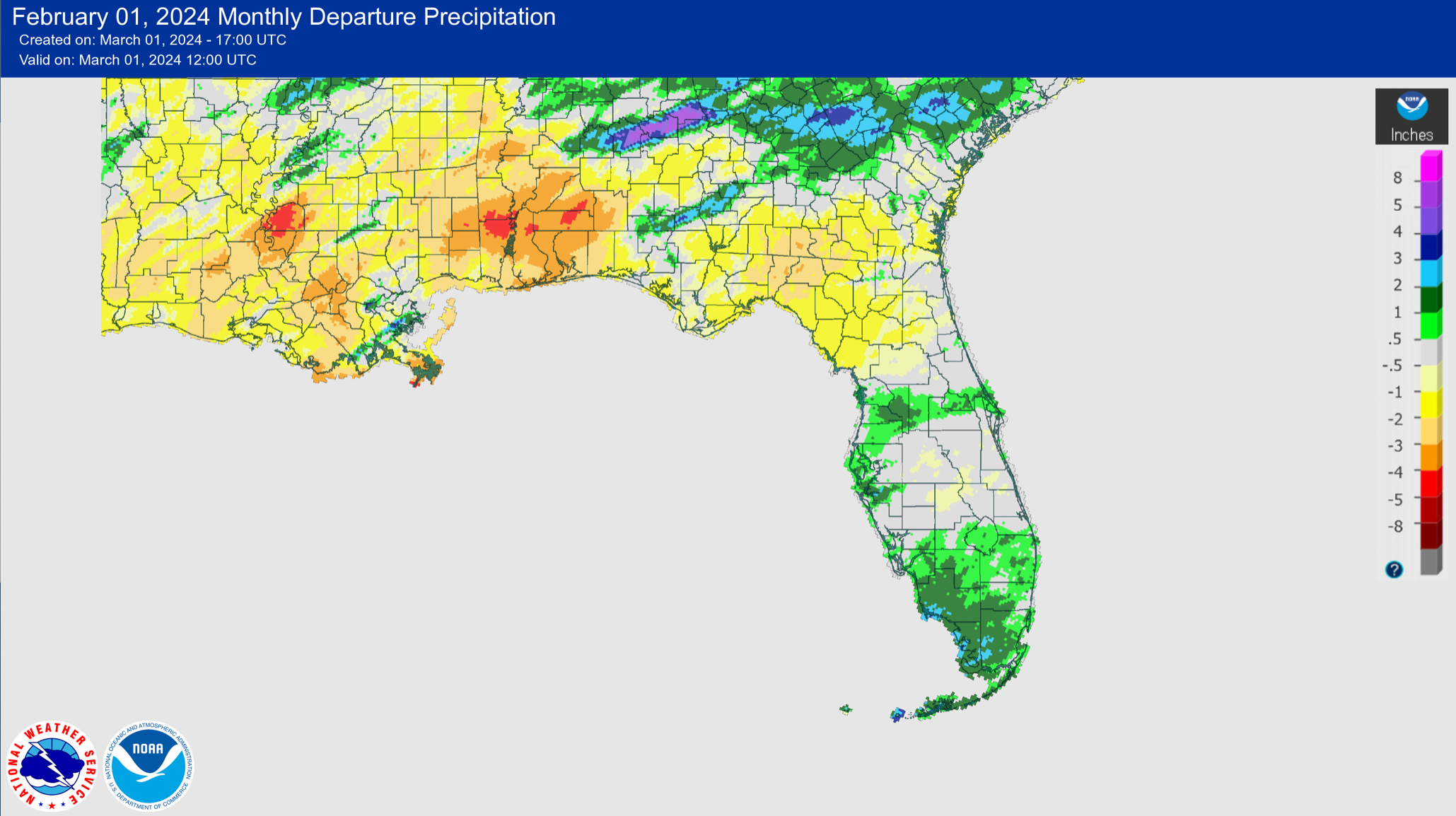
Average monthly temperatures in February were near to below normal. Monthly mean temperature departures from normal ranged from -2.2 ̊F in Key West to +0.9 ̊F in Tallahassee. Temperatures were variable throughout the month, with periods of above and below normal temperatures which averaged out as near normal for the month overall.
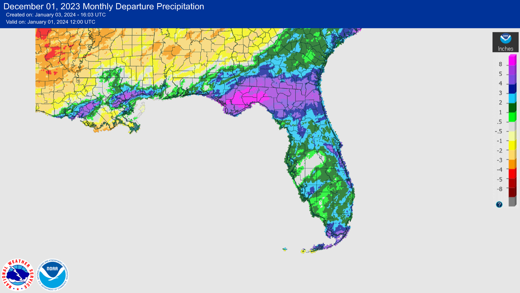
The figures below are graphical depictions of the monthly rainfall departure from normal (in inches) for December, January, and February (courtesy of the National Weather Service), as well as the 3-month seasonal rainfall departure from normal (courtesy of the Midwestern Regional Climate Center).
|  | |
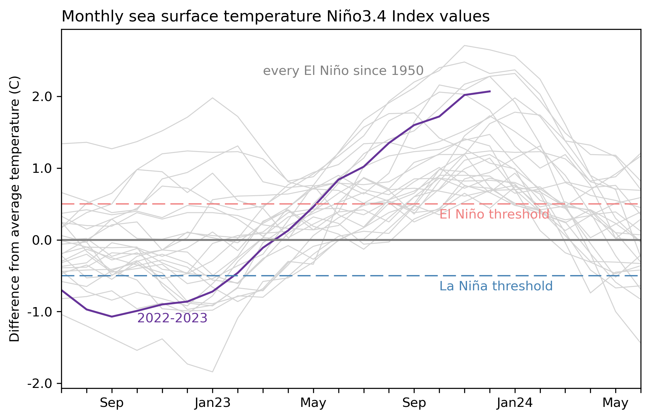
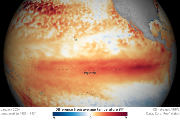
A Wet, Cool and Stormy Winter, Courtesy of El Niño | This winter turned out to be a very 'typical' and impactful El Niño event for Florida. El Niño conditions in the tropical Pacific Ocean persisted and strengthened into a strong event as winter progressed. This El Niño will rank as the 5th-strongest on record since 1950 based on the November-January period, reaching a sea surface temperature (SST) Nino-3.4 index value of +2.0 ̊C. Winter (DJF) was wet, cloudy, and stormy across the state, and December-January 2023-24 became the cloudiest winter on record for the Florida Peninsula, based on an 84-year period. | |
|
During fall, North Florida saw a streak of around 30 consecutive days without measurable rainfall during October-November, which was indicative of delayed El Niño rainfall. Flash drought developed in the western Panhandle in November due to the lack of rainfall. By December, however, El Niño rainfall kicked in with more frequent rainfall from December-February; some places had as many as 30 days or more with measurable rainfall during this period.
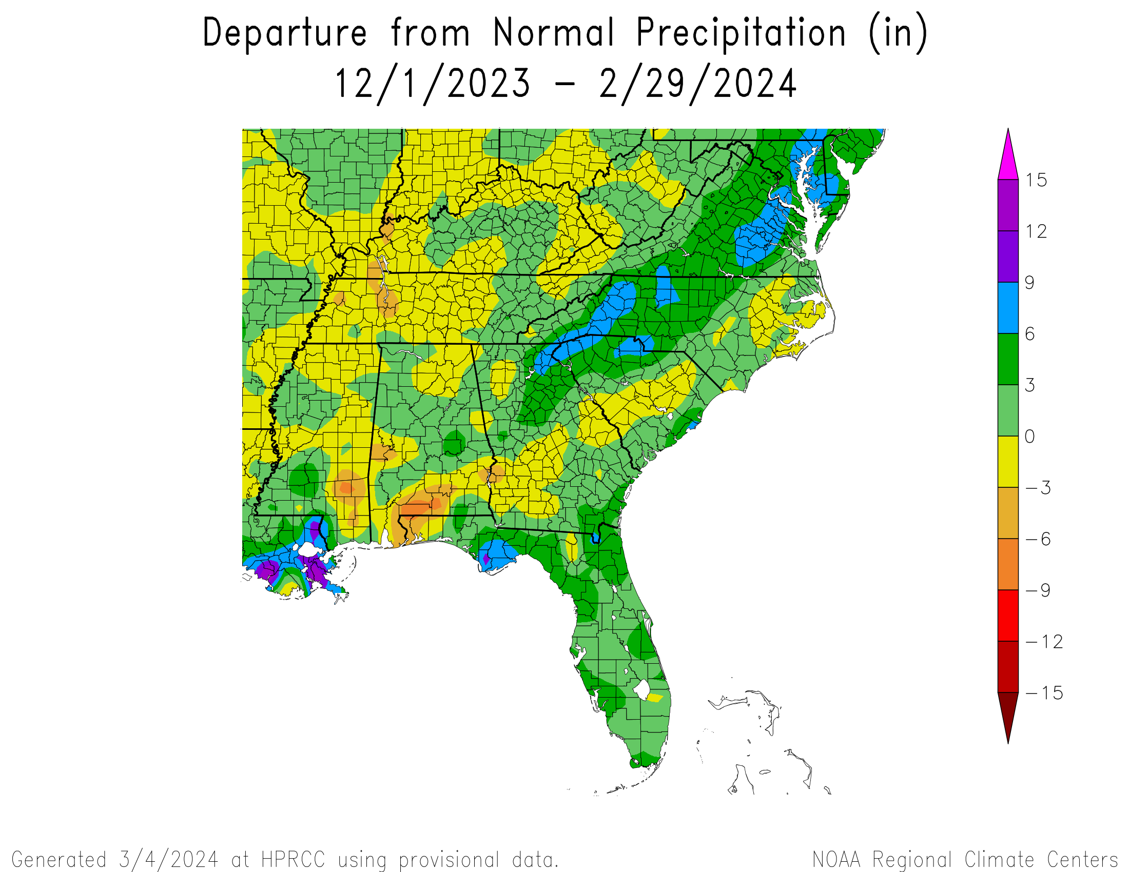
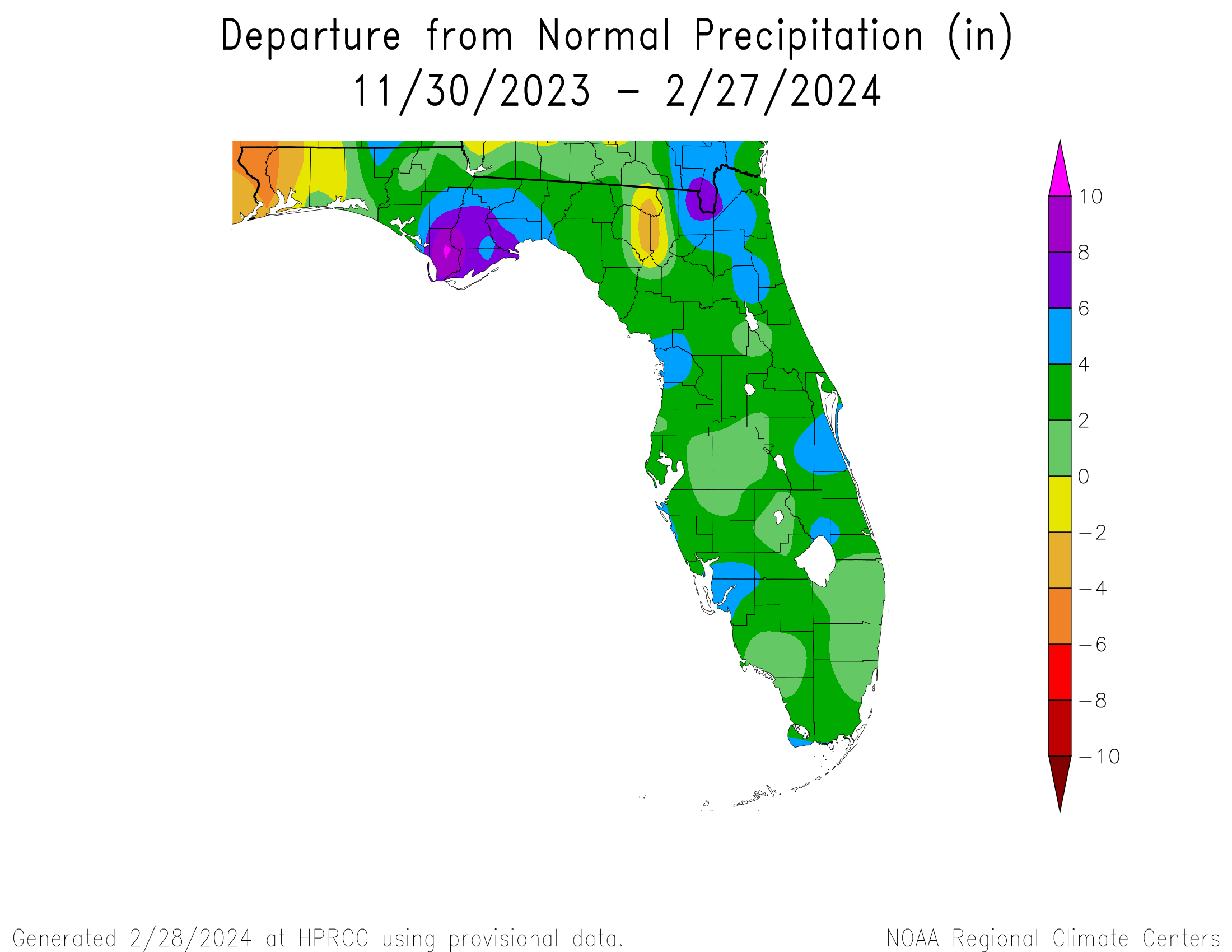
Statewide average precipitation this winter was above normal. The map below shows the rainfall departure from normal, from November 30, 2023 to February 27, 2024, which combines various station network data, courtesy of the High Plains Regional Climate Center. Some areas received 4-6+ inches of surplus rainfall, and several stations recorded one of their top 5 wettest winters on record: Key West (4th-wettest winter on record based on 72 years), Fort Myers (5th-wettest based on 98 years), and Apalachicola (5th-wettest winter on record based on 80 years). By the end of February, stream flows were running normal to above normal across the state, and drought has virtually disappeared.
| | |
|
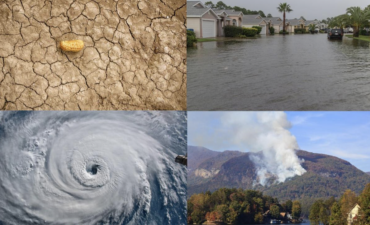
Severe Weather
Severe weather reports since January 1 show a cluster of tornado and severe wind reports in the Panhandle and Southeast Florida. A few notable storms occurred during the past few months:
- A no-named Gulf low on December 17 produced strong, damaging winds and 3-5 feet of storm surge along Florida's west coast and up through the Carolinas. Heavy rain was reported in north-central and northeast Florida with storm totals of 5-6+ inches.
- A powerful storm system and squall line moved through the region on January 9, impacting the Panhandle and North Florida. There were several reports of tornadoes, including an EF3 tornado and two EF2 tornadoes confirmed in Bay County and an EF2 in Jackson County. Wind gusts of 100+ mph were reported in Santa Rosa and Walton Counties. The storm caused at least 9 injuries.
- Another powerful storm system came ashore near Apalachicola on February 4, bringing storms, tornadoes, and heavy rain.
| |
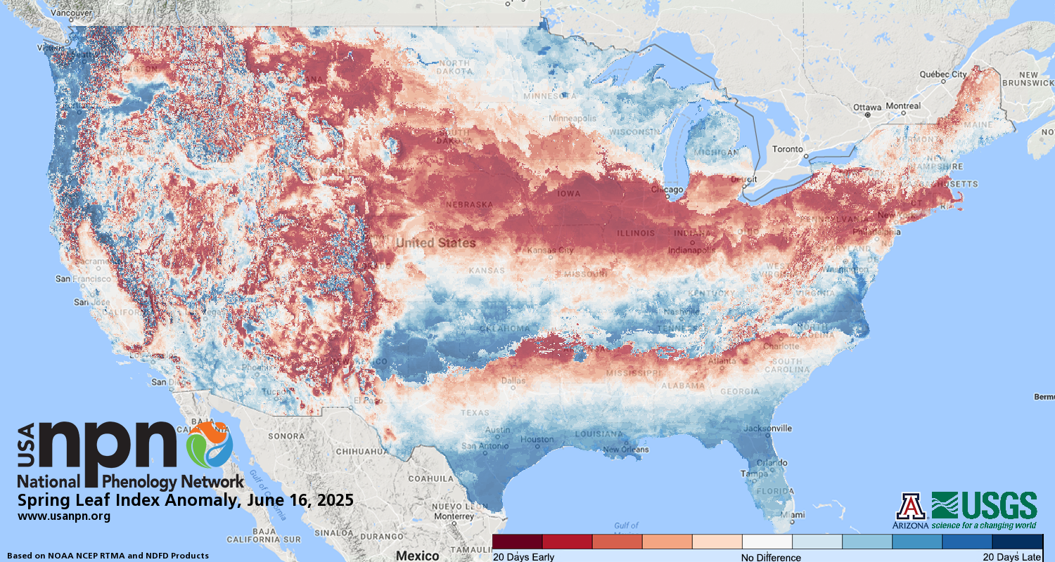
Above-average rainfall and cloudy conditions resulted in cooler temperatures this past winter, with seasonal average temperatures near normal overall. El Niño tends to bring more rain and clouds in winter in Florida and as a result cooler temperatures. The first spring leaf-out was delayed in Florida this year by about 1-2 weeks due to the cooler weather. | |
NOAA Issues La Niña Watch; El Niño Advisory Remains | |
El Niño conditions, the warm phase of the El Niño Southern Oscillation climate pattern in the tropical equatorial Pacific Ocean, continued through February. However, SST anomalies and area-averaged subsurface temperature anomalies have begun to weaken in the eastern and east-central Pacific. Atmospheric anomalies across the topical Pacific Ocean also weakened. A transition to ENSO-neutral conditions is expected during April-June 2024 (79% chance).
Strong El Niño events in the past were followed by a rapid transition to La Niña conditions the following summer. It is looking likely that this will happen again this year. Recent forecasts now indicate we are in an El Niño Advisory and a La Niña watch at the same time. There is currently a 55% chance of a transition to La Niña during June-August 2024.
| |
Early Indicators for an Active 2024 Atlantic Hurricane Season | While no official forecasts have been issued for the 2024 Atlantic Basin hurricane season, there are indicators that suggest this year could end up being another active storm season. The prospect of La Niña conditions developing and being in place during the time of peak hurricane season is increasing. In addition, sea surface temperatures in the Atlantic Ocean are extremely warm and even warmer than last year. These factors are conducive to the formation and intensification of tropical cyclones, but it is too early to forecast how other factors will develop that can have a dampening effect on tropical cyclone activity. NOAA and Colorado State University's hurricane season forecasts will be issued later this spring, but early predictions suggest that these forecasts may call for an above-average season. | |
Spring 2024 Leaning Wetter than Normal in Florida with Temperatures Less Certain | The NOAA Climate Prediction Center's outlook for this spring is leaning toward a wetter than normal spring on average, March through May, for Florida as El Niño continues to influence our seasonal weather patterns. The spring temperature outlook is less certain, with equal chances of being above, below, or near normal. Drought is not expected to impact the state. | |
Recent Engagements & News | |
|
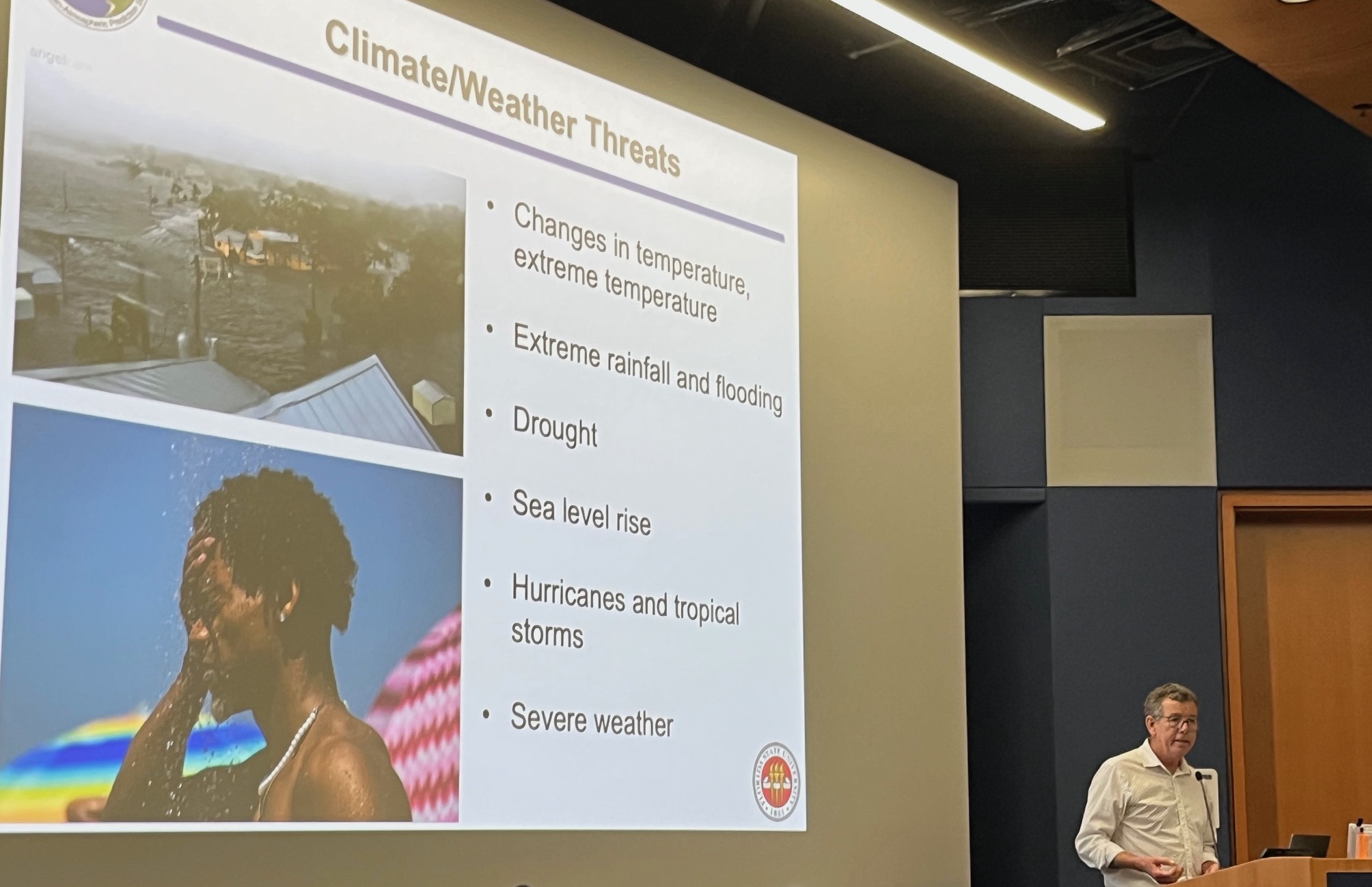
FCC Participates in the 9th Annual UF Climate Communications Summit
Florida State Climatologist David Zierden and Assistant State Climatologist Dr. Emily Powell participated in the 9th Annual Climate Communications Summit at the University of Florida on January 25, 2024. Zierden gave a "State of Climate Change in Florida" talk, and Zierden and Powell participated in a journalism workshop on climate data for storytelling.
Information about the event can be found here. Read a summary here.
| |
|
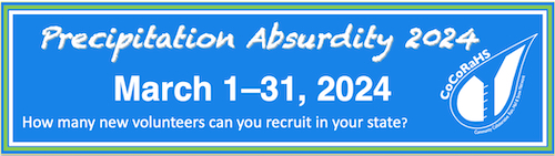
CoCoRaHS Precipitation Absurdity 2024 Now Underway!
Each year, CoCoRaHS holds a friendly national recruiting contest to see which state can recruit the most new volunteers during the month of March. This year, CoCoRaHS has decided to re-name the annual recruiting contest to "Precipitation Absurdity." Besides the name, everything else about the competition this year is the same.
There is always a need for more weather observations. As the saying goes, "the rain doesn't fall the same on all". Due to the variability of precipitation, amounts measured can be quite different only a block or two away.
Help fill in the gaps by recruiting a friend, relative, or neighbor during our recruiting contest this month! The more observations, the clearer the picture, and the better the understanding of where it did and did not rain.
The contest is broken down into 2 categories:
- "Traditional Count" - the state that recruits the greatest overall number of new observers in March.
- "Per Capita" (or population-weighted) - the state that recruits the greatest number of new observers per one million of its total population.
The winning state in each category receives the "CoCoRaHS Cup" to keep and exhibit for a year until next year's contest (in the tradition of the NHL's Stanley Cup). The cup usually travels around the state during the year.
You can view current standings at this link: https://cocorahs.org/marchmadness.aspx.
| |
|
Climate Diagnostics and Prediction Workshop/Climate Prediction and Applications Workshop
This upcoming climate prediction workshop is co-hosted by the Center for Ocean-Atmospheric Prediction Studies (COAPS) and the FSU Department of Earth, Ocean, and Atmospheric Science (EOAS). The workshop will be held at the FSU Turnbull Center in Tallahassee March 26-29. State Climatologist David Zierden will be giving one of the keynote presentations on March 28.
For more information and to register, visit:
https://www.cpc.ncep.noaa.gov/products/outreach/CDPW/48/.
| |
|
Southeast Climate Monthly Webinar Series
This webinar series, hosted by the Southeast Regional Climate Center in partnership with the National Integrated Drought Information System (NIDIS) and the NOAA National Weather Service, is held on the 4th Tuesday of each month at 10am ET. The next webinar is March 26, and the special topic is "U.S. Phenology Network and the 2024 Pollen Season." Register here.
| |
|
The Florida Climate Center is part of a three-tiered system of national, regional, and state climate offices, including NOAA's National Centers for Environmental Information (NCEI - in Asheville, North Carolina) and the Southeast Regional Climate Center (in Chapel Hill, North Carolina). The Florida State Climatologist and staff at the Florida Climate Center provide the following information and services to the people of Florida:
Climate Data
Historical weather observations for weather stations throughout the state of Florida. We are able to provide data for most stations from 1948-present.
Climate Information
Long-term historical averages for various stations, climate divisions, and the entire state.
Extreme Event Records
Information and analyses on extreme events such as freezes, droughts, floods and hurricanes.
Special Analysis
With their vast knowledge of El Niño, La Niña and climate variability, the State Climatologist and staff can offer expert insight into Florida's climate trends.
Outreach
Activities, presentations, and workshops that inform and educate the people of Florida about current and emerging climate issues. We also coordinate volunteers for the Community Collaborative Rain, Hail & Snow Network (CoCoRaHS).
| | | | |