Our shop is currently open:
Tuesday - Saturday:
10am - 5pm
Sunday & Monday:
Closed
These hours are for Winter/Spring 2021
You can shop online
any day, any time:
Or give us a call at:
508-945-1660
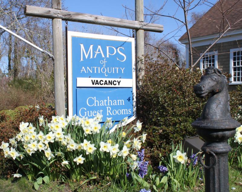
If you or your loved-ones need accommodations, send them over to our converted 18th century farmhouse, Chatham Guest Rooms. We have been very well reviewed on TripAdvisor!
Do you need a getaway?
If you visit the Cape, we recommend you stay in one of our rooms at Chatham Guest Rooms! The rates are reasonable and you will be staying in the building that is home to Maps of Antiquity! You can pop in to look at maps quite easily during business hours. Renting rooms year 'round!
|
|
|
The New Year has come and gone and we are almost beginning the second month of 2021. We hope you were able to send off 2020 in a way that was both satisfactory and safe. The temperatures here on Cape Cod are the coldest they have been so far this winter and we have a lovely light dusting of snow on the frozen ground, despite the gusting wind whipping the fallen snowflakes back up. It is the perfect weather to stay inside with a cup of tea or coffee and look at some of our new additions on our website!
We shall highlight some exciting maps below but you can always visit our Newly Listed Maps section to see everything new from the past month or so. We have a Great Maps - Super Deals category that offers our discounted items. And don't forget that we also have a category specifically for maps under $100!
If you are looking for something specific, we recommend using the "Search" function at the top of our website or the menu on the left side of the web page. You can also use [Ctrl+F] to search within a webpage. It is advisable to view our website on a computer (not mobile) for best image quality and enlargement.
The USPS seems to have recovered from their holiday delays. Thank you for your patience if your package was later than expected!
|
|
New Maps for January:
(in no particular order)
|
|
| | Ile de la Cite with Notre Dame and Sainte-Chapelle |
This 1908 folio contains 12 sheets which together create a large and beautifully detailed map of Paris as it was in 1710. It features illustrations of major buildings and bridges, the four city gates are pictured in the upper corners and inset maps in the lower corners. These could be framed individually or they could be joined to create a large map. Click over to our website for more photos.
|
|
| |
Rzeczpospolita Polska - The Republic of Poland - 1923
|
|
| |
Roma e suoi dintorni or Pianta di Roma - 1873
|
We have many new antique folding maps including the maps above of Italy, Poland (in Polish), and Rome, as well as Vienna, Greece, Alaska, and more. These maps were sometimes cut into sections and mounted on cloth, making it possible to fold and unfold many times easily and without damaging the paper. These maps were very useful to people who needed to travel for business or pleasure. It is delightful to imagine that these maps may have been carried by a 19th century lady or gentleman in their pocket or suitcase!
|
|
| | A Correct Chart of the Southern Coasts of Africa, from the Equator to the Cape of Good Hope - 1796 |
|
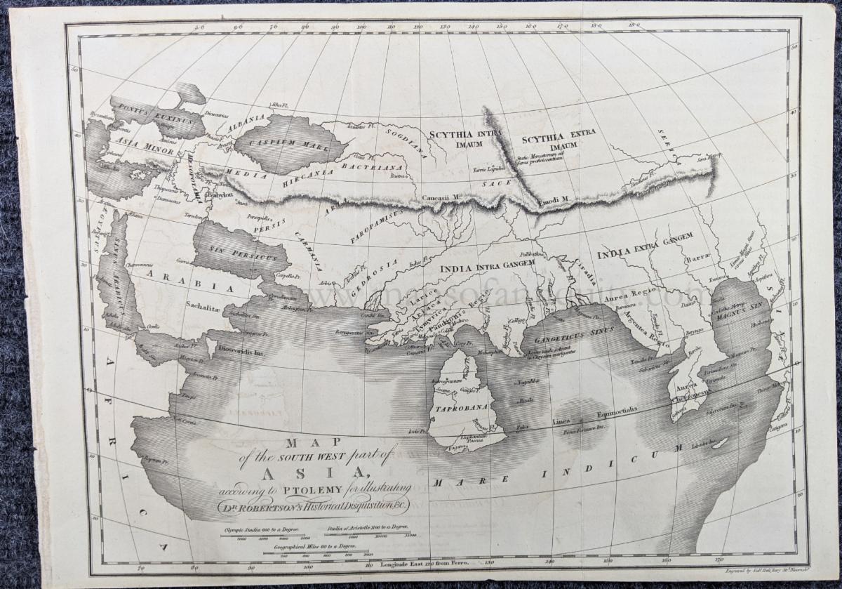
| Map of the South West part of Asia, according to Ptolemy for illustrating Dr. Robertson's Historical Disquisition - c. 1800
|
|
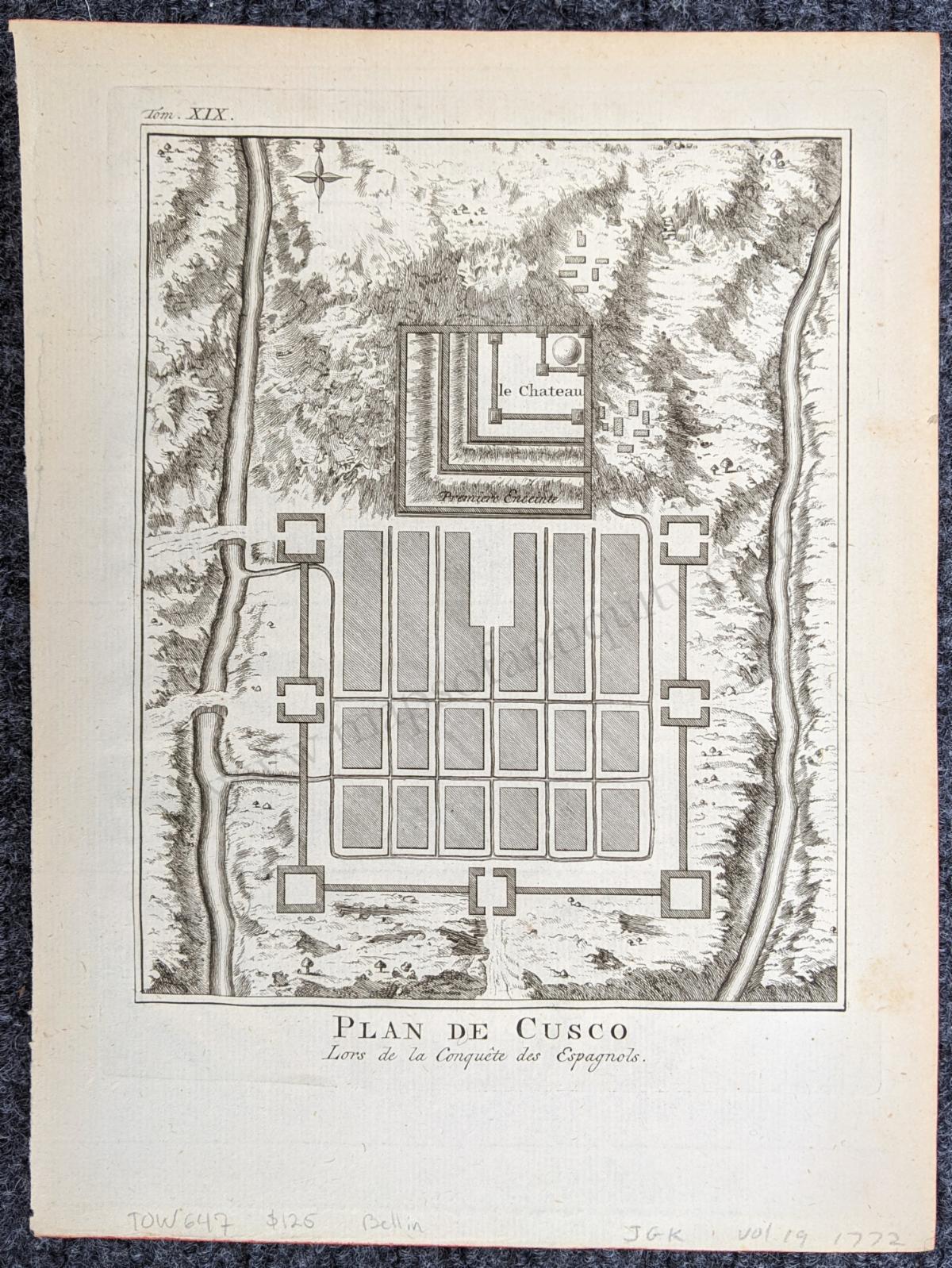
| Plan de Cusco Lors de la Conquete des Espagnols - 1772
|
|
| | Mappe-Monde sur Le Plan de l'Equateur. Hemisphere Septentrionale. - 1787 |
If you appreciate a well aged map, we have good news for you! Many of our newly added maps are from the 1700s and many are priced under $100!
|
|
| | Appomattox Court House - 1867 |
The American Civil War is a fascinating topic and a popular choice for antique maps. We have some new Civil War maps on our website including Bermuda Hundred, Appomattox Court House, Chancellorsville, and Jetersville.
We also have some newly restocked Civil War prints:
|
| | Plate 172. United States and Confederate States Uniforms. - 1895 |
|
| | Plate 175. U.S. and Confederate Flags and Badges in color with additional notes. - 1895 |
|
|
| | A Map of Long Island - 1961 |
|
| | Esso Pictorial Plan of Ireland - 1933 |
|
| | A Picture Map of New Bedford - 1930 |
If the winter doldrums are getting you down, a bright, colorful, and humorous pictorial map might be just what the doctor ordered. 'What makes a map a pictorial map?" you might ask. Well, the simple answer is that a pictorial map was created for visual enjoyment above other reasons- they might have some travel information but they were made to inform the viewer of other things, such as history, folklore, or the best fishing spots, and they sometimes include illustrations or stunning color. A few of our newest antique maps are above, but we have many more pictorial maps showing many different locations!
|
|
| | General Map of the Philippines or Filipinas - 1899 |
|
| | Bay of Manila, and Manila Philippines - 1899 |
We are excited to offer some interesting and detailed maps of the Philippines, including maps of various individual islands. The maps in the atlas were drafted by Philippine draftsmen under the direction of Rev. Jose Algue, S. J., director of the Manila Jesuit Observatory, and the atlas was published by the US Coast and Geodetic Survey. The text on the maps is in Spanish.
|
|
| | The Canadian Rockies - 1930 |
This gorgeous map includes Banff National Park, Kootenay National Park, Yoho Park, and more. The key directs viewers to Railway lines, Highways, Secondary Roads and Trails, Towns, Flag Stations, Post Offices, Hotels, Bungalow Camps, Tea Houses, Gas Stations, Warden's Huts, Waterfalls, Glaciers, Swamps, etc.
|
|
Happy New Year (a bit late)!
Thank you for a special and busy holiday season!
|
|
 | | Find us on Social Media for more updates |
Do you tweet, follow, like, and pin? Well, Maps of Antiquity has an active Facebook page where we post map-related articles, unusual maps and prints that we add to our website, company news, and answers to frequently-asked questions.
On Pinterest, we display some of our maps and prints and add opinions and comments about specific pieces. We also provide boards with decorating ideas.
On Twitter, Maps of Antiquity offers links to articles and brief news. We also periodically update Google Plus and LinkedIn with company news and product information.
Follow us on Instagram for fun posts like #MapMonsterMonday and snapshots of the shop!
So if you are spending time on social media, be sure to look us up. Also, if you have a preferred social media where you think we should be active....let us know!
|
|
|