Winter 2021-2022 Newsletter |
|
|
Dear Florida Climate Center Friends, |
We'd like to present you with the Winter 2021-2022 edition of our quarterly newsletter. In this newsletter, you'll find our recent monthly climate summaries; a recap of the 2021 annual weather and climate for Florida; the spring 2022 outlook; and an update on events, news, and activities we've been engaged in these past few months. If you have any questions, please send us an e-mail at climate@coaps.fsu.edu.
Thanks,
The Staff of the Florida Climate Center
|
|
|
Monthly Climate Summaries for Florida |
The Florida Climate Center's December, January, and February Climate Summaries for Florida are available, as well as previous monthly summaries. These summaries provide an analysis of temperature and precipitation patterns during the months of December through February across the state, along with data on hazardous weather, drought, and daily records tied or broken each month.
December closed out the year with unseasonably warm weather. Average temperatures were well above normal, with monthly departures from normal ranging from +2.5 ̊F in Key West to +9.1 ̊F in Pensacola. The statewide average temperature for December was +7.9 ̊F above the 20th century average, making it the 3rd-warmest December on record for Florida.
Closer to normal temperatures returned in January. Monthly mean temperature departures from normal ranged from -2.0 ̊F in Pensacola to +1.0 ̊F in Fort Myers. Temperatures varied widely throughout the month, beginning with exceptionally warm weather early in the month, followed by several cold fronts that impacted the state in mid and late January. The month ended with record cold temperatures and freezes that were felt even in south Florida.
Warm weather returned in February with monthly mean temperatures above normal across the state. Average temperature departures from normal ranged from +0.2 ̊F in Key West to +3.9 ̊F in Tampa, and several locations recorded one of their top ten warmest Februaries on record.
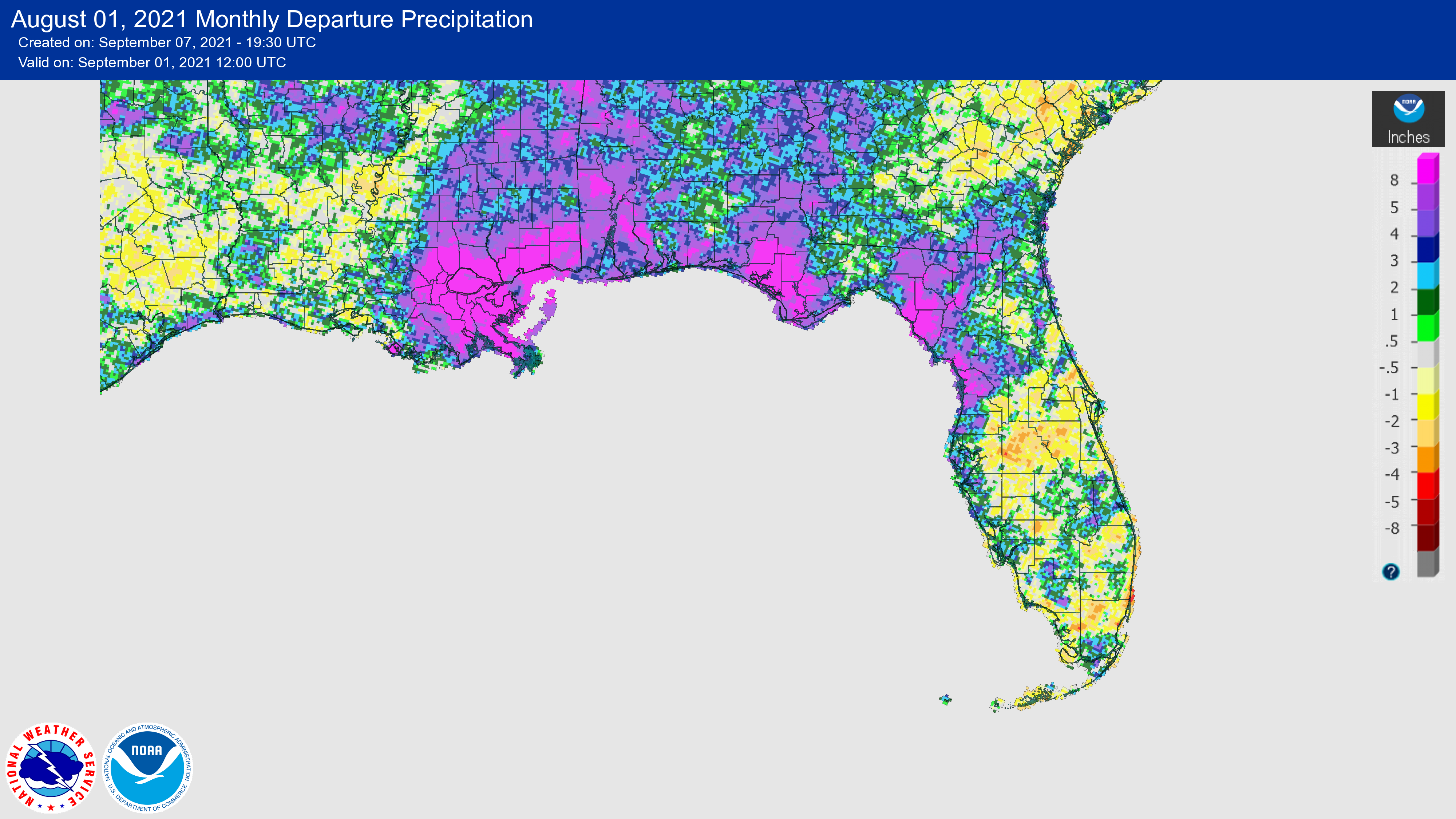
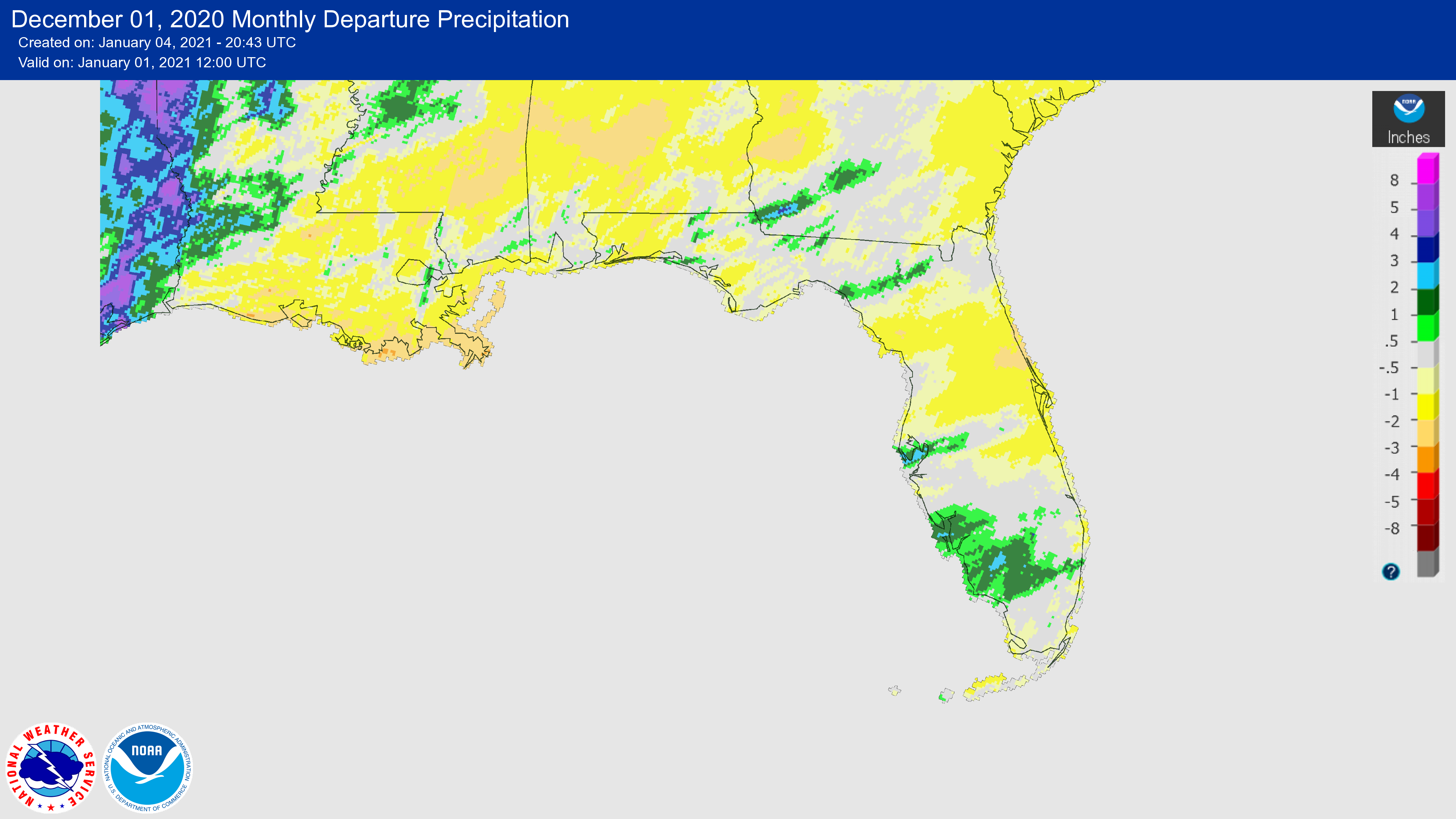
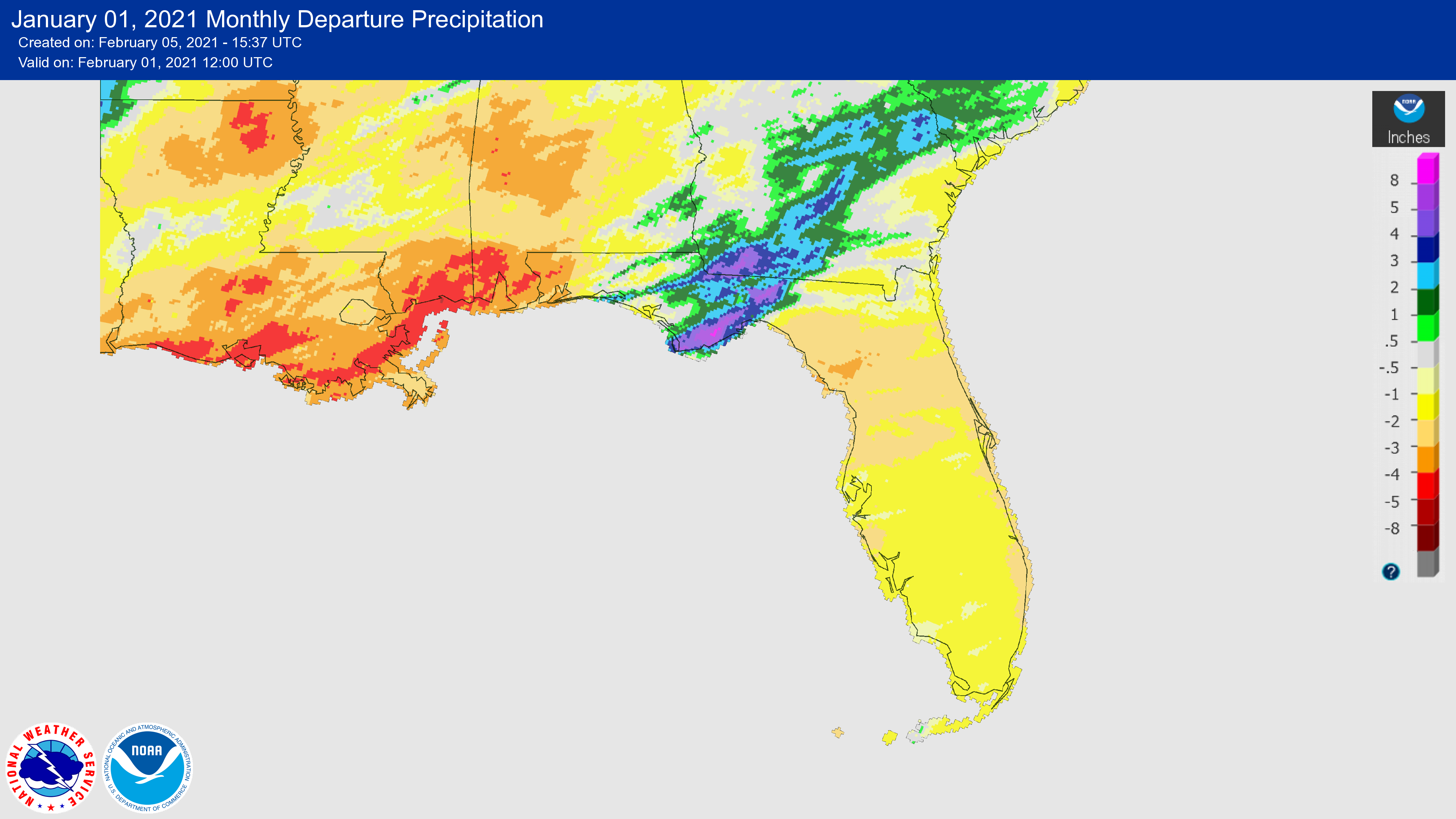
The figures below are graphical depictions of the monthly rainfall departure from normal (in inches) for December, January, and February (courtesy of the National Weather Service). Rainfall during the past few months has been below normal across much of the state. As of February 22, 13% of Florida was in moderate drought (D1) and 58% of the state was abnormally dry, per the U.S. Drought Monitor.
|
|
2021 Year-End Review: Above-Average Warmth and Variable Precipitation Across Florida for the Year |
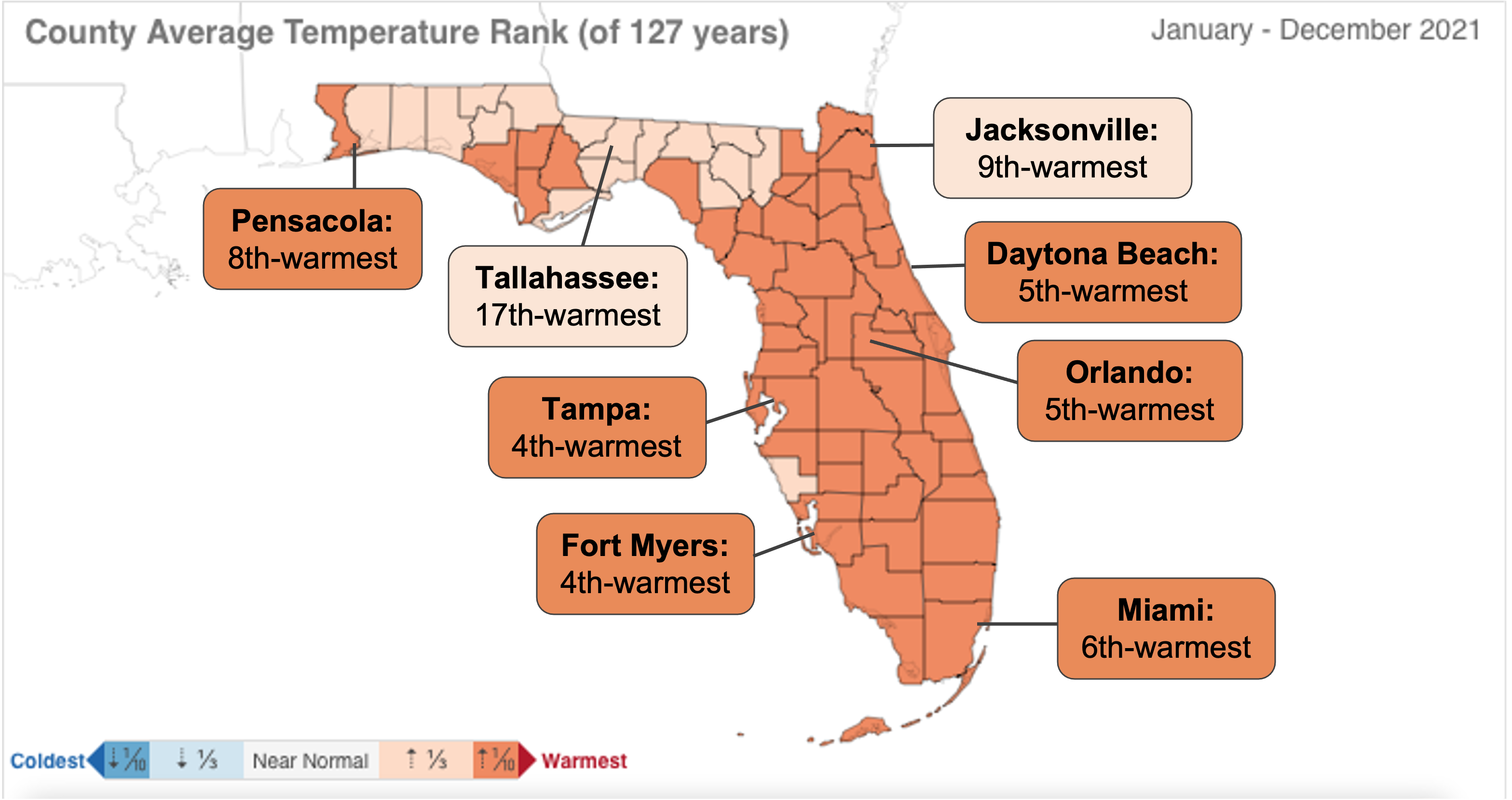
2021 was tied with 2018 as the 8th-warmest year on record since 1895 for Florida. Several months were relatively cool or near normal, which kept 2021 from ranking higher. 2021 was the 11th year in a row with above-average temperatures, and 21 out of the past 22 years have been warmer than the historical average in Florida. We closed the year with a December monthly average temperature anomaly of +7.9 ̊F above average, which marked our 3rd-warmest December on record.
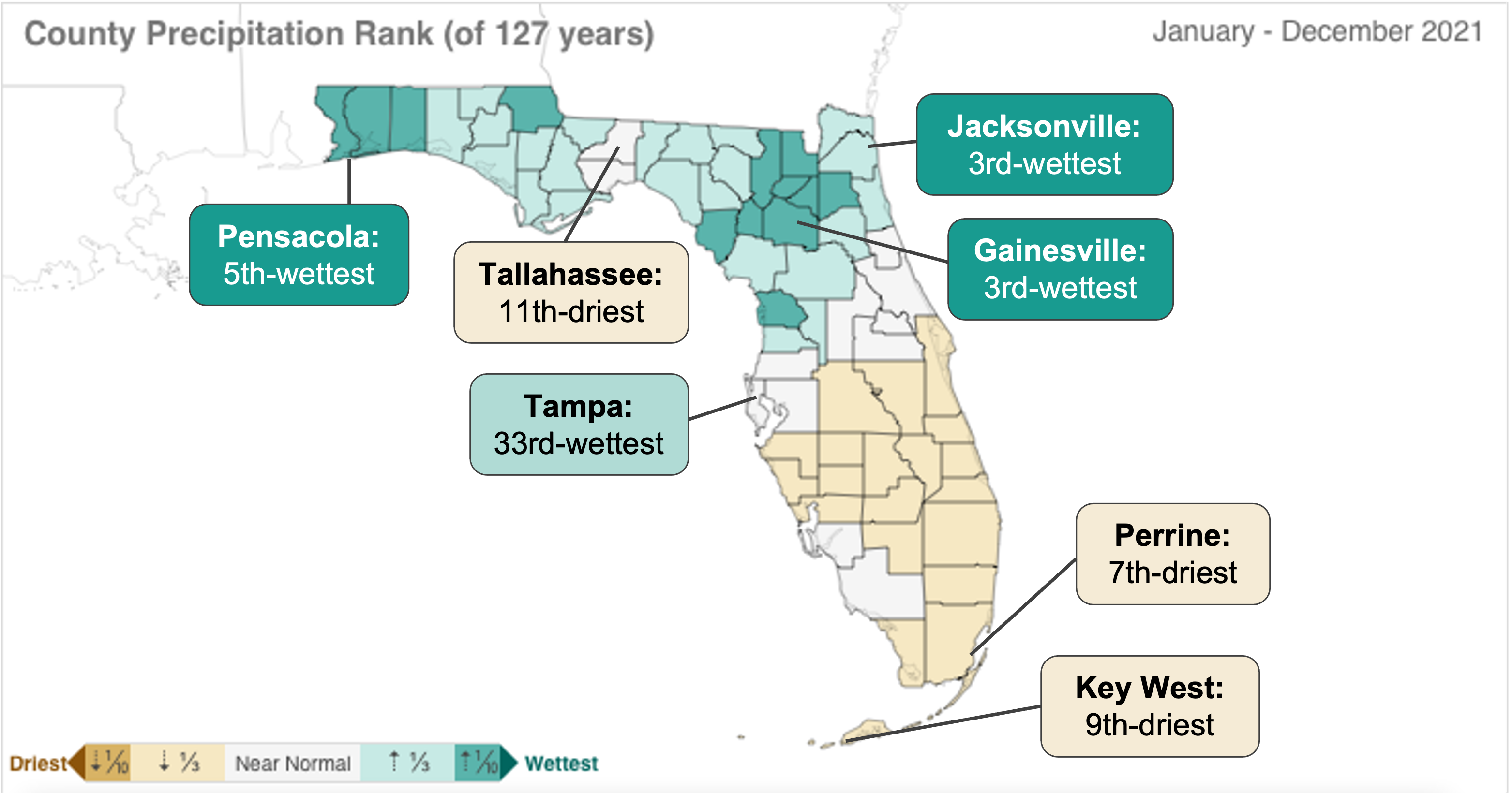
Precipitation in Florida was near the historical average in 2021, when considering the annual total averaged over the land area of the state. The 2021 statewide average precipitation was 56.14" (exclusively rainfall), which was +2.49" above the 20th century average of 53.65" (1901-2000). This total ranked 48th-wettest in the instrumental record dating back to 1895. 12 of the last 22 years have been wetter than the historical average, and 10 of the last 22 years have been drier than average, per the NCEI. The maps below show the 2021 county and select station rankings for average temperatures (top) and total precipitation (bottom).
2021 was an active weather year nationwide, with 20 billion-dollar weather and climate disasters according to NOAA, which was 2 events shy of the record 22 events set in 2020. Florida largely missed the worst of these disasters.
The 2021 Atlantic Hurricane Season was the third most active on record, with 21 tropical storms, 7 hurricanes, and 4 major hurricanes. Several of these storms impacted Florida, including Tropical Storms Elsa, Claudette, Fred, and Mindy, as well as some impacts from Hurricane Ida.
|
|
2021 Annual Average Temperature Rankings for Counties and Select Stations |
|
2021 Annual Precipitation Rankings for Counties and Select Stations |
|
La Niña Likely to Influence Spring Temperatures and Precipitation |
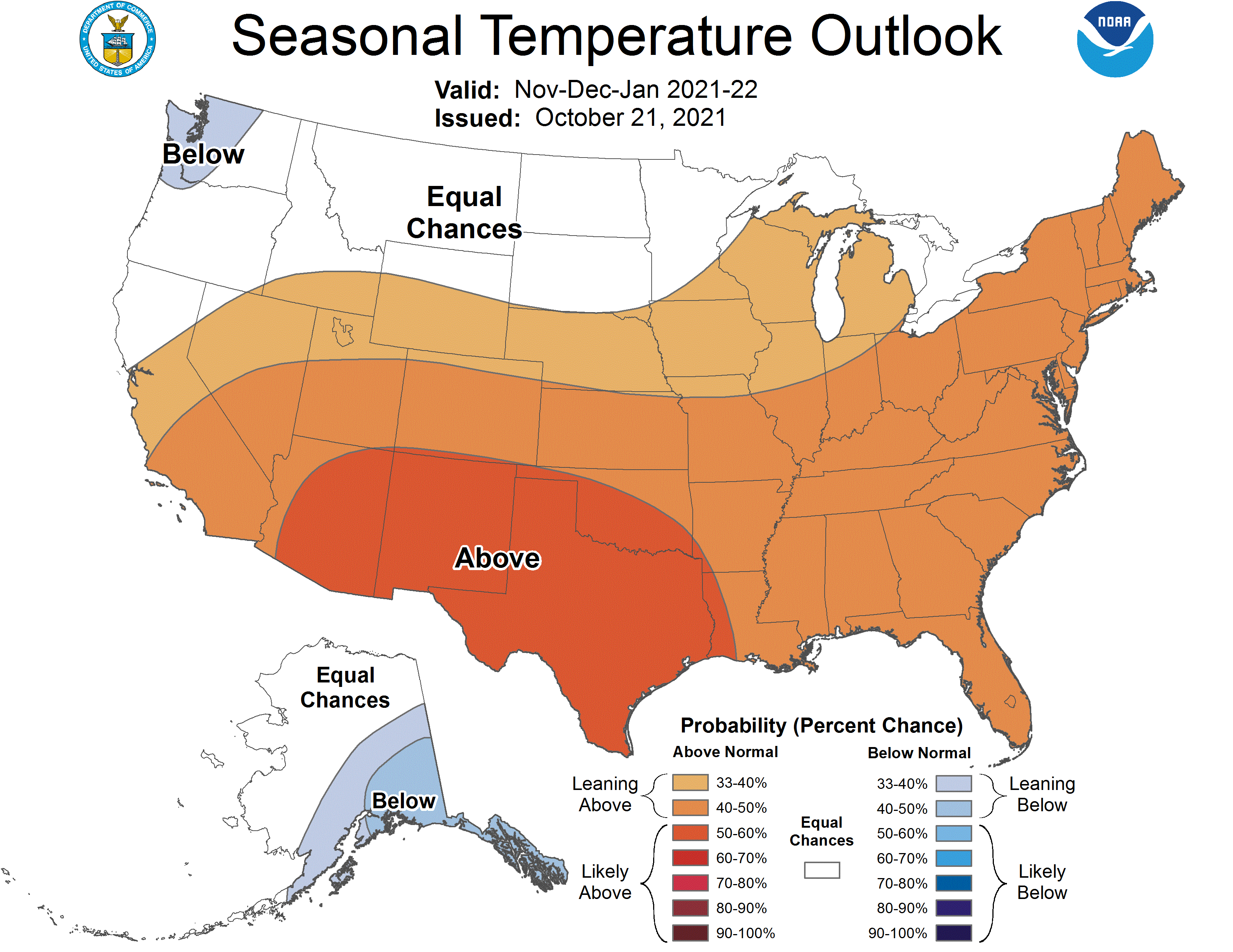
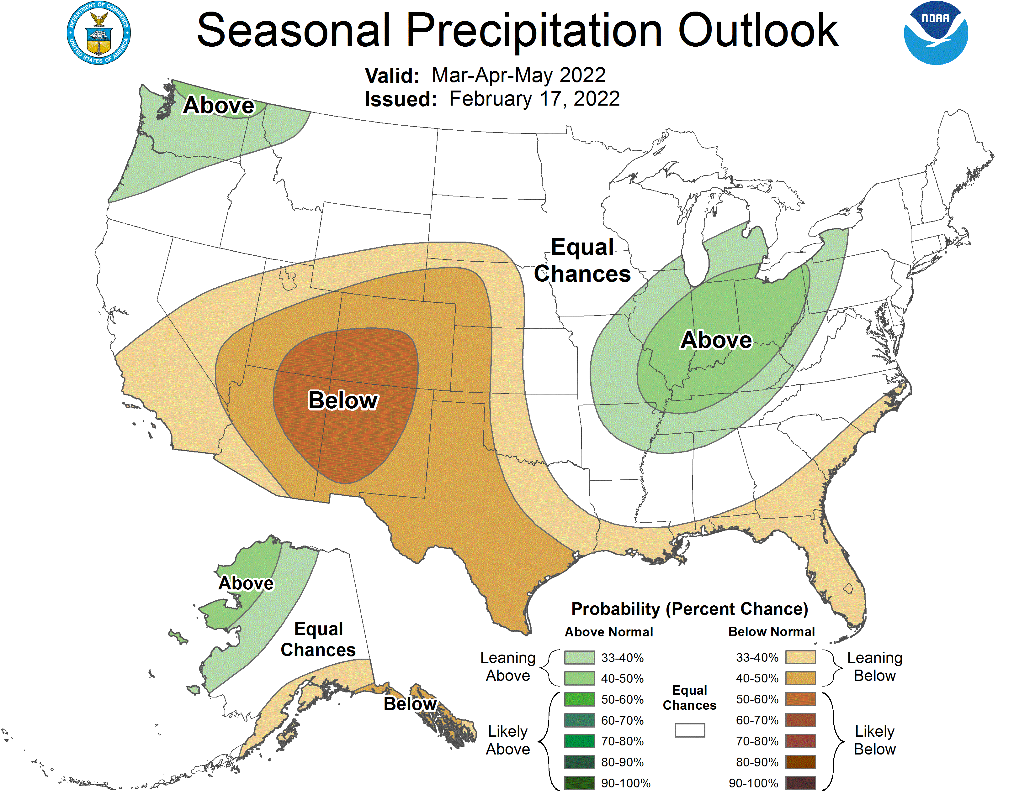
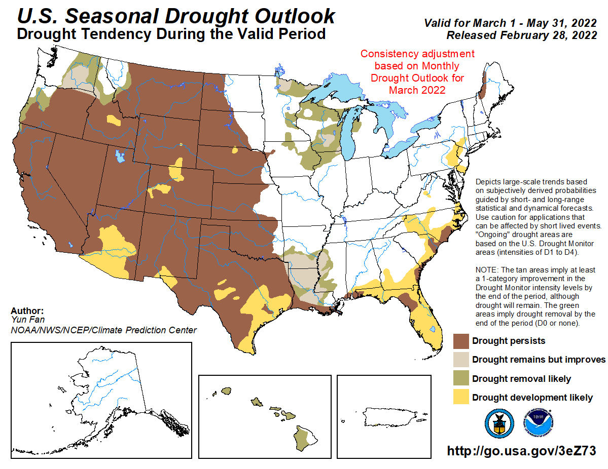
La Niña conditions, the cool phase of the El Niño-Southern Oscillation (ENSO) climate pattern, continued in the tropical Pacific Ocean over the past few months. La Niña is expected to continue through the Northern Hemisphere spring with a 77% chance it will persist through May 2022. According to the National Weather Service's Climate Prediction Center, temperatures are most likely to be above normal and precipitation most likely below normal for Florida and the southern tier of the U.S. over the next few months. Drought development is favored during this same period across Florida (see maps below).
|
|
Florida Climate Center in the News |
|
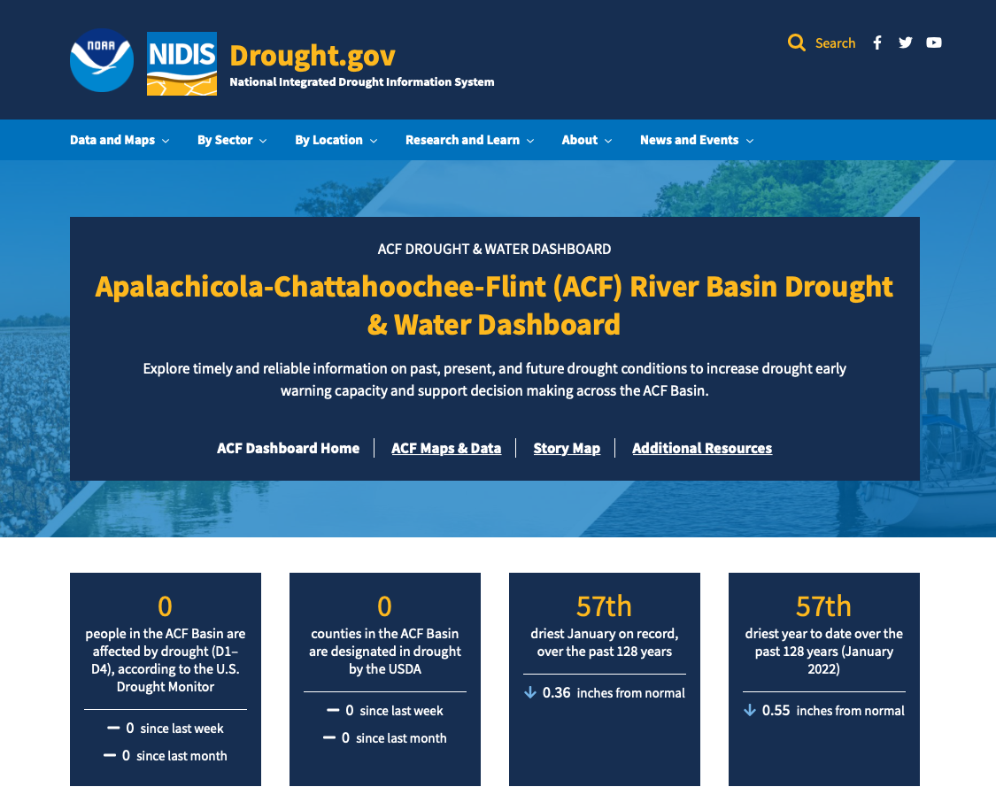
New Apalachicola, Chattahoochee and Flint (ACF) River Basin Drought & Water Dashboard Launched, Monthly Webinars to End |
|
NIDIS, in partnership with state and regional partners, recently launched the new Apalachicola, Chattahoochee, and Flint (ACF) River Basin Drought and Water Dashboard and StoryMap. These new resources provide real-time information on the climate, water, and drought status of the ACF River Basin with interactive, shareable, and user-friendly graphics on current and predicted drought conditions to assist decision-making at the basin and local levels. With these new resources, the ACF River Basin Drought and Water monthly webinars will soon come to an end. The last monthly webinar will be in May 2022. The new ACF River Basin Drought & Water Dashboard can be accessed here and the Story Map here.
|
|
Southeast Climate Monthly Webinar Series
This webinar series, hosted by the Southeast Regional Climate Center in partnership with the National Integrated Drought Information System (NIDIS) and the NOAA National Weather Service, is held on the 2nd Tuesday of each month at 10am ET. The next webinar is March 8 and the special presentation is titled: CoCoRaHS - The Value of Citizen Science Observers. Register here.
|
|
The Florida Climate Center is part of a three-tiered system of national, regional, and state climate offices, including NOAA's National Centers for Environmental Information (NCEI - in Asheville, North Carolina) and the Southeast Regional Climate Center (in Chapel Hill, North Carolina). The Florida State Climatologist and staff at the Florida Climate Center provide the following information and services to the people of Florida:
Climate Data
Historical weather observations for weather stations throughout the state of Florida. We are able to provide data for most stations from 1948-present.
Climate Information
Long-term historical averages for various stations, climate divisions, and the entire state.
Extreme Event Records
Information and analyses on extreme events such as freezes, droughts, floods and hurricanes.
Special Analysis
With their vast knowledge of El Niño, La Niña and climate variability, the State Climatologist and staff can offer expert insight into Florida's climate trends.
Outreach
Activities, presentations, and workshops that inform and educate the people of Florida about current and emerging climate issues. We also coordinate volunteers for the Community Collaborative Rain, Hail & Snow Network (CoCoRaHS).
|
|
|
|
|
|
|