|
How is it already July?! We hope you are having a great month so far! We're doing a LAST CALL for our membership hike on July 13th! There are still spots available. More information is below!
In this month's edition of our newsletter, we have a final report update from one of our 2023 Discovery Pool grant recipients. We also have a few updates from our agency partners, along with an article on staying safe during the summer in southeastern Utah.
We hope you have a great and safe July! Thank you for your continued support.
| |
CANYONLANDS NATURAL HISTORY ASSOCIATION
Membership Hike
| |
|
LAST CALL! We are delighted to announce that our membership events are back for 2024! Mark your calendars for a wonderful wildflower hike in the Manti-La Sal National Forest on Saturday, July 13th. Join us to experience how plant life has regenerated in the Gold Basin area, which burned in the Pack Creek Fire of 2021. Program expert Barb Smith with the US Forest Service will be our guide! Spots are limited!
To sign up for the hike, please email Denise at denise@cnha.org or call 435-259-6003 ext. 480
Save the date for our fall hike! Join us October 5th for an exploration in the Bears Ears National Monument!
Become a Member here and join us for our hike!
Photo: US Forest Service - Manti-La Sal National Forest
| |
CANYON COUNTRY
Safety in the Summer
| |
|
Stay safe while exploring southeastern Utah this summer. Always check the weather forecast before going out on your adventures. It's HOT out there! Expect high temperatures, intense sunlight, and low humidity. Hydration is essential in the desert. Eat plenty of food and make sure to drink at least one gallon of water, per person, each day.
Southeastern Utah experiences rain that can sometimes lead to extreme flooding during the summer months. Again, always check the weather forecast before going out on your adventures. If you plan to recreate on public lands in Canyon Country, be prepared for washouts, high and fast-moving water in rivers and streams, standing water, debris, and impassable roads or trails after flooding events.
Stay safe out there! Check out these videos on our YouTube channel from 2022 of flash floods in Moab and Arches National Park.
Graphic: Veronica Verdin (NPS)
| |
|
Flash floods can happen at any time after heavy rainfall and quickly, even if it is not raining yet in your location. Flash flood conditions in desert landscapes may happen when heavy rainfall is not soaked into the desert sands. These conditions may become dangerous if you encounter fast-moving, high water.
Know Before You Go
Check the local weather conditions for the area you plan to visit in Utah. Be prepared for changes in weather and stay informed on weather warning alerts.
Stay Safe On Your Next Adventure
- If you encounter flooding or rain, seek higher ground.
- You may encounter debris, washed out roads and trails, and/or standing water. Wait until the water recedes before attempting to hike out. When you go across a dry wash, think about how to get back. A dry wash may collect or fill with water before you return.
- Even if it is not raining where you are there is still a chance of flooding from rain upstream. Narrow slot canyons are especially susceptible to flash flooding. Always plan ahead and check the weather before going out.
- Please plan ahead to avoid vehicles getting stuck or needing to call emergency services. Do not attempt to cross flood waters on foot or in a vehicle.
- Traveling on wet or flooded dirt roads (especially those crossing high clay content soils) creates ruts and can cause damage. Once it dries, those ruts can harden and make it very difficult for others to use the road.
Learn more here.
Photo: BLM Moab
| |
CANYONLANDS NATURAL HISTORY ASSOCIATION
Discovery Pool Update
| |
Assessing the Health and Vulnerability of Scattered Old-Growth Ponderosa Pine in Southern Utah: Final Report
The final report for Larissa Yocom's Discovery Pool project is now available. Yocom sought out to answer the research question: "what factors are leading to the decline of old-growth ponderosa pine in southern Utah, and what management activities benefit these trees?"
The objectives of the study were to:
- Identify locations of old-growth ponderosa pine stringers on BLM land in southern Utah in collaboration with agency partners
- Prioritize and select stands for study
- Gather pilot data in selected stands to inform the question of what is leading to the decline of old-growth ponderosa pine stand
- Compare pilot data of tree growth and mortality in managed and unmanaged stands to determine whether recent management actions have relieved or added stress for old-growth ponderosa pine.
The conclusion:
"The stringers of ponderosa pine on Ray Mesa have changed substantially over the past centuries as human populations, land use, and climate have changed. Aerial images reveal the densification of the forests across the Mesa in the absence of frequent surface fire since the early twentieth century. Forest restoration activities such as thinning and burning have been shown to increase resilience of old trees to climate stress as well as reduce the risk of future high-severity wildfire. On Ray Mesa, our analysis of tree growth indicated that the old trees that have survived the recent treatments unharmed have benefited from the reduction in competition, likely by experiencing an increase in access to water. However, the treatments were likely responsible for the mortality of some trees, as shown in our analysis of death dates between 2009 and 2023. We conclude that restoration activities should be carried out to increase resistance and resilience of old ponderosa, but care must be taken to keep any prescribed fire from damaging old tree roots, stems, and crowns."
Read the full final report here.
| |
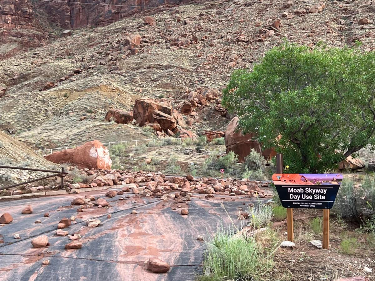
BUREAU OF LAND MANAGEMENT - MOAB FIELD OFFICE
Campground Closures
| |
|
The Moab Field Office will be conducting summer seasonal campground closures from July 10th through August 29th, 2024. These seasonal closures assist in directing visitation and managing facilities, and allows for maintenance and improvement projects to proceed during this relatively slow period of the year.
The following campgrounds are included in the closure:
- Ledge A
- Ledge B (back loop will remain open)
- Ledge C
- Ledge E (sites 1 & 2 will remain open)
- Horsethief Loops Buckskin & Cayuse
- Horsethief Group Sites A, B, C, D, E
- Lone Mesa Group Sites A, B, C, D, E
- Big Bend (middle and upper end, including Upper Big Bend, will remain open)
- Oak Grove
- Lower Drinks
- Upper Drinks
- Ken's Lake Loop A (closure begins early on July 8th)
View more information on camping and the Moab Field Office here.
Photo: BLM Moab
| |
US FOREST SERVICE
Manti-La Sal National Forest Updates
| |
|
The Moab/Monticello Trail Crew began their season in early June and has been diligently clearing trails. They have focused on the Trans La Sal Trail, removing fallen logs and trimming overgrown areas that have developed since the Pack Creek fire. If you encounter any trees blocking trails or spots needing maintenance while you're out, please inform the Forest Service so they can prioritize their efforts.
Work is also progressing on the new Porcupine Rim Campground! The recreation staff aim to complete the project by this fall, making the campground ready for camping.
Don't forget! Construction has started along the La Sal Mountain Loop Road. They are currently working on Horse Creek to Geyser Pass. Work takes place daily Monday through Friday from 8:30 a.m. to 5:00 p.m. During work hours, there will be no access through the work area. In observance of the July 4th holiday, there will be no work from noon on Wednesday, July 3, through Monday July 8, at 6 a.m. The road will be open to vehicles during this time. Get the latest updates and access information here.
For the most up-to-date information on the forest, check out the U.S. Forest Service Manti-La Sal National Forest Facebook page!
Photo: US Forest Service - Manti-La Sal National Forest
| |
NATIONAL PARK SERVICE
Canyonlands Virtual Junior Ranger Pledge
| |
|
Looking for an at-home summer activity with the kiddos? You can become a Canyonlands Junior Ranger without visiting the park! Download and complete the Junior Ranger booklet online, mail it to the park, and receive a badge! Then, take the Canyonlands Virtual Ranger pledge with the awesome rangers, just like you would in the park! Click here for more information.
We also have a great variety of Junior Ranger merchandise in our online store. Check it out here!
| |
|
Visiting Canyonlands National Park Island in the Sky District
July through September?
Canyonlands National Park is embarking on a multi-year reconfiguration of Grand View Point parking lot to improve vehicle and pedestrian safety. Construction work in 2024 will occur over a period of eight weeks in late summer between July and September. During this time, Grand View Point Overlook, Grand View Point Trail, and 0.3 mi (0.5 km) of park road will be closed from 6 a.m. Mondays to 4 p.m. Thursdays. The closure applies to all uses, including vehicles, tour buses, motorcycles, bicycles, and pedestrians.
The construction area will reopen for public use at 4 p.m. each Thursday and stay open through weekends, closing again at 6 a.m. Monday mornings. During these open periods, parking may be limited due to construction materials and equipment along the roadway. Grand View Point is a primary destination at the Island in the Sky district of Canyonlands.
Read the full news release here.
| |
Community Artist in the Parks: Annie Dalton
See how Annie turns her inspiration into art, or join her (with your own art supplies) for a side-by-side creative endeavor. Bring water, sun protection, and your imagination.
Annie Dalton was born in Moab but lived all around the southwest as a child. She studied Fine Art and Biochemistry in college, graduating with a BA from Arizona State. Annie strives to create art that encourages people to slow down, savor the moment, and reconnect with nature. Raised by an artist and miner/driller, her art and a love of this landscape and its elements are interwoven.
Learn more and check out July dates here.
Can't make it but still want to support? Check out her artwork here!
| |
MIC Free Lecture Series
Join us Thursday's at 5pm at the Moab Information Center for our free lecture series.
July 11 | Geology of Canyonlands by Rhodes Smartt
July 18 | Ecological Interactions between Mountain Goats and American Pikas by Mallory Sandoval Lambert (Discovery Pool grant recipient)
July 25 | Soundscapes by Robert Anderson
Check out full details and all lecture dates here.
| |
Your Purchases Support Education and Research on the
Public Lands of Southeastern Utah.
| |
|
Our Mission
Canyonlands Natural History Association (CNHA) is a non-profit organization, which exists solely to assist the National Park Service, the U.S. Forest Service, and the Bureau of Land Management in their education and visitor efforts. Proceeds from sales support these agencies’ educational, interpretive, and scientific programs on the Colorado Plateau.
Follow Us!
| | | | |