|
A Message From the Core Committee
Greetings Volunteers and Friends:
Summer is flying by and since May, we have launched
11 more projects bringing our running total to 240! That brings the number of deployed volunteers to over 1,800 volunteers in 71 countries. See more detail on our latest Missions in Progress and Featured Projects below, including on-site work in the Central African Republic, more World Health Organization Mapathons, and numerous HOT/OSM disaster activations.
In July, Core Committee members were joined by numerous volunteers at the Esri User Conference in San Diego. We hosted our annual luncheon where we recapped a very busy year, and spoke with dozens of new friends, volunteers and partners. See the full recap below.
Our most important summer news comes direct from the Core Committee. As we have gotten steadily busier over the last few years, we have modified our policies to allow for up to nine Core Committee members (increased from seven). As part of that expansion, we are thrilled to welcome our two newest members, Troy Wirth of Nevada and Wincy Poon of Georgia. It is always exciting for us to add fresh, passionate volunteers to our evolving team, so please give them a warm welcome in future communications.
Also as part of this expansion, we are excited to be in a position to hire a part-time administrative assistant. The position will be responsible for managing many of the day-to-day tasks involved with running GISCorps. Our hope is that the new position will free up the Core Committee to vet more projects and get more volunteers involved. If you or someone you know are extremely detail oriented, highly motivated, and have a very flexible schedule, please consider applying. View the job description.
We have also been in communication with the FEMA staff in Puerto Rico and are raising funds to send up to 16 volunteers to help local communities update their mapping capabilities. If you are able to contribute to the funding push, read more about the GoFundMe campaign, and please share with your friends and family networks.
Thank you once again for your continued support of URISA's GISCorps. We are grateful to you and all our volunteers for the remarkable contributions you make.
With warmest regards,
GISCorps Core Committee: Dianne Haley, German Whitley, Leslie Zolman, Allen Ibaugh, Carol Kraemer, David Hansen, Troy Wirth, Wincy Poon, and Shoreh Elhami
|
| Deployment and Partnership News |
Missions in Progress
A total of five missions are currently in progress with several more in the works. More details on these projects are posted on our What We Do web page under 'New and Ongoing Projects'.
|
Featured Projects
Volunteers Participate in Two Mapathons Hosted by WHO
In July and August, hundreds of GISCorps volunteers participated in two Mapathons in the Horn of Africa, both in support of WHO's polio eradication efforts.
During the weekend of July 20-22, 2018, five volunteers participated in this project to validate settlement names and locations within 15 kilometers of the Kenya, Somalia and Ethiopia borders.
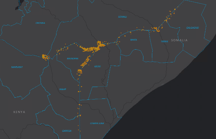
Then, from August 9-12, 2018, 218 volunteers from 46 countries participated in a Mapathon to map structures in a focused area within 15 kilometers of the Kenya, Somalia and Ethiopia borders. This Cross Border area has been identified as being at high-risk for polio outbreaks and the
spread of the virus between countries.
World Wildlife Fund - Central African Republic:
From June 15 - July 29, 2018, William Ouellette, Senior GIS Engineer at TomTom BV in Gent, Belgium, was deployed to an on- site mission in the Central African Republic (CAR).
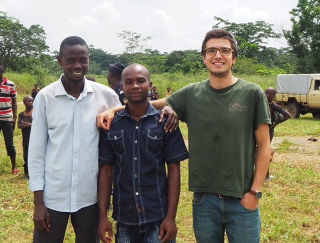
The request for a volunteer came from WWF (World Wildlife Fund for Nature). The Dzanga Sangha Special Reserve in the southwest section of the country is the only area in which they operate, and WWF has fostered a long standing relationship with the Ministry of Water and Forest in the country. Read more here.
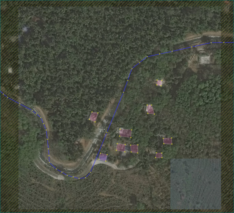
Mabi-town, Japan Flooding
In early July, parts of Western Japan were devastated by a series of disasters caused by torrential rain, including landslides and severe flooding. One area hit particularly hard was the town of Mabi in Okayama prefecture, where flood waters as deep as 5 meters inundated the main part of town, killing dozens and
displacing thousands.
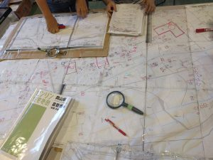
In the immediate aftermath of the tragic flood, thousands of volunteers descended upon the town to help. One such volunteer saw the need for a geospatial solution and reached out to GISCorps for help.
Read more about this mission
here
.
Humanitarian OpenStreetMap Team Projects
Our OSM-skilled volunteers have been in high demand of late. HOTOSM has had multiple disaster activations this summer including the Ebola outbreaks in the Democratic Republic of Congo; the Osaka, Japan earthquake; severe flooding in Sri Lanka, India, and Japan; and the Attapeu Dam collapse in Laos.
At least 20 volunteers have contributed over 100 hours digitizing and validating, and efforts are ongoing.
If you are a HOTOSM contributor and want credit for your work via GISCorps (for GISP credit or other), make sure to fill out
this Google form
.
Watch for a new HOTOSM page on our website soon!
|
|
If you haven't already, don't forget to join us on social media. We have a
Facebook
group, a
Twitter
handle (@GISCorps), a
LinkedIn
page, and a
Slack
group. We aren't on the cutting edge with some of these things, but we do share on occasion and would love for more volunteers to help us get the word out. Find other ways to
'Spread the Word'
on our website. Also double check that the 'giscorps.org' domain is not being sent to your Spam folder.
|
Since the launch of the GIS Service Pledge, 27 volunteers have been granted a free personal use license. You can see the names and locations of those volunteers in
this web map
.
If you know of a worthy cause that could benefit from your GIS expertise, review the guidelines and apply for the Pledge
here
. Send any questions specific to the GIS Service Pledge to:
[email protected]
.
|
| Conference News & Announcements |
Esri UC 2018 Recap
It was a very busy and successful week in early July at the 38th Esri User Conference. Core Committee members Allen Ibaugh, Shoreh Elhami, and German Whitley presented at our annual lunch meeting on the successes of GISCorps over the last year. German and Curtis Day managed the GISCorps kiosk in the Sustainable World Expo area along with help from volunteers Alexis Handelman, Tarig Ahmed, Bethany Hall, Milan Budhathoki, Dacey Zelman-Fahm, Bhanu Vedula, Manjul Shrestha, Anand Trivedi, and Aaron Dorsey. All worked tirelessly to sign up dozens of new volunteers, hand out well over 100 brochures and stickers, and connect with both new and old Partner Agencies. See the photo highlights on our webpage. Thank you all for the help!
GIS-Pro & CalGIS 2018
URISA's 2018 GIS-Pro conference will take place in Palm Springs, California on October 9-12 with Jack Dangermond as the keynote speaker.

As in previous years, there will be GISCorps gatherings and an all-conference presentation on the main stage during the Awards Breakfast. This year, there will also be a Silent Auction to benefit GISCorps!
Check out the substantial educational content in seven focused program tracks and register soon.
|
 Name
:
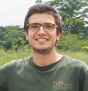
William Ouellette
Name
:
William Ouellette
Organization
:
TomTom BV, Gent, Belgium
- GISCorps mission(s)/Year served: GIS Capacity Development in Dzanga Sangha, Central African Republic, 2018
- Share your experience about the mission: I had read a lot about the challenges of conservation in Africa ahead of the mission, but anti-poaching in the Dzanga Sangha Special Reserve turned out to be a whole other ball game, with its array of specific problems and challenges. I took from the experience at least as much as I have given, as it was my first serious experience in Conservation. Eye-opening all the way, and I am even saying that after my third visit to the continent. They were sitting on a gold mine of data which no one had seriously exploited before my arrival. In my short 45 day stay here, I did my best to teach the team how to make maps with QGIS for patrol briefing/debriefing purposes, with the support of spatial data layers generated through queries on the SMART database. They were instantly able to grasp the benefits of this information, which motivated them to learn how to produce these maps flawlessly.
- Anything else to share: If you want a truly unique wildlife experience in a really interesting cultural context, this place must be visited. They are struggling to get the tourist numbers up because of the apparent political instability of the country, but I can 100% vouch for the safety of the area. Don't let the travel advice fool you and go visit, or volunteer, or apply at WWF, or donate through your organization and pay a visit to the park, you won't regret it.
|
| Thank you for your continued support of URISA's GISCorps! |
|
|
| URISA's GISCorps Core Committee |
| Shoreh Elhami Dianne Haley Dave Hansen Allen Ibaugh Carol Kraemer Wincy Poon German Whitley Troy Wirth Leslie Zolman Contact us: www.giscorps.org Email: [email protected] Twitter:@giscorps |
|
| |
| Please support GISCorps with a tax-deductible donation in 2018. Your support is greatly appreciated! 
|
|
|
URISA
Education Calendar
|
|
Austin, Texas Raleigh, NC Toronto, Ontario
For more information, visit
|
|
|
|