We're Open
Year 'Round!
Our shop is normally open:
Monday - Saturday:
10am - 5pm
Sunday:
12 noon- 5pm
We're also available after hours by appointment, and you can
shop online 24/7 at:
Or give us a call at:
508-945-1660
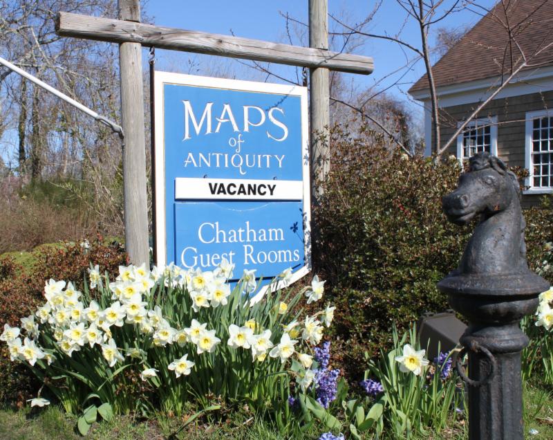
If you or your loved-ones need accommodations, send them over to our converted 18th century farmhouse,
Chatham Guest Rooms
. We have been very
well reviewed
on TripAdvisor!
Planning your summer adventure?
If you visit the Cape, we recommend you stay in one of our rooms at Chatham Guest Rooms! The rates are reasonable and you will be staying in the building that is home to Maps of Antiquity! You can pop in to look at maps quite easily during business hours. Book early because the summer will fill up quickly!
|
|
|
HELLO MAP LOVERS,
"What is one to say about June, the time of perfect young summer, the fulfillment of the promise of the earlier months, and with as yet no sign to remind one that its fresh young beauty will ever fade."
-Gertrude Jekyll
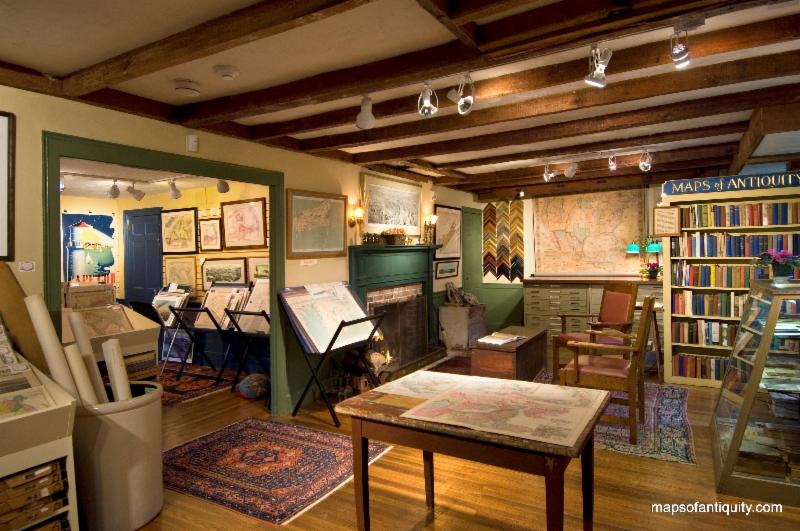
Summer is thoroughly upon us once again. The air on the Cape is humid and the tourists are relaxing on the beaches and popping into shops. Our store has begun to be noticeably busier in the past few weeks and we are enjoying the pleasure of introducing many new people to the delights of antique maps.
Despite the quickening pace of life, we have still managed to list some interesting new maps that we are excited to share with you. But this month we will also highlight some of our favorite things in the store in an effort to give these lovely maps and prints the spot light that we feel they deserve.
As always, you can see our recent acquisitions by
visiting our Newly Listed category, which is updated as often as we can manage in this busy time of year. If you are looking for something specific, we recommend using the 'Search' function at the top of our website or the menu on the left side of the web page.
|
|
New Items for June 2019:
(in no particular order)
|
This antique chart was created before the Golden Gate Bridge was started in 1933. It offers a good representation of San Francisco, includes Oakland, Berkeley, and the general Bay area.
|
This handsome old map of South Carolina by Buchon is from "Atlas Geographique, Statistique, Historique et Chronologique des Deux Ameriques", the French edition of Carey & Lea's "American Atlas."
The map is surrounded by French text giving extensive information on climate, education, religion, government, soil and crops, rivers and bays, manufacturing and commerce, history, etc.
|
Consisting of two joined sheets, this nautical chart shows the coastline of Northern California to Haida Gwaii in Canada, including Vancouver, and the coasts of Washington and Oregon etc. It has 16 inset maps: Fuca Straight, Royal Bay (Victoria), San Francisco, Vancouver Island, and more.
|
These two pictorial maps are full of fun and fascinating information with illustrations and historical facts.
|
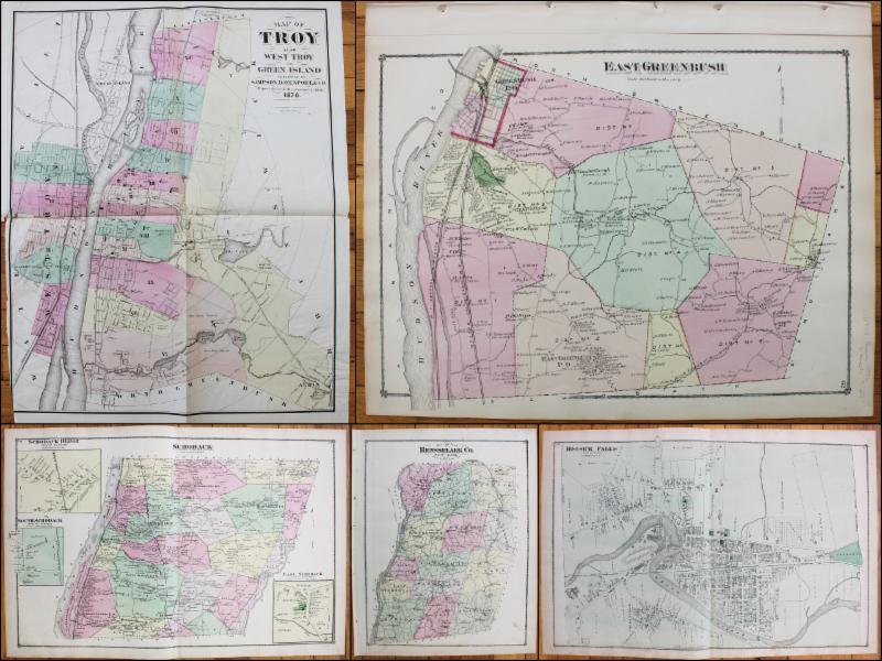
These maps feature property owners names and both atlases include prints of notable buildings.
|
|
Our Staff's Favorite Maps!
|
Bob's Favorite:
The De Crevecoeur Maps of Nantucket and Martha's Vineyard
With unusual and interesting geography and little notes, it's no wonder Bob likes these very old maps of the islands off of Cape Cod. They are from an English version of the book called Letters from an American Farmer. Did you know that Bob lived on Nantucket for a while?
|
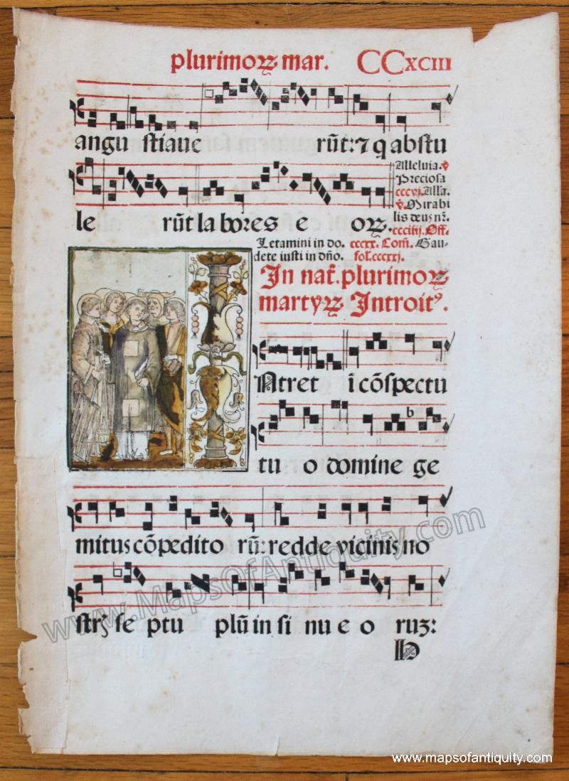
Danielle's Favorite:
Antique Sheet Music
We believe this sheet of antique music to have been produced sometime in the 1500s but it is difficult to put too firm a date on it. The decorative illustration is what sets this sheet apart from many others. This was likely produced by woodblock print and hand colored.
|
Perri's Favorite:
Strabonis Ptolemaic Maps
As an art history major who focused on Medieval art, Perri is particularly fond of these 1540s maps by Munster, which are recreations of Strabo's Ptolemaic maps. Their graphic quality and unique geography are so interesting and unusual!
|
Marik's Favorite:
18th Century Road Maps
These British maps are called strip maps and they show specific routes and include all of the useful information that a traveler in the 1700s might need, including hills, brooks, roads, towns, churches, and more. One of these sheets even has Sherwood forest on it!
|
Everyone's Favorite:
Hold-To-Light Prints
There are few moments more delightful than when we lift one of these antique hold-to-light prints up to a light, revealing the hidden magic: parts of the paper is cut away with colored tissue on the back and the light illuminates these areas, making them glow! It never fails to enchant our customers, which is probably one of the reasons we all like these so much.
|
|
 |
| Find us on Social Media for more updates |
Do you tweet, follow, like, and pin? Well, Maps of Antiquity has an active Facebook page where we post map-related articles, unusual maps and prints that we add to our website, company news, and answers to frequently-asked questions.
On Pinterest, we display some of our maps and prints and add opinions and comments about specific pieces. We also provide boards with decorating ideas.
On Twitter, Maps of Antiquity offers links to articles and brief news. We also periodically update Google Plus and LinkedIn with company news and product information.
Follow us on Instagram for fun posts like #MapMonsterMonday and snapshots of the shop!
So if you are spending time on social media, be sure to look us up. Also, if you have a preferred social media where you think we should be active....let us know!
|
|
|