We're Open
Year 'Round!
Our shop is normally open:
Monday - Saturday:
10am - 5pm
Sunday:
12 noon- 5pm
We're also available after hours by appointment, and you can
shop online 24/7 at:
Or give us a call at:
508-945-1660
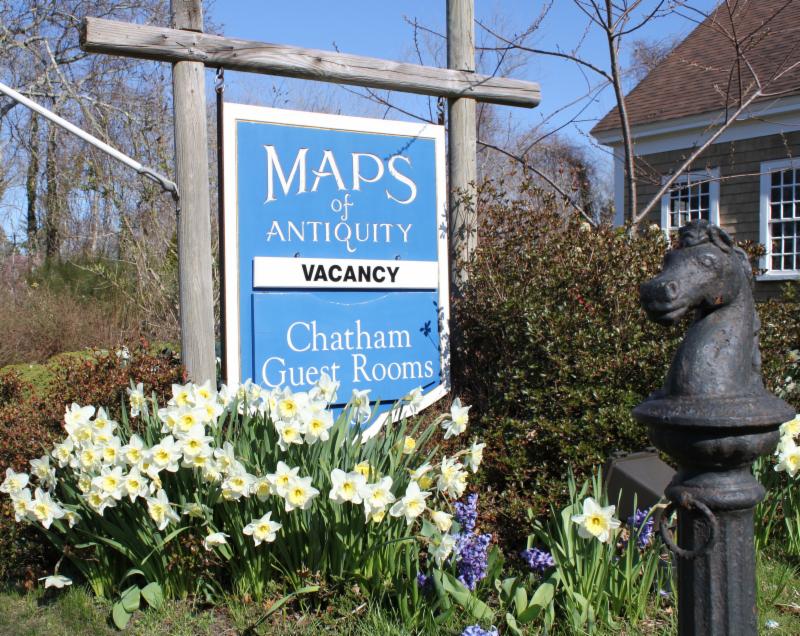
If you or your loved-ones need accommodations, send them over to our converted 18th century farmhouse,
Chatham Guest Rooms
. We have been very
well reviewed
on TripAdvisor!
Looking for a quiet winter getaway? Planning your summer adventure?
If you visit the Cape, we recommend you stay in one of our rooms at Chatham Guest Rooms! The rates are reasonable and you will be staying in the building that is home to Maps of Antiquity! You can pop in to look at maps quite easily during business hours.
|
|
|
DEAR MAP LOVERS,
Happy Spring, dear friends! We hope you have fully adjusted to the time change (if you live somewhere that Daylight Savings Time is used), and that your days are becoming ever cheerier with the increased daylight.
|
|
| We are still waiting for this year's crocuses- these are from 2017! |
We have been working on a new project: organizing and inventorying several large collections of antique nautical charts. We estimate that we have 250-300 19th century nautical charts that we will be listing over the next few months. We also have a similar number of early 20th century charts. We already have a few on our website and are very excited to share them with you here. We hope you will check back often to see what is new!
Of course, many of our nautical charts are on the more valuable side, but we have listed many new items at a variety of price points. We know that nautical charts are not in everyone's budget range, so next month we will be sure to have lots of less pricey pieces!
As always, you can see our recent acquisitions by
visiting our Newly Listed category, which is updated at least once a week. If you are looking for something specific, we recommend using the 'Search' function at the top of our website or the menu on the left side of the web page.
|
|
New Nautical Charts for March 2019:
(with two other interesting offerings at the end)
|
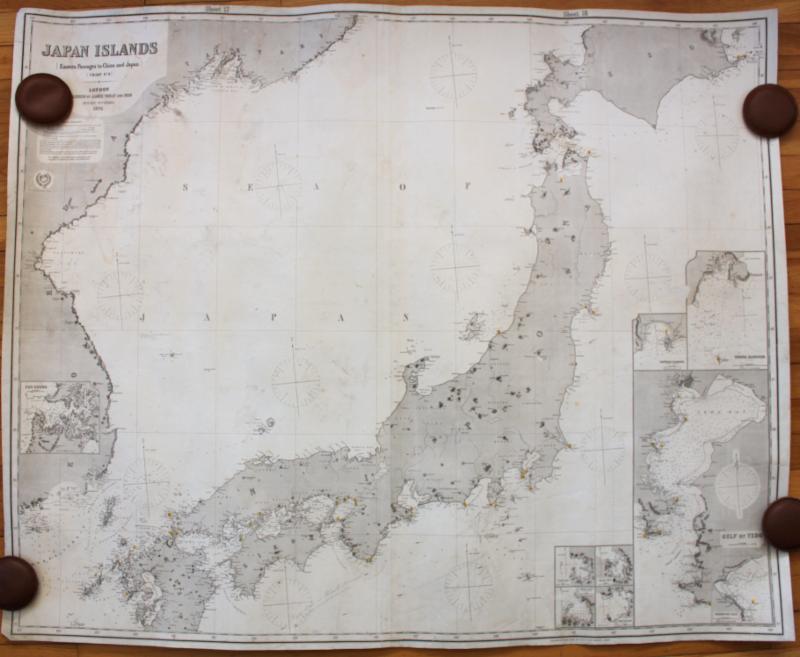
This chart of Japan is in very good condition and has some plotting. This chart was published just 25 years after Japan ended its 200 year long isolation policy. This chart includes eight insets with great detail. This is a fantastic collector's chart.
|
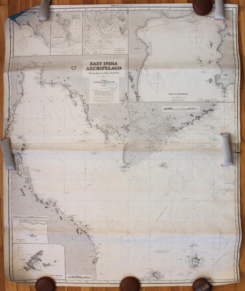
#2: Western Route to China, No. 3, East India Archipelago - 1886
Published b
y Imray & Son in 1886, this chart shows the area of the Gulf of Thailand and has six inset maps, including Bangkok, Thailand and Saigon (Ho Chi Minh), Vietnam.
|
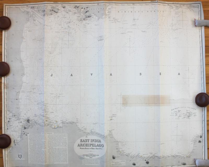
#3: East India Archipelago, Western Route to China, Chart No. 1 - 1885
Centered on the Java Sea, this chart includes the Sunda Strait between Sumatra and Java and the Banka Strait between Sumatra and Bangka.
|
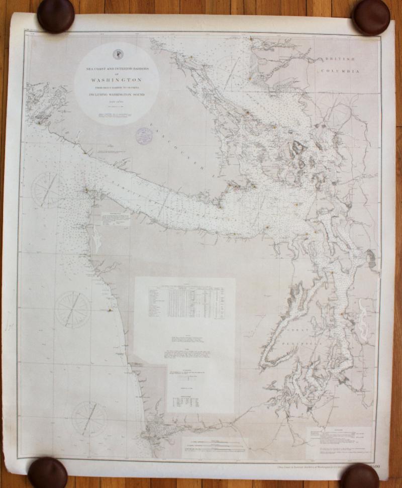
#4: Sea Coast and Interior Harbors of Washington From Grays Harbor to Olympia - 1886/1891
Let's transition acro
ss the Pacific with this chart of
Washington state's coastline, as well as all of Puget Sound- including Seattle and Tacoma. The chart also includes Victoria and Vancouver. It is in very good condition and will look great framed and hung on a lucky someone's wall!
|
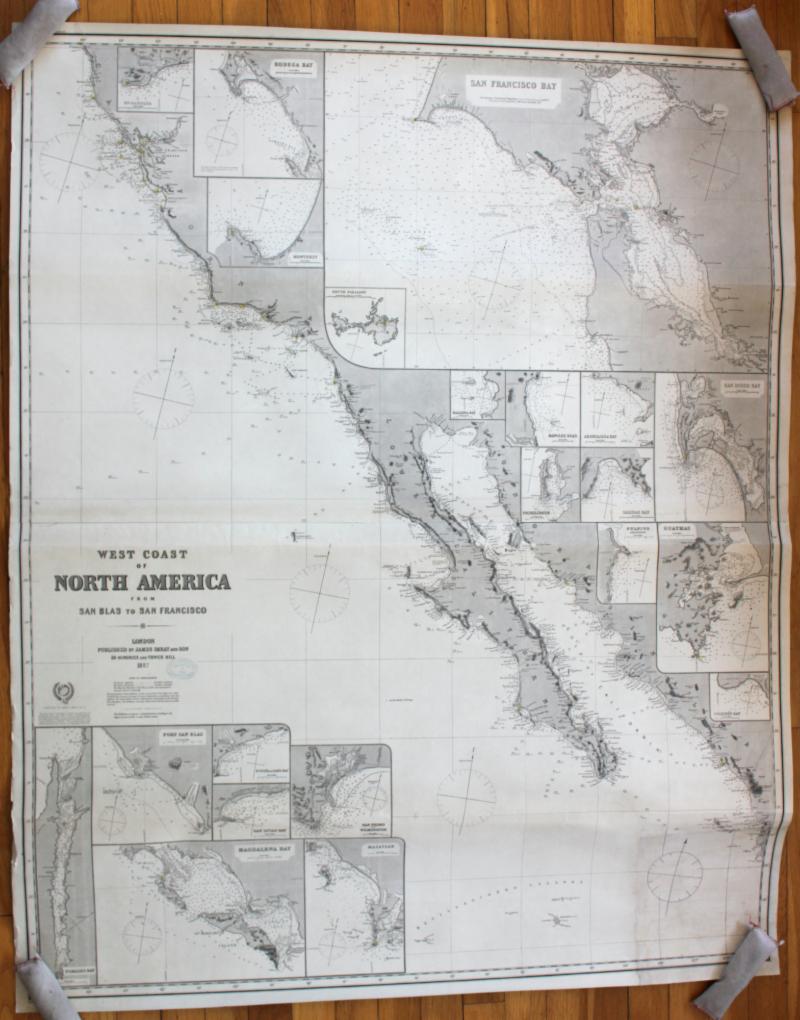
#5: West Coast of North America from San Blas to San Francisco - 1887 / 1888
This chart covers the west coast from San Francisco to Baja California and has an astounding number of inset maps- 21 to be exact! The largest is in the upper right corner and shows San Francisco Bay.
|
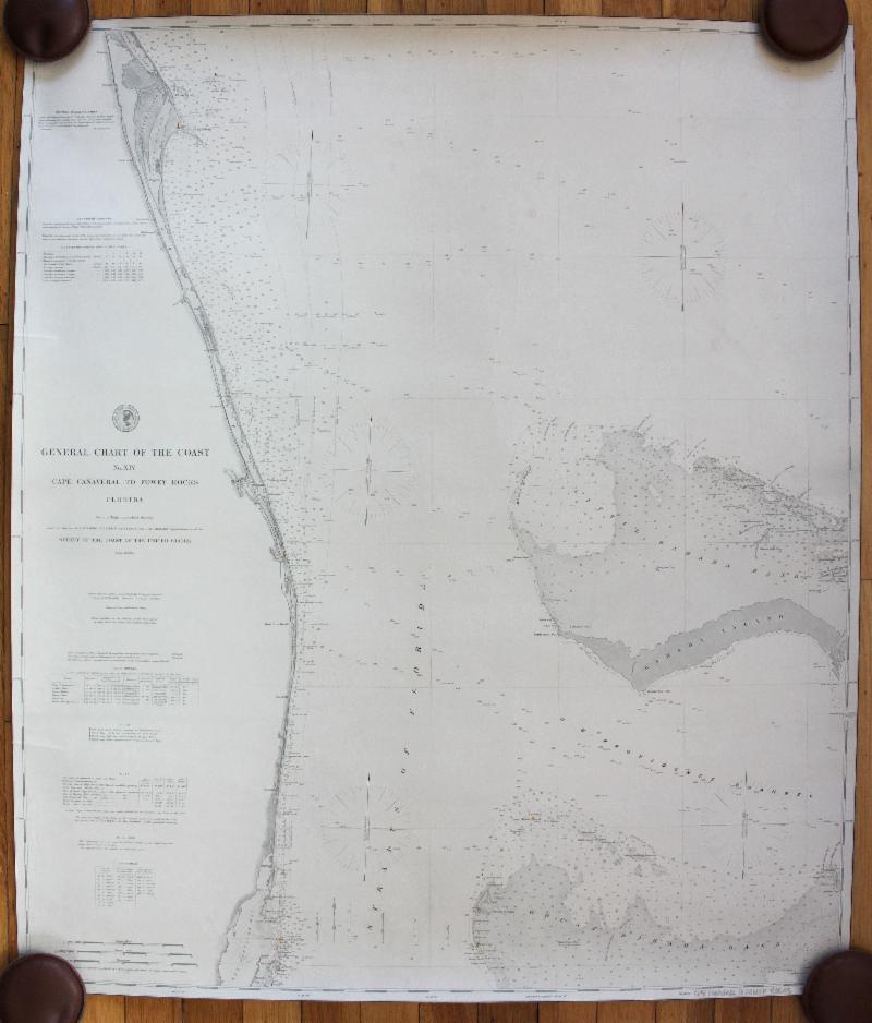
#6: General Chart of the Coast No. XIV Cape Canaveral to Fowey Rocks - 1884
As we continue this review of charts around the world, we come to Florida and this fabulous chart that includes the western part of the Bahamas
.
It shows the areas of Fort Lauderdale, West Palm Beach, St Lucie, Key Biscayne, a railroad to West Palm Beach, and Little Bahama Bank. West Palm Beach was newly settled around this time and wouldn't be incorporated until 1894.
|
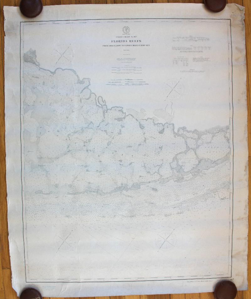
#7: N
o. 167 Florida Reefs from the Elbow to Lower Matecumbe Key - 1863 / 1895
This chart of the southern tip of Florida includes Key Largo, Plantation Key, Upper and Lower Matecumb Keys, Lignumvitae Key, and the coast of the Everglades.
|
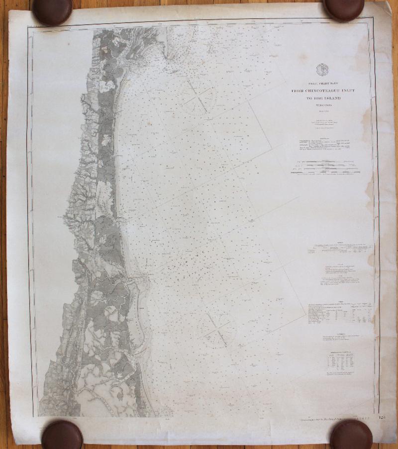
#8: From Chincoteague Inlet to Hog Island Virginia
- 1875 / 1892
This nautical chart shows the coast of Virginia and was published in 1875, corrected to 1892.
It includes Assateague, Chincoteague (remember Misty?), Wallop's Island, Parramore Island, and Hog Island. It has some water stains, but it will still look great framed.
|
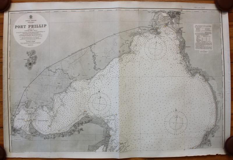
#9: Port Phillip - 1894
To conclude our nautical chart review, we will finish in Australia
with this chart of Port Phillip. It was
published by the British Admiralty in 1894 and includes Melbourne and Geelong, as well as other coastal towns/cities.
|
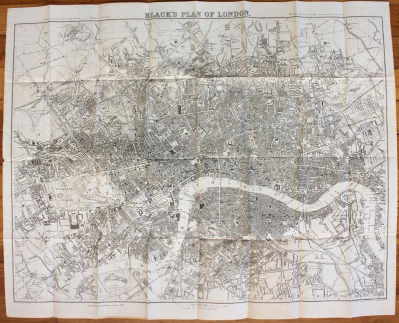
#10: Black's Map of London, with book - 1862
We couldn't send a newsletter without just a couple of maps as well. This lovely map of pre-Brexit London includes street names, gardens, important buildings, bridges, railroads, and more. Particularly notable is the very early Metropolitan Railway, the first section of which was built beneath the New Road using the "cut-and-cover" method between Paddington and King's Cross and in tunnel and cuttings beside Farringdon Road from King's Cross to near Smithfield, near the City. It opened the following year to the public on 10 January 1863 with gas-lit wooden carriages hauled by steam locomotives, the world's first passenger-carrying designated underground railway.
|
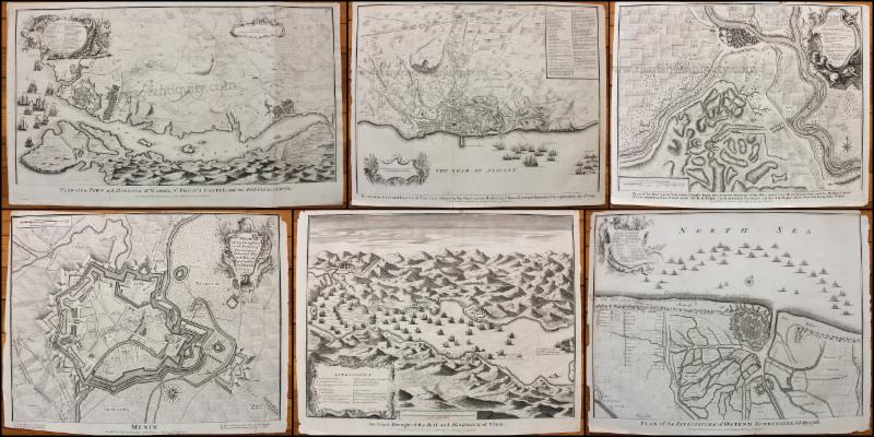
#11:
Maps of the War of the Spanish Succession by Basire - 1745
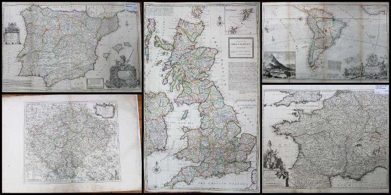
The War of the Spanish Succession was fought to determine who would become king of Spain after the death of the childless Charles II of Spain in November 1700. Philip of Anjou was proclaimed king but disputes over separation of the Spanish and French crowns and commercial rights led to war in 1701 between the Bourbons of France and Spain and the Grand Alliance (England, the Dutch Republic, and Holy Roman Emperor Leopold, including the Archduchy of Austria). These fantastic maps show the plans and locations of battles fought during that conflict.
|
|
 |
| Find us on Social Media for more updates |
Do you tweet, follow, like, and pin? Well, Maps of Antiquity has an active Facebook page where we post map-related articles, unusual maps and prints that we add to our website, company news, and answers to frequently-asked questions.
On Pinterest, we display some of our maps and prints and add opinions and comments about specific pieces. We also provide boards with decorating ideas.
On Twitter, Maps of Antiquity offers links to articles and brief news. We also periodically update Google Plus and LinkedIn with company news and product information.
Follow us on Instagram for fun posts like #MapMonsterMonday and snapshots of the shop!
So if you are spending time on social media, be sure to look us up. Also, if you have a preferred social media where you think we should be active....let us know!
|
|
|