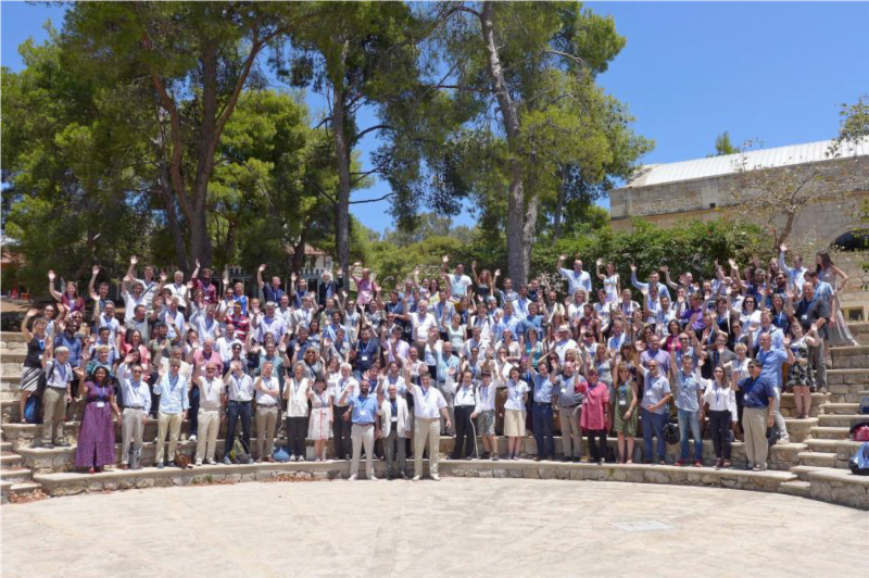
|
LCLUC Spring Newsletter : Issue No.6 |
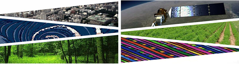
We are happy to share recent updates from our Science Team Members and related research on Land Cover and Land Use Change.
This edition includes a detailed programmatic update from our Program Manager Dr. Garik Gutman, fresh off the press publications from our team and related projects, published meeting reports, and detailed information on our upcoming meetings. You will find information about our upcoming Spring Science Team Meeting and other LCLUC related meetings.
Be sure to check out the LCLUC mapper product on our website which shows the geographic distribution of principal investigators, project team members and geographic area of research projects.
We invite you to join our mailing list for future updates and to receive informa
tion about our webinar series.
Meghavi Prashnani
and
Catherine Nakalembe [Program Support] and
Chris Justice
[Program Scientist], and Garik Gutman [Program Manager]
|
|
|
|
Dr. Garik Gutman [Program Manager]
|
Dear LCLUCers, friends of LCLUC, international colleagues,
Greetings for the New Year 2019. In keeping with the LCLUC tradition, I would like to summarize our past year achievements, mention some future plans and convey my best wishes to the whole LCLUC family and our friends around the world.
The geographic focus on Asia with socio-economic aspects of land use has remained an integral part of the program until recently. However, the new solicitation is expanding the geographic interests of the program as you will see below. Along with the continued observations from the LCLUC workhorse mission - the Landsat program - we have experienced a tremendous increase in the number of observations at landscape scale owing to our partner agency ESA's Sentinel program. Our program, along with many colleagues over the world, is investing in developing multi-source methods in studying LCLUC. I appreciate contributions from each and every one of you in keeping the LCLUC a global outreach, vibrant program at NASA's Earth Science. This year the program has a new component: I was given a task to coordinate a pilot study to assess the value to NASA of commercial data from three private companies. Based on this assessment NASA will purchase a lot of commercial data in year so that NASA-affiliate scientists will have access to these data free of charge. Seven LCLUCers are involved in this pilot and will report their preliminary results at the forthcoming Science Team meeting.
|
|
|
Recent LCLUC Publications
|
|
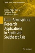
Land-Atmospheric Research Applications in South and Southeast Asia
Book Series: Springer RemoteSensing/Photogrammetry
Editors: Prof. Krishna Prasad Vadrevu, Dr. Toshimasa Ohara, Dr. Chris Justice
Publisher: Springer International Publishing
Print ISBN: 978-3-319-67473-5
Electronic ISBN: 978-3-319-67474-2
This edited volume sheds new light on the impact of rapid Land Use/Cover Changes (LU/CC) on greenhouse gases (GHG's) and aerosol emissions in South and Southeast Asia.
|
|
|
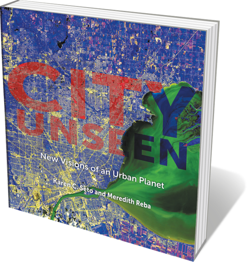
City Unseen: New Visions of an Urban Planet
Editors : Karen Seto and Meredith Reba
Publisher : Yale University Press (2018)
Cities are a tug-of-war between nature and humanity - their configuration shaped by topography even as they mould the environment in and around them. This stunning study by Karen Seto and Meredith Reba explores this uneasy symbiosis through surreally hued satellite images of 100 cities. Snaps of Phoenix, Arizona, taken 31 years apart reveal serious urban sprawl, and a shot of grain fields around Semikarakorsk, Russia, is a controlled riot of colour and line with the verve of early modernist art.
|
|
|
|
|
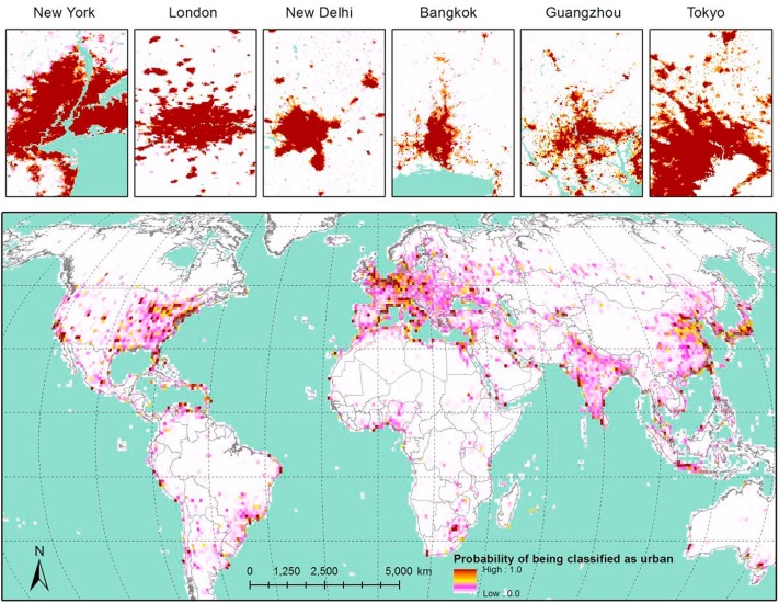
Hybrid
global urban maps resampled at 60-km resolution produced by sequential inference based on Bayes' rule.
|
Ouyang, Z., Fan,P., Chen, J. , Lafortezza, R., Messina, J.P, Giannico,V., & John, R., Landscape and Urban Planning, September 2018
Highlights
-
- Sequential analysis based on Bayes' rule was applied for data integration.
- A hybrid global urban land map was developed for year 2000.
- The hybrid global urban map provides uncertainties in classifying urban lands.
- Future "Big Data" solution is discussed under the Bayesian framework.
Read More
|
|
|
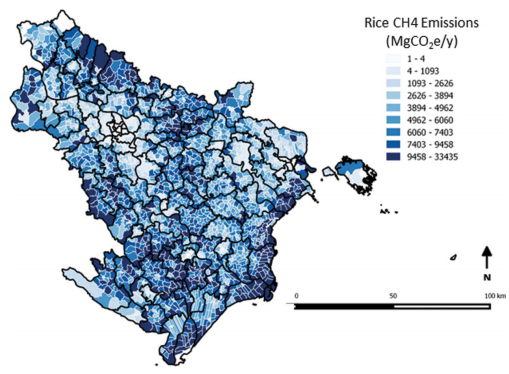
Improved rice residue burning emissions estimates: Accounting for practice-specific emission factors in air pollution assessments of Vietnam
|
|
|
Harvested rice fields representative of the two dominant burning practices in Southeast Asia and Vietnam. Pictures taken by the author in Hanoi Province during June or October 2016.
|
Lasko,K., Vadrevu,K. Environmental Pollution 236 (2018) 795-806, Elsevier , May 2018
Highlights
- Developed burning practice emission factors for pile and non-pile burning.
- P.M 2.5 emissions underestimated by 44-77% when using general emission factors.
- 32% difference in emissions between rice pile burning and non-pile burning.
- 180 Gg, 130Gg, and 150Gg PM2.5 emitted forpile, non-pile and current status.
- SAR data is useful to approximate the rice residue burning dates.
|
|
|
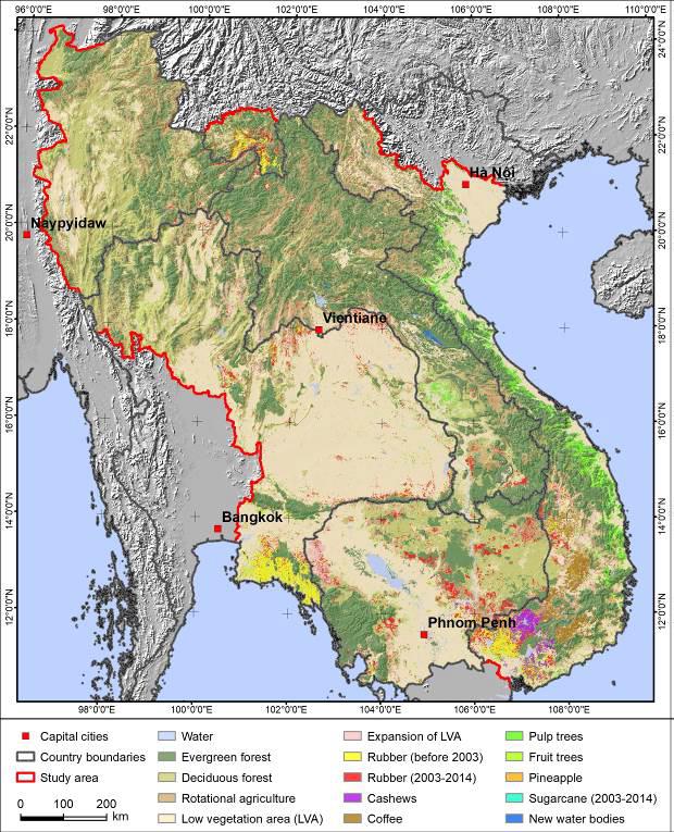
The expansion of tree-based boom crops in mainland Southeast Asia: 2001 to 2014
|
|
|
Examples of transformations to boom crops using Google Earth high resolution images. Different boom crop types can be distinguished based on crop spacing and canopy size and structure
|
|
Hurni K., Fox J., Journal of Land Use Science,ISSN: 1747-423X , July 2018
Highlights
This research sought to map the extent of tree-based crops in the study region in 2014; and the expansion of rubber and sugarcane between 2003 and 2014. The map provides information on the extent of boom crops (e.g. cashews, pulp trees, coffee, and fruit trees) and detailed information on the expansion of sugarcane and rubber plantations for the MSEA region, allowing for a comparison between countries and sub-national regions.
|
|
|
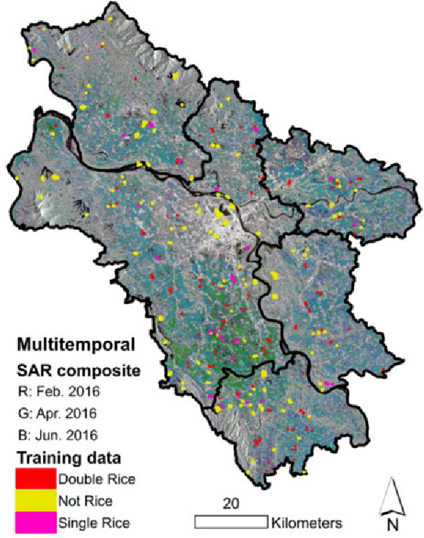
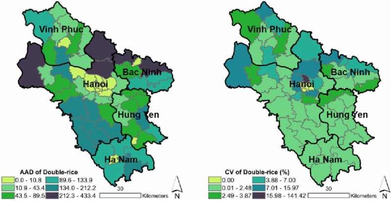
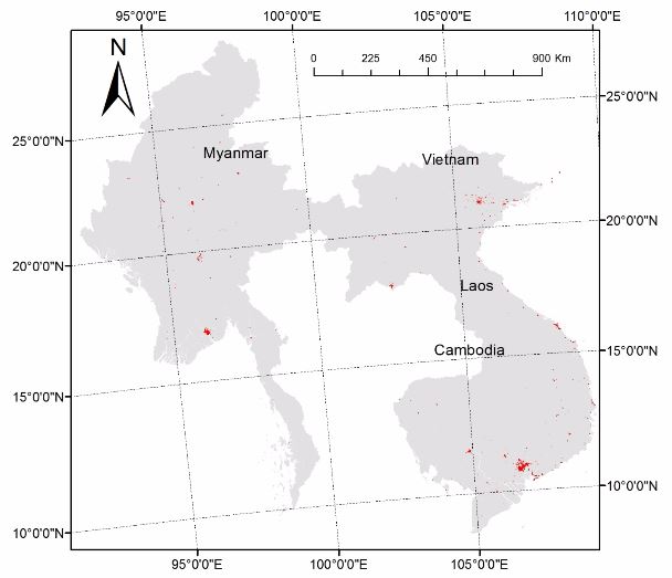
Mapping Double and Single Crop Paddy Rice With Sentinel-1A at Varying Spatial Scales and Polarizations in Hanoi, Vietnam.
|
|
|
Multitemporal SAR composite with training polygons overlaid. Note: border thickness of training data exaggerated for visualization
|
|
|
|
Commune-level rice variation. AAD and CV for double rice area per commune with province boundaries overlaid.
|
Lasko, K., Vadrevu, K.P., Tran, V.T. and Justice, C., IEEE Journ
al of Selected To
pics in Applied Earth Observations and Remote Sensing, 11(2): 498-512, February 2018.
Highlights
- Classification accuracy for six classifiers was obtained on 26 Landsat blocks.
- SVM and KNN exhibited higher accuracy than other classifiers on edge pixels.
- SVM and KNN classifiers are relatively fast to train.
- SVM classification accuracy is particularly sensitive to parameter optimization.
- A strong trend exists between accuracy and edge pixel presence.
|
|
|
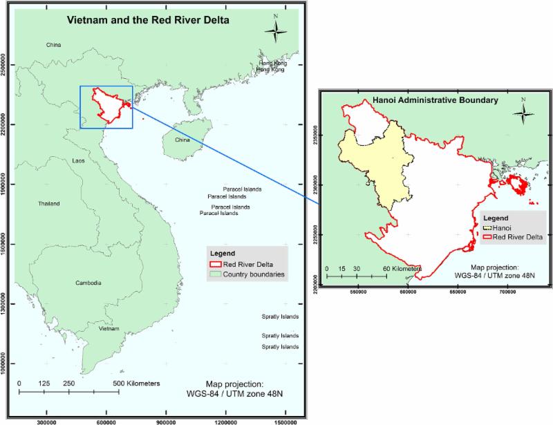
Large-Scale Land Concessions, Migration, and Land Use: The Paradox of Industrial Estates in the Red River Delta of Vietnam and Rubber Plantations of Northeast Cambodia
|
|
|
| Study sites in the Red River Delta and Northeast Cambodia. |
|
Fox J. , Nghiem T., Kimkong H., Hurni K., Baird G. The Role of Remote Sensing for Understanding Large Scale Rubber Concession Expansion in South Laos,
Land
7 (2): 1-17
Highlights
This study investigated the implications of large-scale land concessions in the Red River Delta, Vietnam, and Northeast Cambodia with regard to urban and agricultural frontiers, agrarian transitions, migration, and places from which the migrant workers originated.
|
|
|
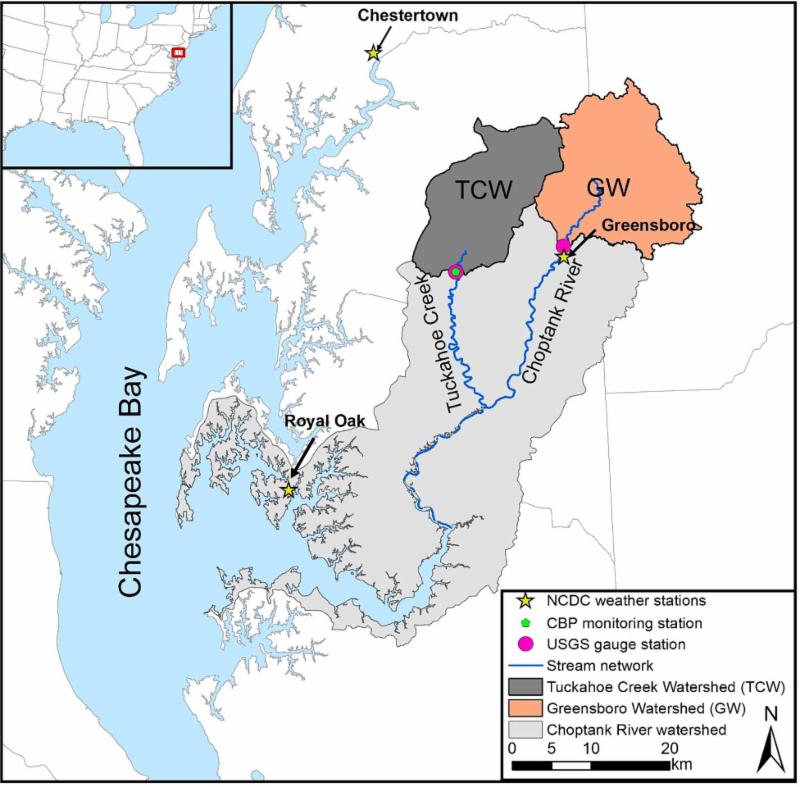
Comparative analyses of hydrological responses of two adjacent watersheds to climate variability and change using the SWAT model
Lee, S., Yeo, I.-Y., Sadeghi, A. M., McCarty, G. W., Hively, W. D., Lang, M. W., and Sharifi, Hydrol. Earth Syst. Sci., 22, 689-708, January
2018.
Highlights
|
|
|
The location of the Tuckahoe Creek Watershed and
Greensboro Watershed
|
This study evaluated the impacts of climate variability and change on two adjacent watersheds in the Coast
al Plain of the Chesapeake Bay Watershed, using the So
il and Water Assessment Tool (SWAT) model.
Simulations from 2001 to 2014 as a baseline scenario, predicted hydrologic outputs (water and nitrate budgets) and crop growth were analyzed. The watershed with a larger percent of croplands demonstrated a greater increased rate of 5.2kgNha−1 in nitrate yield relative to the watershed with a lower percent of croplands as a result of increased export of nitrate derived from fertilizer. The watershed dominated by poorly drained soils showed increased nitrate removal due do enhanced denitrification compared to the watershed dominated by well-drained soils.
|
|
|
Quantifying urban growth patterns in Hanoi using landscape expansion modes and time series spatial metrics
Nong DH, Lepczyk CA, Miura T , Fox JM. PLoS ONE 13(5): e0196940, May 2018.
Highlights
|
|
|
Maps of study area. |
Urbanization has been driven by various social, economic, and political factors around the world for centuries. Because urbanization continues unabated in many places, it is crucial to understand patterns of urbanization and their potential ecological and environmental impacts. Given this need, the objectives of this study were to quantify urban growth rates, growth modes, and resultant changes in the landscape pattern of urbanization in Hanoi, Vietnam from 1993 to 2010 and to evaluate the extent to which the process of urban growth in Hanoi conformed to the diffusion-coalescence theory.
|
|
|
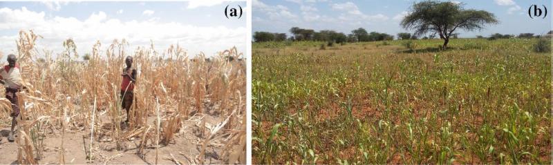
Characterizing agricultural drought in the Karamoja sub-region of Uganda with meteorological and satellite based indices
|
|
|
A failed sorghum field in Rupa sub-county, August 13, 2015. b A moderately impacted field in Nadunget sub-county, August 14, 2016. These two fields are within 10 km distance.
|
Nakalembe C., Natural Hazards, Springer, Vol.91, Issue 3, pp 837-862 February 2018
Highlights
This study characterizes agricultural drought in Karamoja to enable a comprehensive understanding of drought, concomitantly evaluating the suitability of NDVI-based drought monitoring. The study reveals that in comparison with the existing data, NDVI data currently provide the best, consistent, and spatially explicit information for operational drought monitoring in Karamoja. Results indicate that the most extreme agricultural drought in recent years occurred in 2009 followed by 2004 and 2002 and suggest that in Karamoja, moderate to severe droughts (e.g., 2008) often have the same impact on crops and human needs (e.g., food aid) as extreme droughts (e.g., 2009).
|
|
|
Global Estimates of Ecosystem Service Value and Change: Taking Into Account Uncertainties in Satellite-based Land Cover Data
|
|
|
Spatially explicit ecosystem service value estimates.
|
Highlights
- Spatial variation of mapping uncertainty is presented.
- Wetlands have the highest per unit value yet the greatest mapping uncertainty.
- An integrated land cover map improves global ecosystem service value (ESV) estimate to 49.4 trillion Int$/year.
- Global forest ecosystems lost 716.0 billion Int$/year ESV between 2000 and 2012.
|
|
|
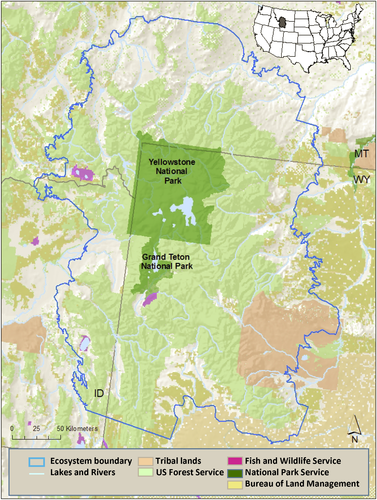
Trends in vital signs for Greater Yellowstone: application of a Wildland Health Index
Hansen, A. J., and L. Phillips. Ecosphere 9(8) :e02380. 10.1002/ecs2.2380, August 2018.
|
|
|
|
Map of the Greater Yellowstone Ecosystem depicting land allocation types overlaying shaded relief.Modified from Hansen and Phillips
|
|
Highlights
Trends in ecological
condition are not evaluated across the entire GYE nor widely reported in the media.
This paper applies a Wildland Health Index (WHI) to evaluate trends in ecological vital signs in the Greater Yellowstone Ecosystem (GYE). Components of the WHI include criteria for judging ecosystem health, vital signs consistent with these criteria, monitoring at spatial scales relevant to the ecosystem, evaluating trends in condition, and communicating with decision makers.
|
|
|
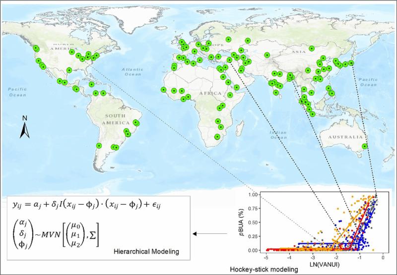
Improving Estimates of Built-up Area from Night Time Light across Globally Distributed Cities through Hierarchical Modeling
Ouyang,Z. , Lin, M., Chen,J., Fan, P., Qian,S. and Park, H. Science of The Total Environment Volume 647, 10 January 2019
Highlights
- Improved estimates of built-up area were achieved from nighttime light.
- A hierarchical hockey-stick model was used to consider local settings of cities.
- Bayesian framework provides a prior model for future updating with new data.
- The influence of local urban settings on estimating built-up area was investigated
|
|
|
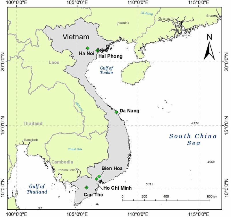
Urbanization, economic development, environmental and social changes in transitional economies: Vietnam after Doimoi. Landscape and Urban Planning
|
|
Vietnam and its six
large cities
with populations over one million: Ho Chi Minh City, Hanoi, Hai Phong, Da Nang, Can Tho, and Bien Hoa.
|
Fan P.,Ouyang Z., Nguyen D.D., Nguyen T., Park H., and Chen, J., Landscape and Urban Planning, Elsevier, November 2018.
Highlights
- Average built-up land intensity increased significantly for Vietnam after Doimoi.
- Urban land grew faster than urban population for HCMC and Hanoi.
- Urban air quality (PM2.5 and NO2 concentrations) in large cities deteriorated.
- Economic development strongly influenced urbanization.
- Urbanization deteriorated the environment but improved social conditions
|
|
|
Satellite scatterometer estimation of urban built-up volume: Validation with airborne lidar data
|
|
|
3D visualizations of lidar data for (a) Austin, TX and (b) Washington, DC.
|
Mathews A.J., Frazier A.E., Nghiem, S., Neumann G, Zhao, Y. International Journal of Applied Earth Observation and Geoinformation,
Pages 100-107,
May 2019,
Highlights
- Evaluates utility of scatterometer data for estimation of urban built-up volume.
- Dense Sampling Method-processed scatterometer data are compared to airborne lidar.
- Analysis conducted for nine urban areas in the United States.
- Strong, linear correlations observed between radar- and lidar-derived datasets.
- Results promote three-dimensional approach to land use/land cover analyses.
|
|
|
Global 30m Landsat Tree Canopy Version 4
We are excited to announce the release of version 4 Tree Canopy Cover (TCC) product, replacing the previous version of global tree canopy cover estimates for 2000, 2005, 2010, and 2015. It also includes annual tree cover estimates from 2010 to 2015 for North and South America. Previous versions of TCC were derived using the Landsat Global Land Survey collection, however for version 4 we mined and processed the entire Landsat archive, providing an improved and accurate representation for a given year.
|
|
|
Urban built-up areas in transitional economies of Southeast Asia
This dataset describes the spatial distribution of urban built-up land at 30m x 30m resolution.Built-up land here are defined as locations dominated by constructed surfaces or built environment, where dominancy implies>50% coverage of pixels. Multiple remote sensing data, including Landsat, DMSP/OLS night time light, MODIS NDVI data and other ancillary spatial data, were integrated to develop this 30-m resolution urban built-up map of 2010 with an object-oriented classification approach.
|
|
|
Rice maps in Geotiff format derived from the Sentinel-1 SAR satellite
Multiscale synthetic aperture radar (SAR) and optical imagery were fed into a random forest classifier using field observations and surveys as training data to m
ap rice extent. The rice area map and start of season maps are available in geotiff or shapefile format via FTP.
|
|
|
Rubber is replacing natural forests in Mainland Southeast Asia
LCLUC PI, Dr. Jefferson Fox and his team uncovered the dramatic expansion of commercialized agriculture over the past 50 years in the mountainous region of Mainland Southeast Asia . The emphasis has been on tree-based cash crops, and in particular, rubber. Much of this expansion has come at the expense of the region's native forests.
|
|
|
NASA LCLUC scientists seek ways to improve dams in the lower Mekong River
LCLUC project on assessing the impacts of dams on the dynamic interactions among distant wetlands, land use, and rural communities in the Lower Mekong River Basin by Dr. Jiaguo Qi and his team was highlighted in Bangkok post for finding out ways to protect the environment by improving dams.
|
|
|
LCLUC researchers help tackle a toxic practice in Thailand
Bangkok, Thailand made international headlines this year when the air pollution in the city reached such toxic levels officials were forced to close hundreds of schools.
LCLUC
researchers, Dr. V. Bandaru and his team, are collaborating with partners in Thailand to conduct an interdisciplinary project aimed at assessing alternative methods for managing crop residue that would not only help reduce emissions but may also improve soil quality.
|
|
|
Inbal Becker-Reshef receives the 2018 Servir Excellence Award
Inbal Becker-Reshef, a former LCLUCer received the SERVIR Excellence Award for 2018. The Award is for her significant efforts in expanding the crop monitoring capabilities of regional and national institutions in East and Southern Africa for improved Food Security decisions.
|
|
|
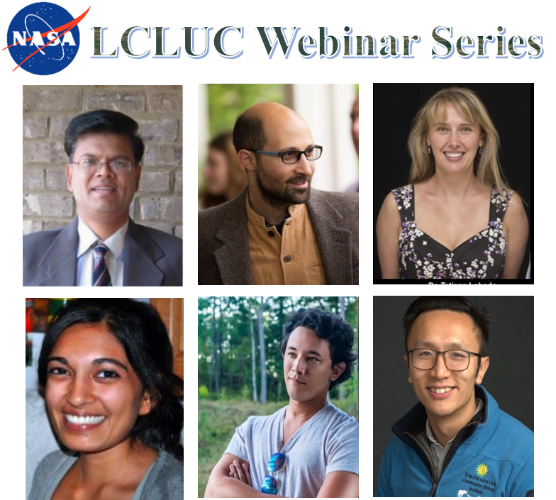
LCLUC Webinar Series, 2018
|
|
The LCLUC Webinar Series -2018 featured LCLUC South/Southeast Asia Research Initiative (SARI) projects.
|
|
|
Recent LCLUC and Related Meetings
|
|
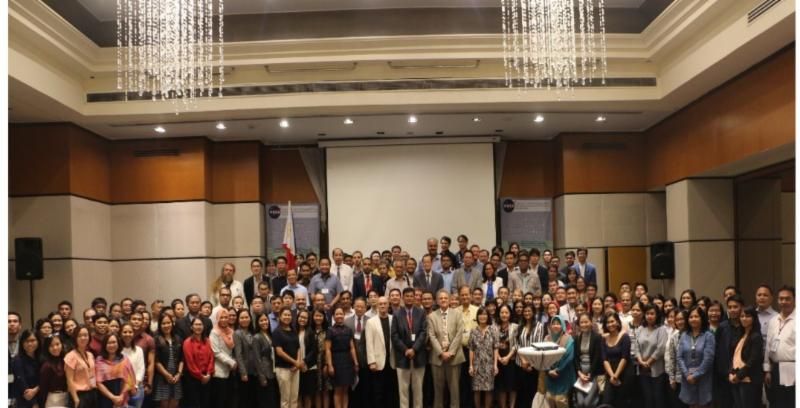
Land Cover/Land Use Changes (LC/LUC) and Impacts on Environment in South/Southeast Asia - International Regional Science Meeting
Philippines
28 - 30 May, 2018
This international meeting provided a forum to discuss Land Cover/Land Use Change and its impacts, with a regional focus on South and Southeast Asian countries.
|
|
|
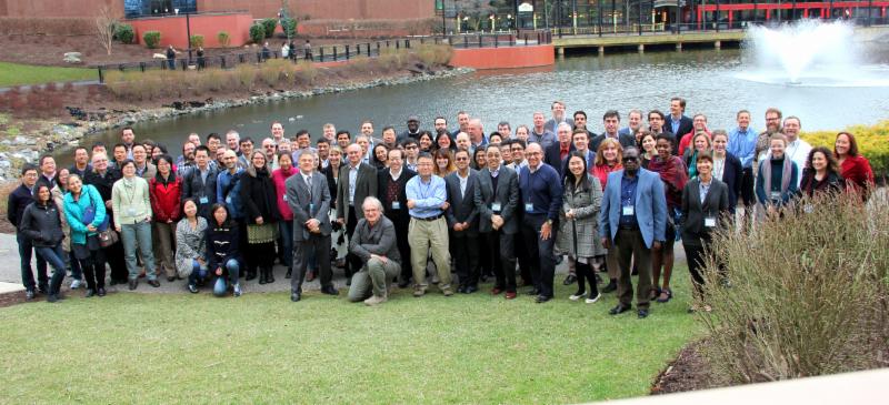
NASA LCLUC Spring Science Team Meeting 2018
Gaithersburg, MD
3 - 5 April, 2018
This LCLUC Science Team meeting comprised presentations from the LCLUC Science Team members funded for research on LCLUC in South Asia and Synthesis (ROSES 2015 Selections), and posters of recent results from other ongoing LCLUC research including LCLUC-relevant projects under other programs, such as Inter-Disciplinary Science, Carbon Cycle, Students Fellowships and New Investigator Programs. The third day was focused on the final results from the 2014 LCLUC Multisource land Imaging (MuSLI) initiative, recent MuSLI proposal selections and future interactions with the Landsat Science Team.
|
|
|
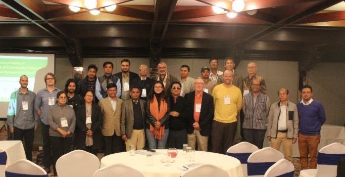
An international meeting on Twenty-five years of community forestry: Mapping tree dynamics in the Middle Hills of Nepal
Kathmandu, Nepal
29 - 30 November, 2018
This workshop brought together participants from 28 national and international institutions to discuss about the rate, extent, and socioeconomic importance of Nepal's tree transition based on three decades of Landsat satellite data and spatial modeling.
|
|
|
South-Central East European Regional Information Network , SCERIN-6 Capacity Building Workshop
Zagreb, Croatia 11 - 14 June,
2018
This workshop discussed about the current Land Cover dynamics in the South-Central East European Regional Information Network (SCERIN) region to identify the typical pre-cursors of Land cover change via remote sensing to monitor their significance and influence on the environment and biogeochemical cycling. The workshop also facilitated capacity building in coordination with a Trans-Atlantic Training (TAT5) for graduate students and young professionals.
|
|
|
An International Meeting On Land Cover/Land Use Changes and Water Energy Food (WEF) Nexus in Southeast Asia, National University of Laos, Vientiane, LAOS
Vientiane, Laos
11 - 17 August, 2018
This meeting brought together the international experts and stakeholders from various agencies and institutions in the US and other countries to share and exchange their ideas, methods, technologies and knowledge to address these emerging water-energy-food issues in the region. This meeting focused on developing better knowledge and solutions to synergistically manage water resources for all sectors, communities and ecosystems.
|
|
|
3rd joint EARSeL LULC & NASA LCLUC Workshop
Chania, Greece
11 - 12 July, 2018
This workshop was focused on water, food and sustainability research supported by Earth Observations and derived remote sensing products. The workshop addressed innovative research on the relationships amongst natural processes (e.g. biogeochemical and hydrologic cycles) and social/behavioral processes (e.g. decision making and governance) as supported by remote sensing observations. Land-use change with an emphasis on forests and watershed management, urban areas flooding and water consumption, arable lands irrigation and combating drought were some of the topics presented at this workshop.
|
|
|
Upcoming LCLUC And Related Meetings
|
|
NASA LCLUC Spring Science Team Meeting 2019
Rockville , MD
9 - 11 April, 2019
This LCLUC Science Team meeting will consist of presentations from the LCLUC Science Team members funded for research on the LCLUC in Southeast Asia and Caucasus (ROSES 2016 Selections), LCLUC Synthesis projects and posters of recent results from other ongoing LCLUC research, including LCLUC-relevant projects under other NASA programs, such as Inter-Disciplinary Science and Carbon Cycle Programs, the Graduate Student Research and New Investigator Program. The third day will focus on the preliminary results from the 2017 Multi-Source Land Imaging (MuSLI) component of the LCLUC Program.
|
|
|
GOFC-GOLD Mediterranean Regional Information Network (MedRIN) meeting
Paphos, Cyprus
18 - 21 March, 2019
The second Mediterranean Regional Information Network (MedRIN) meeting and workshop will take place at the Aliathon Holiday Village, in Paphos, Cyprus as a component of the 7th International Conference on Remote Sensing and Geoinformation of the Environment (RSCy2019). The conference is being held 18-21 March 2019. The MedRIN workshop will be held on 20 March 2019 at the conference venue.
|
|
|
Land Use/Cover Changes, Environment and Emissions in South/Southeast Asia - An International Regional Science Meeting
Johur Bahur, Malaysia
22 - 27 July, 2019
The aim of this meeting is to review the availability, potential, and limitations of different data sources and methodologies for the monitoring and the study of LCLUC, and quantification and its impact on the environment. The meeting presentations will focus on synergies among various approaches and provide recommendations on how to improve the use of earth observations, ground data and modeling techniques for the improved understanding of land use sources and sinks.
Read More
|
|
|
Global Land Programme 4th Open Science Meeting
Bern, Switzerland 24 - 26 April
, 2019
This conference represents a unique opportunity to build and enhance scientific capacity and enable transformations to a sustainable future by identifying core questions, synthesizing research, and setting future agendas. Conference attendees will strive to develop connections between researchers and stakeholders from civil society, government, and the private sector, and to bridge science and decision-making for sustainable management and governance of land use worldwide.
Read More
|
|
|
GOFC-GOLD South-Central East European Regional Information Network (SCERIN) meeting, Serbia, 2019
Novi Sad, Serbia 24 - 28 June, 2019
SCERIN is one of the regional networks of the Global Observation of Forest and Land Cover Dynamics (GOFC-GOLD) panel of the Global Terrestrial Observing System program for observations, modeling, and analysis to support sustainable development. This meeting will discuss current Land cover / Land use change dynamics and its impacts in SCERIN region.
Read More
|
|
|
|
|
|
|