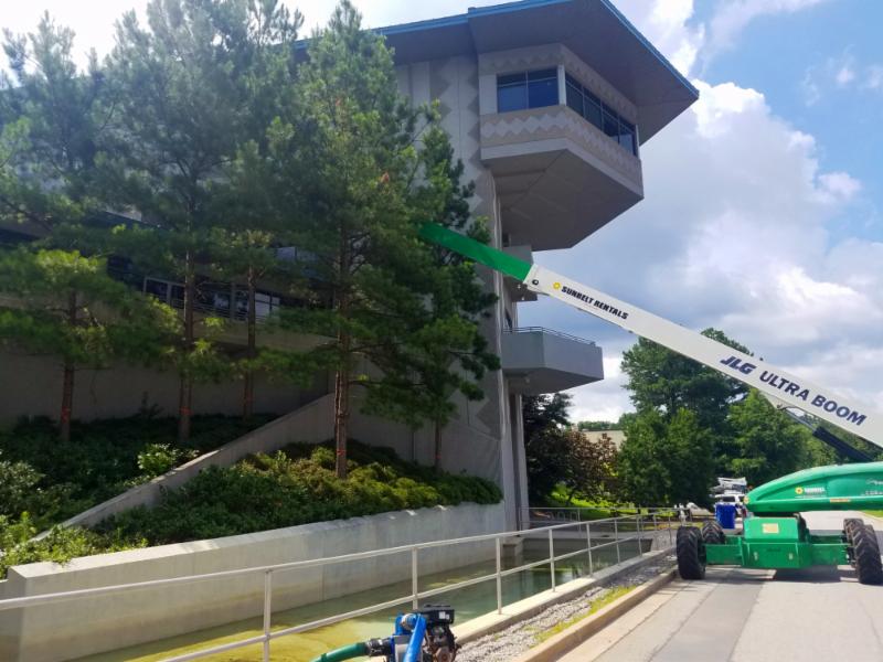
Water Supply Program
Quarry/Chattahoochee/Hemphill
|
|
Update:
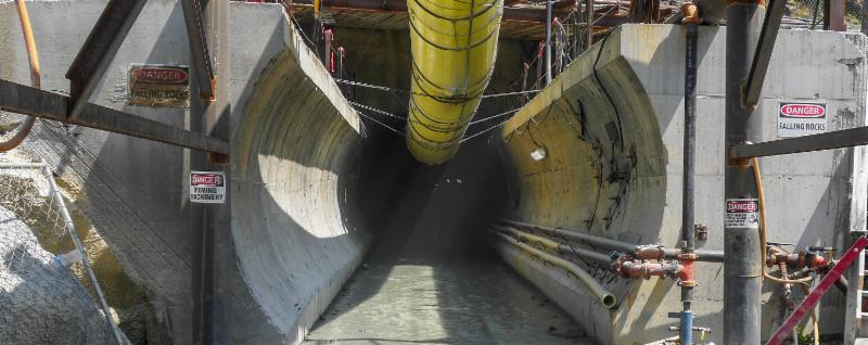
The 400-foot long tunnel boring machine (TBM), named “Driller Mike”, has completed the 5-mile journey to connect the former Bellwood Quarry, the Chattahoochee River and the Hemphill Water Treatment Plant.
In the next phase of construction, the interior of the tunnel will be lined with concrete. Crews are currently working to remove the remaining TBM parts out of the tunnel. In addition, tunnel cleaning is currently in progress.
Controlled blasting at the Hemphill Water Treatment Plant’s WSP project site (Huff Road NW) is currently underway.
Construction of two new pump stations continues at the Bellwood Quarry and the Hemphill Water Treatment Plant sites.
The Water Supply Program will increase Atlanta’s reserve water supply from three to five days to 30 to 90 days. The $300 million investment includes the construction of a five-mile tunnel connecting the Chattahoochee River, the Hemphill Water Treatment Plant, and the former Bellwood Quarry, which will be transformed into a 2.4-billion-gallon reservoir. The Water Supply Program is scheduled for completion by September 2019.
Expected Completion:
September 2019
Project Location:
Northwest Atlanta
Council District(s):
3, 9
Neighborhood Planning Unit(s):
C, D, G, J, K
|
|
Clear Creek West Sewer Improvements Project
Civic Center Vault
|
|
Update:
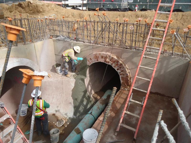
Construction phase has actively resumed. Crews will continue to pour walls and foundation
The City of Atlanta Department of Watershed Management (DWM) has identified the need for an underground storage vault to be installed to increase the storage capacity of the existing combined sewer system in the Clear Creek West basin. The vault associated with this project is located in the southeastern corner of the existing Civic Center parking lot adjacent to Ralph McGill Boulevard. The Butler Street trunk and relief combined sewers drain the upper section of the west Clear Creek basin. During certain rainfall events this system can become surcharged, which may result in flooding. The storage vault will store excess combined sewer flows from the Butler Street Relief Combined Sewer, which intercepts the Butler Street Trunk Combined Sewer at the I-75/85 entrance ramp from Freedom Parkway and Highland Avenue. Stored combined sewer flow in the vault will reduce the peak flow in the downstream combined sewer helping to reduce flooding.
This stormwater vault will help manage rainfall runoff from the adjacent federal highways and downtown portions of the basin. Additionally, implementation of green infrastructure projects are proposed to further manage combined sewer peak flows to the combined sewer system and to reduce the required capacities of the vaults.
Expected Completion:
March 2019
Project Location:
Northeast Atlanta
Council District(s):
2
Neighborhood Planning Unit(s):
M, E
|
|
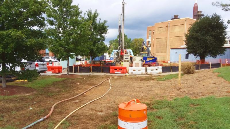
Upper Proctor Creek Capacity Relief Project
Rodney Cook Sr. Park In Historic Vine City
|
|
Update:
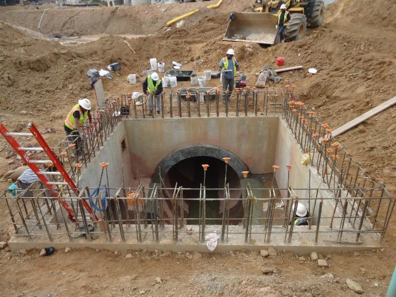
Major milestones have recently been achieved at
The Upper Proctor Creek Capacity Relief facility. Installation of the 96” Mineral Springs trunk line has been completed and successfully tested. In addition, all structures within the area of the capacity relief pond have been demolished and storm sewer pipes are being installed. The surrounding retaining walls are currently being constructed and DWM is working closely with the Trust for Public Land who is developing the surrounding park, concurrently, in coordination with the Department of Parks and Recreation.
The Upper Proctor Creek Capacity Relief project is a multi-phase effort to reduce flooding and combined sewer flows in the Vine City neighborhood. This project consists of a collection of innovative stormwater practices designed to redirect surface runoff away from the Beckwith Trunk and Mineral Springs combined sewer systems. The capacity relief facility is currently under construction led by the Astra/Rohadfox, Joint Venture under FC-9445. The components of this project include a wet pond, green infrastructure (bioretention, stormwater planters, rainwater harvesting cisterns, and soil restoration), aerating water features, separated storm drain pipelines, new sidewalks and roadway improvements.
Expected Completion:
November 2018
Project Location:
Vine Street NW
Council District(s):
3
Neighborhood Planning Unit(s):
C, D, E, G, H, I, J, K, L, M T
|
|
Boone Boulevard Green Infrastructure & Capacity Relief Project
|
|
Update
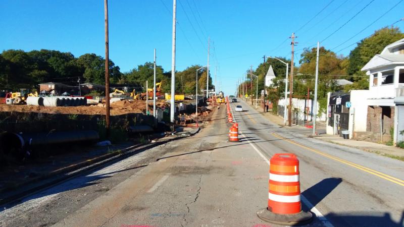
: Water main replacement work will continue on Joseph E. Boone Boulevard NW between Elm Street NW and Northside Drive NW. Contractors will start excavation for installation of two planter boxes between Elm St NW and Sunset Ave NW.
Stormwater planter boxes, sidewalks, driveway aprons and tree installations have been completed along the southern side of Joseph E. Boone Boulevard NW between Joseph E. Lowery Boulevard NW and Sunset Avenue NW. Now under the project, DWM will replace water mains on Joseph E. Boone Boulevard NW between Northside Drive NW and Mayson Turner Road NW.
Expected Completion:
June 2019
Project Location:
Northwest Atlanta
Council District(s):
3
Neighborhood Planning Unit(s):
K, L, M
|
|
Energy Services Performance Initiatives
Noresco/Schneider
|
|
Update:
Contractors will continue lighting upgrades at the 14th Street Administration Complex, changing over from conventional to LED lighting. At South River WRC contractors have completed cleanout of digester #5 and started the cleanout of digester #4. Roofing and leak repair are in the final stages of completion at Utoy Creek.
Facilities infrastructure improvements for RM Clayton WRC, Hemphill water distribution system, South River WRC, Utoy Creek WRC, Chattahoochee Water Treatment and 14th St Admin Complex.
Expected Completion:
December 2020
Project Location:
RM Clayton WRC, Hemphill WTP (Settled Solids only), South River WRC, Utoy Creek WRC, Chattahoochee Water Treatment, and 14th St Admin Complex
Council District(s):
1,3,8,9,10,
Neighborhood Planning Unit(s):
C,D,E,G,H,Z
|
|
RM Clayton Nutrient Recovery – Ostara
|
|
Update
: Contractors will continue micropiling at RM Clayton WRC to form foundation for Nutrient Recovery building.
The purpose of this project is to improve nutrient (phosphorus and nitrogen) removal within the RM Clayton WRC. Enhanced nutrient removal will improve permit compliance, reduce chemical and operating costs
,
and provide a reusable byproduct.
Expected Completion:
July 2020
Project Location:
RM Clayton WRC
Council District(s):
2, 3, 4, 5, 6, 7, 8, 9
Neighborhood Planning Unit(s):
C, D, G
|
|
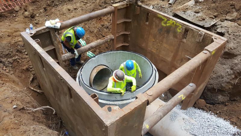
Proctor Creek Sewer Basin
Ashby-Jett Sewer Improvement Project
|
|
Update:
The Purpose of this project is to upsize the existing Ashby-Jett outfall from 18-inches to 30-inches. The City of Atlanta modeling group proposed upsizing the outfall to provide capacity relief and reduce the surcharge in the existing trunk line. The project includes upsizing the existing line by excavating down to, and exposing the existing pipe in an open cut trench so that the pipe can be repaired or replaced. The trench is then backfilled to close it. The existing line is west of the CSX railroad where the fallout discharges into the Proctor Creek Trunk.
Sewer work is completed. Trees will be planted this Fall.
Expected Completion:
November 2018
Project Location(s):
Bankhead, Hills Park, Center Hill, Grove Park, Washington Park, Hunter Hills Knight Park
Council District(s):
3
Neighborhood Planning Unit(s):
L, K
|
|
Neighborhood Planning Unit (NPU)
The City of Atlanta is divided into 25 Neighborhood Planning Units (NPU), which serve as citizen advisory councils that make recommendations to the Mayor and City Council on zoning, land use, and other planning issues. NPUs also allow citizens to receive information about all functions of city government.
|
|
See neighborhoods located within listed NPUs below:
|
|
NPU-B
- Brookhaven
- Buckhead Forest
- Buckhead Village
- East Chastain Park
- Garden Hills
- Lenox
- Lindbergh/Morosgo
- North Buckhead
- Peachtree Heights East and West
- Peachtree Hills
- Peachtree Park
- Pine Hills
- Ridgedale Park
- South Tuxedo Park
NPU-C
- Arden/Habersham
- Argonne Forest
- Brandon
- Castewood
- Channing Valley
- Collier Hills
- Collier Hills North
- Colonial Homes
- Cross Creek
- Fernleaf
- Hanover West
- Memorial Park
- Peachtree Battle Alliance
- Ridgewood Heights
- Springlake
- Wesley Battlle
- Westminister/Milar
- Westover Plantation
- Wildwood
- Woodfield
- Wyngate
NPU-D
- Berkley Park
- Blandtown
- Bolton
- Hills Park
- Riverside
- Underwood Hills
- Whittier Mill Village
NPU-G
- Almond Park
- Atlanta Industrial Park
- Bolton Hills
- Brookview Heights
- Carey Park
- Carver Hills
- Chattahoochee
- English Park
- Lincoln Homes
- Monroe Heights
- Rockdale
- Scotts Crossing
- West Highlands
|
|
NPU-J
- Center Hill
- Dixie Hills
- Grove Park
- Harvel Homes
- Penelope Neighbors
- West Lake
NPU-K
- Bankhead
- Hunter Hills
- Knight Park/Howell Station
- Mozley Park
- Washington Park
NPU-L
NPU-M
- Castleberry Hill
- Downtown
- Old Fourth Ward
NPU-O
- East Lake
- Edgewood
- Kirkwood
- The Villages at East Lake
NPU-P
- Arlington Estates
- Ashley Courts
- Ben Hill
- Brentwood
- Briar Glen
- Butner/Tell
- Cascade Green
- Deerwood
- Fairburn
- Greenbriar Village
- Heritage Valley
- Huntington
- Kings Forest
- Lake Estates
- Meadowbrook Forest
- Mellwood
- Mt. Gilead Woods
- Niskey Cove
- Niskey Lake
- Princeton Lakes
- Wildwood Forest
NPU-S
- Bush Mountain
- Cascade Avenue/Road
- Fort McPherson
- Oakland City
- Venetian Hills
- Westmont Estates
|
|
Department of Watershed Management
72 Marietta Street NW
Atlanta, GA 30303
|
|
|
|
|
|
|