Zillow Highlights Climate ChangeZillow
The popular real estate website Zillow is now including information on climate change issues and sea level rise for its users based on data from the National Oceanic and Atmospheric Administration (NOAA).  This data projects that approximately 1.9 million homes nationwide (roughly 2% of all U.S. homes), worth a combined $882 billion, are at risk of being underwater by 2100.  In some states, the properties at risk of being underwater is alarmingly high.
 
A recent New York Times article also highlighted how buyers of coastal properties are increasingly asking important questions related to future sea level rise:  How many feet above sea level is the home? Are there sea walls to protect against storm surges? Does it have emergency power?  Rising sea levels are changing the way people think about waterfront real estate.  Although the demand for coastal property remains strong, homeowners across the nation are growing more wary of buying property vulnerable to the effects of climate change.
Variances and the NFIPVariances

One of the key responsibilities for a community that participates in the National Flood Insurance Program (NFIP) is the consideration of variance requests from the community's floodplain ordinance or reg
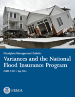
ulations.  It is important especially for the community's Zoning Board of Appeals to understand the additional floodplain variance criteria and the implications of granting a variance in the floodplain.  FEMA's Floodplain Management Bulletin - Variances and the National Flood Insurance Program provides our community further assistance to better understand the floodplain variance criteria. 


The NFIP variance procedures are designed to help local governments protect their citizens and property from flood damages.  Allowing variances to the local floodplain management standards may significantly increase the property's flood insurance rate and jeopardize the community's standing in the NFIP. Therefore, by implementing the NFIP variance procedures, a community will ensure that alternative actions are taken that protect and encourage safe development in the floodplain. This publication outlines the floodplain management variance criteria as set forth in Title 44 Code of Federal Regulations (CFR) Part 60, Criteria for Land Management and Use, Subpart A - Requirements for Floodplain Management Regulations, Section 60.6 (44 CFR ยง60.6).

Real Estate Agent Flood Insurance Fact SheetsRealEstate
Flooding is the nation's most costly and frequent type of disaster.  Yet the risk of flooding is not always on the mind of most home buyers.  Flood risks have changed over time, and the costs and consequences of flooding are rising.  Increasing flood insurance premium rates make it more important than ever to understand a building's flood risk and flood insurance requirements prior to closing. 

FEMA has developed two new fact sheets to inform both real estate professionals and home buyers on flood risk so there are fewer surprises before closing.  These fact sheets can also be helpful for community officials in addressing the questions of prospective home buyers.
New Flood Maps for Quinnipiac River WatershedQRiver
On November 16, 2016, the Federal Emergency Management Agency issued a letter of final determination (LFD) to seventeen communities within the Quinnipiac River watershed that they would be receiving revised flood insurance rate maps (FIRM) effective May 16, 2017.  
 
The communities effected, located in both New Haven and Hartford Counties, include Ansonia, Branford, Bristol, Cheshire, Derby, East Haven, Hamden, Meriden, Milford, New Britain, North Branford, North Haven, Orange, Plainville, Southington, Wallingford, and Woodbridge.  
 
In conjunction with this map update, communities will be required to revise their local floodplain regulations or ordinance to include the new map date and associated panel numbers.  On November 25, 2016, the Connecticut Department of Energy & Environmental Protection sent a regulation review letter to each affected community outlining the required changes.  Preliminary maps can be viewed in individual town halls or online at FEMA's Map Service Center website.   
Natural Hazards LibraryHazlib
The Natural Hazards Center has launched HazLib, a new online library catalog.  Users can explore the extensive library holdings and resources with improved search options, including multifaceted searching that allows users to customize results based on author, topic or other elements.  If you still cannot find what you are looking for with one click you can effortlessly connect with library staff and get help with research questions, catalog searches, resource suggestions, and connecting with disaster experts. 
ASFPM Riverine Erosion Hazards White PaperWhitePaper

In February 2016, the Association of State Floodplain Managers (ASFPM) released the ASFPM Riverine Erosion Hazards White Paper.  Erosion and deposition are among the natural processes of a river.  However, the direction, rate and scale of these processes have been altered by human activity.  Structural controls and channelization meant to protect development has increased vulnerability.


The main purpose of the paper is to encourage state and local governments to begin mapping riverine erosion hazard areas in their communities.  The mapping should be carried out using methodologies that they feel are appropriate for their specific conditions and at a level of detail that meets their specific conditions and at a level of detail that meets their specific requirements.  This white paper looks into the successes and challenges of this approach, and offers eleven recommendations.  

What Sea Level Rise Tool or Model Should I Use?SLRTool
Trying to decide which sea level rise tool or model to use for your community can be a confusing decision.  The National Oceanic and Atmospheric Administration (NOAA), The Nature Conservancy, and Climate Central came together to develop an online Sea Level Rise and Coastal Flood Web Tools Comparison Matrix.  This matrix was created to provide the planning and coastal management communities with an expandable chart to compare the functions and methods of publicly-available sea level rise and coastal flood web tools.  This information in each column is provided by the web tool owner.  Specific questions about the tools can be addressed to the tool owner through the contact information provided in their matrix column.   

 
NOAA          The Nature Conservency         Climate Central
Training OpportunitiesTraining
WEBINARS

NFIP-related training webinars are available through STARR, a FEMA contractor.  Below are some of the upcoming webinars.  To register, go to the NFIP training website  and  click "Training Center" on the top bar, and then on the "Upcoming" tab.  When asked during registration what FEMA Region you are in, please reply "1".
  • December 20, 2016, 1:00pm - CRS:  Preparing for a Verification Visit
  • December 21, 2016, 1:00pm - CRS:  CRS and Coastal Hazards
  • January 5, 2017, 1:00pm - Elevation Certificates
  • January 12, 2017, 1:00pm - Tools for Determining Base Flood Elevation
  • January 17, 2017, 1:00pm - CRS:  Changes in the 2017 CRS Coordinator's Manual
  • January 18, 2017, 1:00pm - CRS:  Changes in the 2017 CRS Coordinator's Manual
  • February 21, 2017, 1:00pm - CRS:  Introduction to CRS
  • February 22, 2017, 1:00pm - CRS:  Repetitive Loss Properties and CRS
  • March 21, 2017, 1:00pm - CRS:  Preparing for a Verification Visit
  • March 22, 2017, 1:00pm - CRS:  Changes in the 2017 CRS Coordinator's Manual

VIDEOS

H2O Partners offers short training videos on the following topics:
  • Demonstrating the Elevation Certificate
  • How the NFIP Works for the Floodplain Professional
  • Effects of Flood Map Changes
  • Role of the Elevation Certificate in Floodplain Management
  •  
  • CONFERENCES & WORKSHOPS
  •  
    April 30-May 5, 2017:  A ssociation of State Floodplain Managers 41st Annual Conference , Kansas City, MO, www.floods.org .  


    FEMA EMERGENCY MANAGEMENT INSTITUTE

    The Emergency Management Institute (EMI) is located at the Federal Emergency Management Agency (FEMA) National Emergency Training Center (NETC) in Emmitsburg, Maryland.  EMI serves as the national center for emergency management training of federal, state and local government officials.  Tuition, housing, and all books and materials are provided at no cost.  Participants are responsible for the cost of a meal pass (approximately $100/week).  Below is a select list of floodplain management classes offered into mid-2017. A full list of training classes can be found at the EMI website.  
     

    E170  HAZUS-MH for Hurricane - July 24-27, 2017
    E172  HAZUS-MH for Flood
    - June 12-15, 2017
    E179  Application of HAZUS-MH for Disaster Operations - September 11-14, 2017
    E190  ArcGIS for Emergency Managers - July 31-August 3, 2017
    E194  Advanced Floodplain Management Concepts I  - January 30-February 2, 2017
    E202  Debris Management Planning for State, Tribal, Local Officials - Jan. 9-12, June 5-8, 2017
    E210  Recovery from Disaster: The Local Government Role -  April 10-13, 2017
    E212  Unified Hazard Mitigation Assistance Program: Developing Quality Application Elements - May 15-18, 2017
    E214  Unified Hazard Mitigation Assistance Program:  Project Implementation and Programmatic Closeout - February 22-23, June 21-22, 2017
    E272  Managing the Floodplain Post-Disaster - February 13-15, 2017
    E273  Managing Floodplain Development through NFIP - May 22-25, August 21-24, 2017
    E274  National Dam Safety Program Technical Seminar - February 22-23, 2017
    E276  Benefit-Cost Analysis:  Entry Level  - January 18-19, June 7-8, August 3-4, 2017
    E278  Community Rating System (CRS) - March 20-23, June 26-29, September 11-14, 2017
    E279  Retrofitting Floodprone Residential Buildings - May 22-25, 2017
    E282  Advanced Floodplain Management Concepts II - April 24-27, 2017
    E284  Advanced Floodplain Management Concepts III - July 24-27, 2017
    E296  Application of HAZUS-MH for Risk Assessment - August 14-17, 2017
    E313  Basic HAZUS-MH - April 3-6, 2017
    E317  Comprehensive Data Management for HAZUS-MH - March 13-16, September 25-28, 2017
    E386  Residential Coastal Construction - August 28-31, 2017
    E582  Mitigation for Tribal Governments - May 22-25, 2017
    E727  E.O. 11988 & 11990:  Floodplain Management & Wetlands Protection - June 6-8, 2017


    EMI also offers free Independent Study courses on various aspects of the NFIP aimed at  community officials, surveyors, insurance agents, and claims adjusters.  These web-based courses are free and can be taken at your own pace. Below is a sample of courses available.  Independent study courses are also available for other topics in emergency management, hazard mitigation planning, disaster response and dam safety.    

    IS-10.a     Animals in Disasters:  Awareness & Preparedness
    IS-11.a     Animals in Disasters:  Community Planning
    IS-30a      Mitigation eGrants for the Subgrant Applicant
    IS-42       Social Media in Emergency Management
    IS-111.a   Livestock in Disasters
    IS-212.b   Introduction to Unified Hazard Mitigation Assistance (HMA)
    IS-276      Benefit-Cost Analysis (BCA) Fundamentals
    IS-277      Benefit-Cost Analysis (BCA):  Entry Level
    IS-279.a   Introduction to Retrofitting Flood-prone Residential Structures
    IS-284      Using the Substantial Damage Estimator 2.0 Tool
    IS-366.a   Planning for the Needs of Children in Disasters
    IS-386      Introduction to Residential Coastal Construction
    IS-393.a   Introduction to Hazard Mitigation
    IS-394.a   Protecting Your Home or Small Business From Disaster
    IS-552      The Public Works Role in Emergency Management 
    IS-554      Emergency Planning for Public Works
    IS-556      Damage Assessment for Public Works
    IS-558      Public Works and Disaster Recovery
    IS-559      Local Damage Assessment
    IS-634      Introduction to FEMA's Public Assistance Program
    IS-1100.a  Increased Cost of Compliance
    IS-1101     Basic Agent Tutorial
    IS-1102     Theory of Elevation Rating
    IS-1103     Elevation Certificate for Surveyors
    IS-1104     NFIP Claims Review for Adjusters
    IS-1105     EC Made Easy:  Elevation Certificate Overview
    IS-1106     FEMA Mapping Changes
    IS-1107     Adjuster Customer Service
    IS-1108     Insuring Condominiums
    IS-1109     Understanding Basement Coverage
    IS-1110.a  Writing Commercial Exposures
    IS-1111     Introduction to Commercial Claims
    IS-1112     Introduction to Flood Claims
    IS-1113     Coastal Barrier Resources Act
    IS-2001     Threat and Hazard Identification Risk Assessment (THIRA)
    Visit the DEEP website at www.ct.gov/deep.  Published by the Connecticut Department of Energy and Environmental Protection, Bureau of Water Protection and Land Reuse, Inland Water Resources Division, Floodplain Management Program.  Editor:  Diane Ifkovic, State National Flood Insurance Program (NFIP) Coordinator, email:  [email protected].
    CT Department of Energy & Environmental Protection
    The Connecticut Department of Energy & Environmental Protection is an Affirmative Action and Equal Opportunity Employer that is committed to complying with the requirements of the Americans with Disabilities Act (ADA).  Please contact us at (860) 418-5910 or [email protected] if you; have a disability and need a communication aid or service; have limited proficiency in English and may need information in another language; or if you wish to file an ADA or Title VI discrimination complaint.